



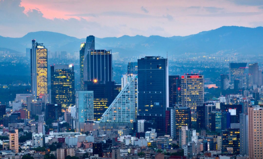

Mexico City is sinking at a pace so rapid that the movement of the ground beneath the sprawling capital can now be detected from space, according to new satellite data.
Get today's headlines by email 
Images captured by the NISAR satellite mission — a joint project between NASA and the Indian Space Research Organisation — reveal that some parts of Mexico City are subsiding by more than half an inch each month. In certain locations, the ground is sinking at a rate approaching 0.8 inches monthly, equivalent to more than 9.5 inches per year.
Researchers say the phenomenon is largely driven by the heavy extraction of groundwater from an ancient aquifer beneath the city.
Aquifer depletion driving subsidence
The Mexican capital, one of the world’s largest urban areas with roughly 22 million residents, was built on the bed of a high-altitude lake. Beneath the city lies a major aquifer that provides about 60% of the drinking water used by its population.
Over decades, intense pumping of this underground water supply has caused the soil above it to compress and sink. The problem has also worsened the city’s long-running water shortage, raising fears that it could one day face a “day zero” scenario in which water supplies run dry.
Urban growth has compounded the issue. Continuous construction and expanding infrastructure have added weight to the city’s soft, clay-rich ground, accelerating the downward movement.
Satellite reveals scale of the problem
The NISAR satellite was designed to observe complex processes on Earth by using advanced radar capable of measuring small movements in the planet’s surface.
Between October 2025 and January 2026 — during the region’s dry season — the satellite mapped changes in ground levels across Mexico City. The data revealed that several districts are sinking steadily, with some areas experiencing particularly fast subsidence.
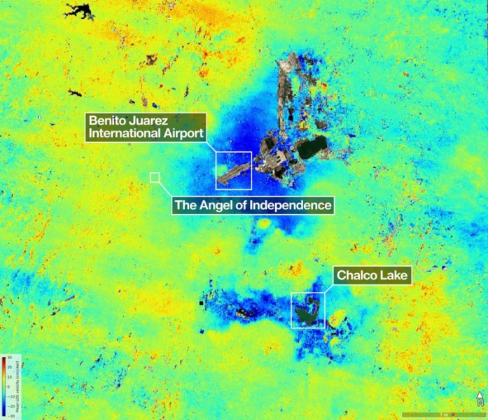
Among the locations most affected is Benito Juárez International Airport, the city’s main air transport hub.
The satellite’s ability to detect gradual land movement allows scientists to monitor how the city is changing over time and to identify areas at risk.
Visible impacts across the capital
Subsidence in Mexico City has been documented since the 1920s. Over the decades, the effects have become increasingly visible across the capital.
Residents have reported cracked roads, uneven pavements and tilting buildings. Transport infrastructure has also been affected, including parts of the rail system.
One of the city’s most recognisable monuments demonstrates the impact of the sinking ground. The Angel of Independence monument, a 114-foot-tall column built in 1910 to mark the centenary of Mexico’s independence, has required the addition of 14 steps at its base as the surrounding ground level has dropped.
Scientists say satellite monitoring will provide new insight into how subsidence is affecting cities worldwide.
“Mexico City is a well-known hot spot when it comes to subsidence, and images like this are just the beginning for NISAR,” said David Bekaert of the Flemish Institute for Technological Research and a member of the NISAR science team.
Tracking changes across the planet
Beyond urban subsidence, the satellite’s radar technology can also measure a wide range of environmental changes. These include glaciers shifting, crop growth patterns and natural hazards such as volcanic eruptions.
Researchers say the mission is expected to produce a growing body of data that will help scientists better understand how Earth’s surface is evolving.
Join the discussion? 
Already a member? 
 Adapted by ASEAN Now. Source 8 May 2026
Recommended Comments
Create an account or sign in to comment