chrissables
Advanced Member
-
Joined
-
Last visited
Everything posted by chrissables
-
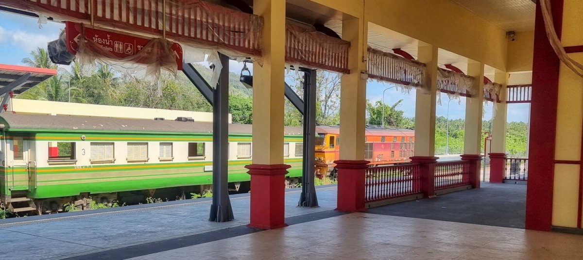
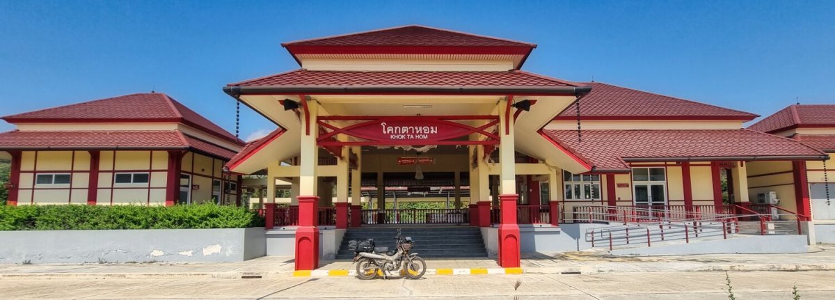
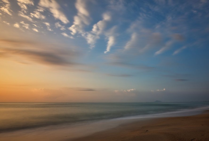
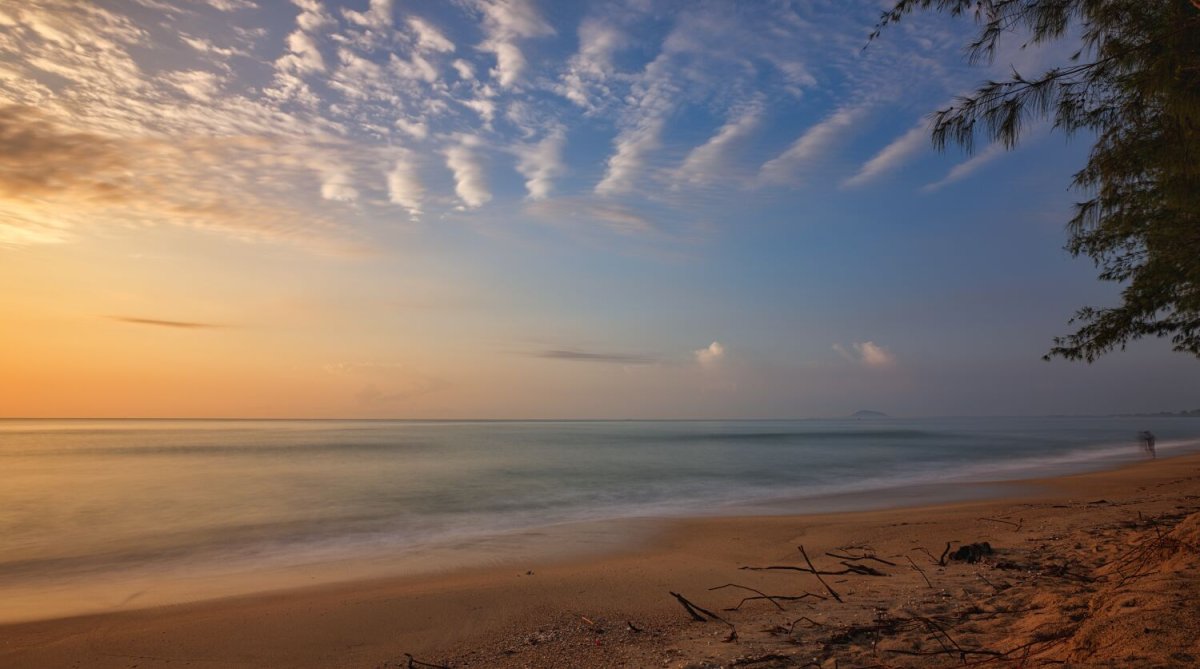
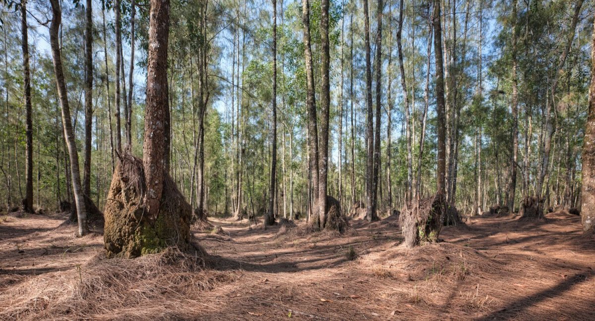
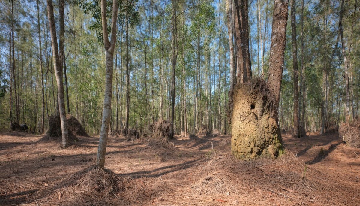
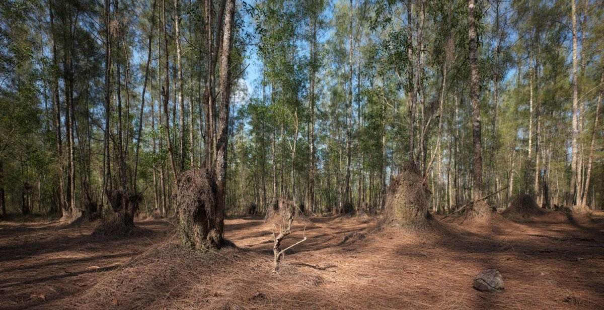
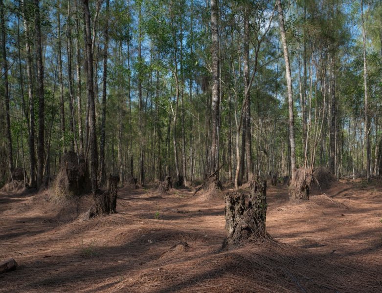
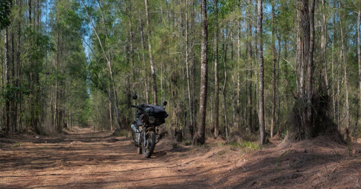
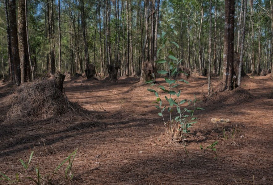
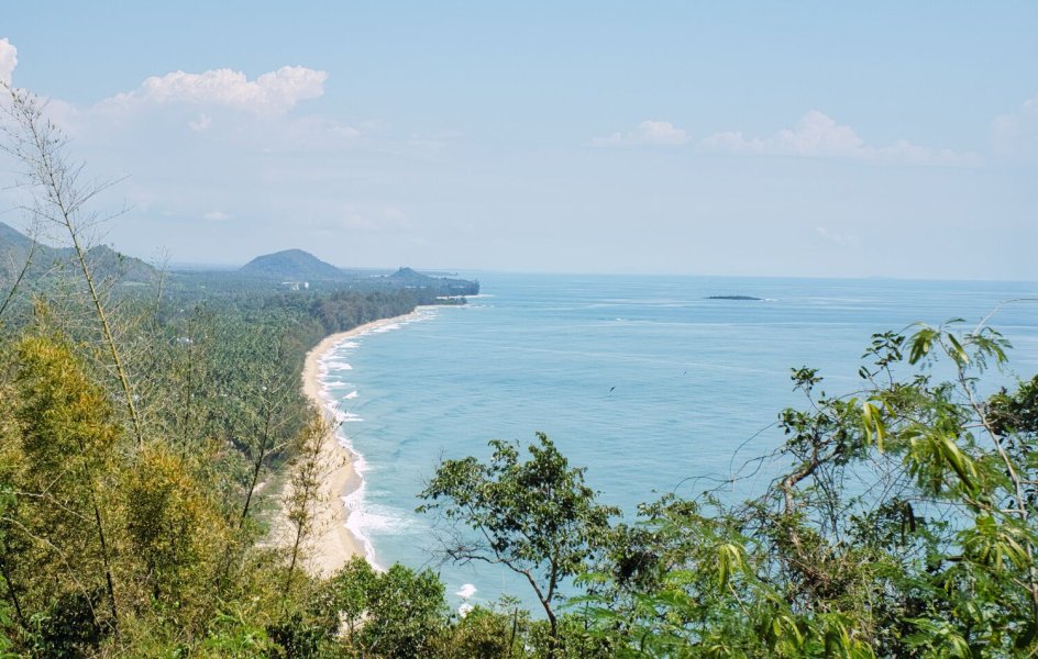
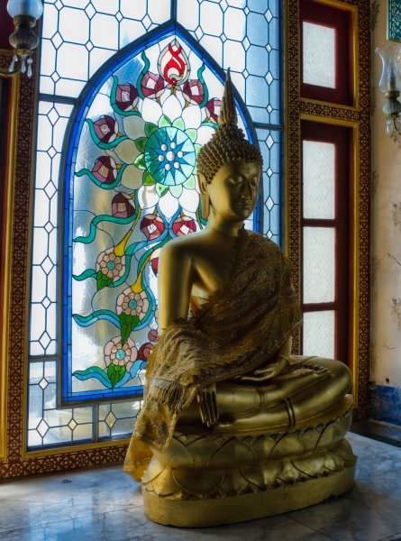
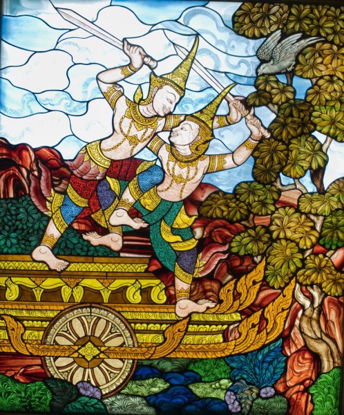
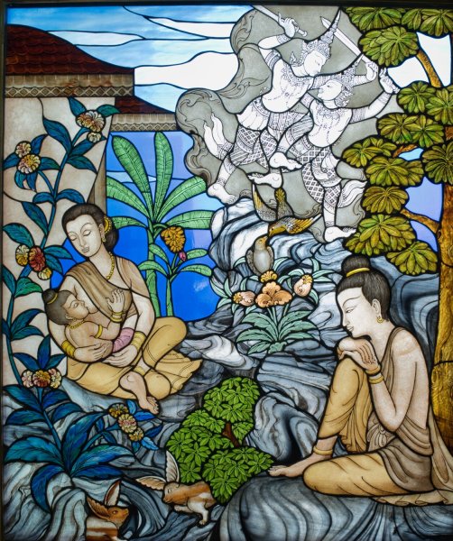
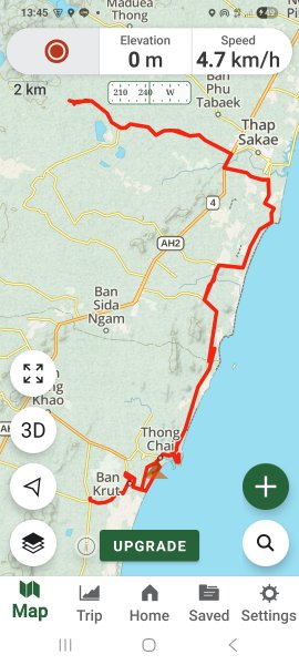
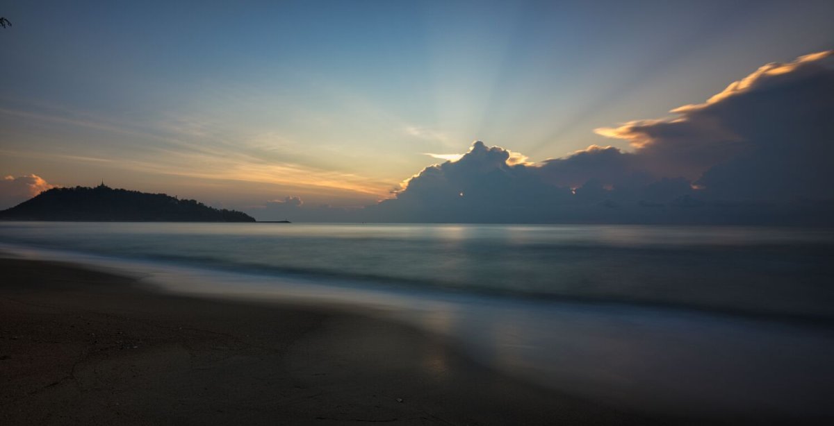
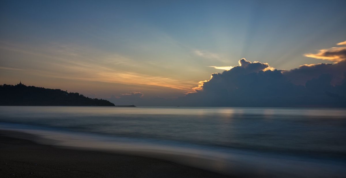
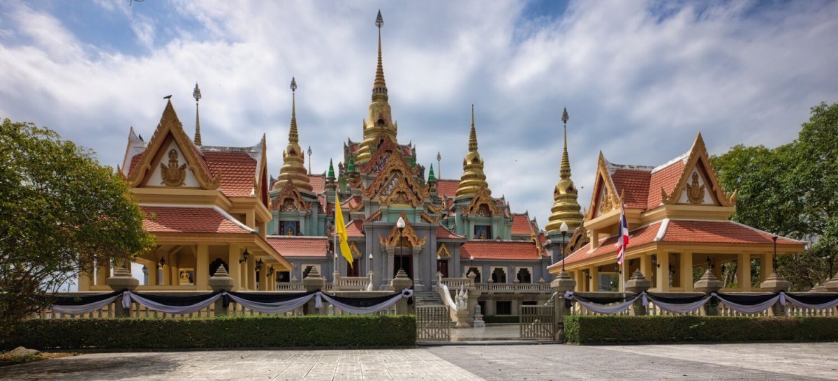
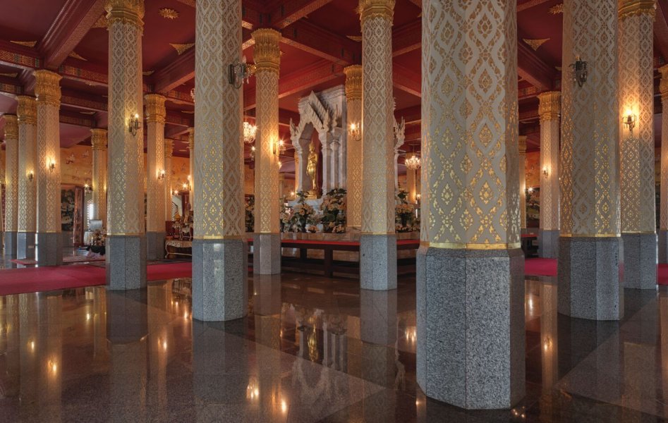
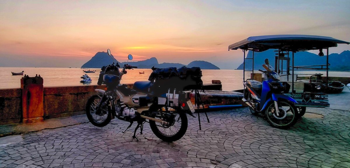
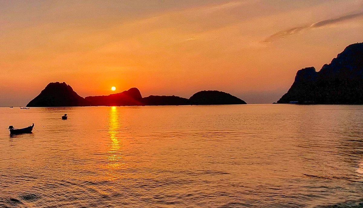
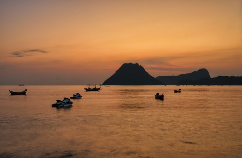
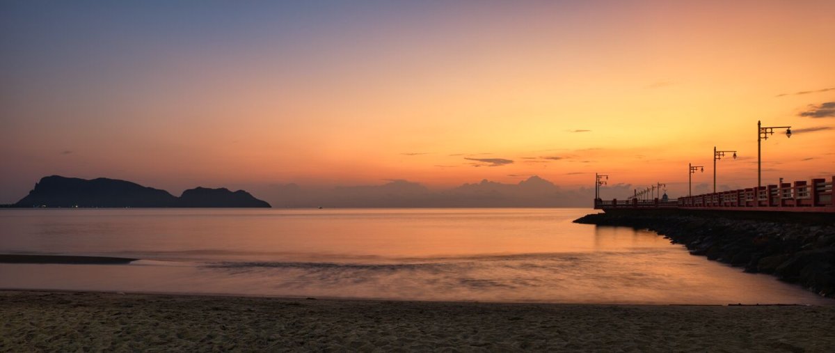
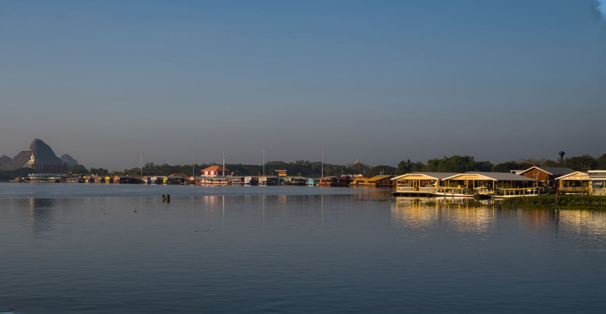
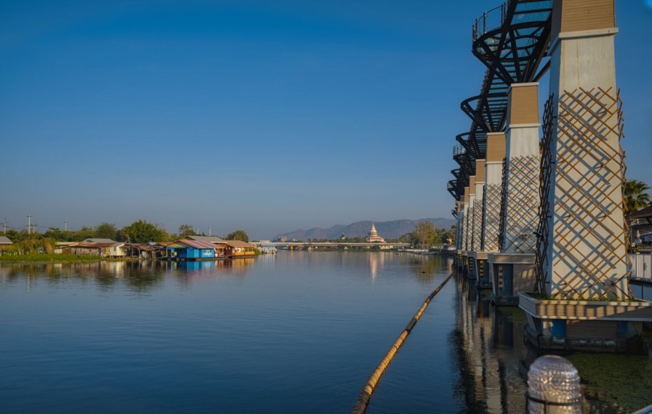
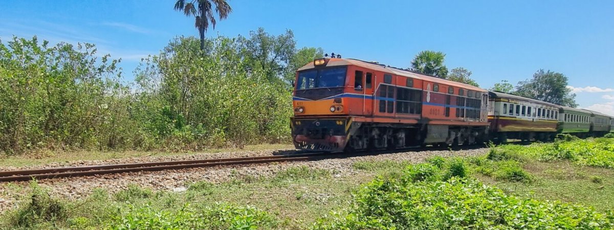
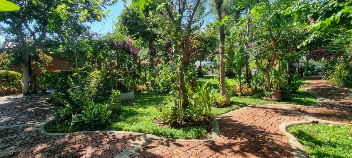
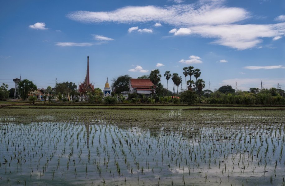
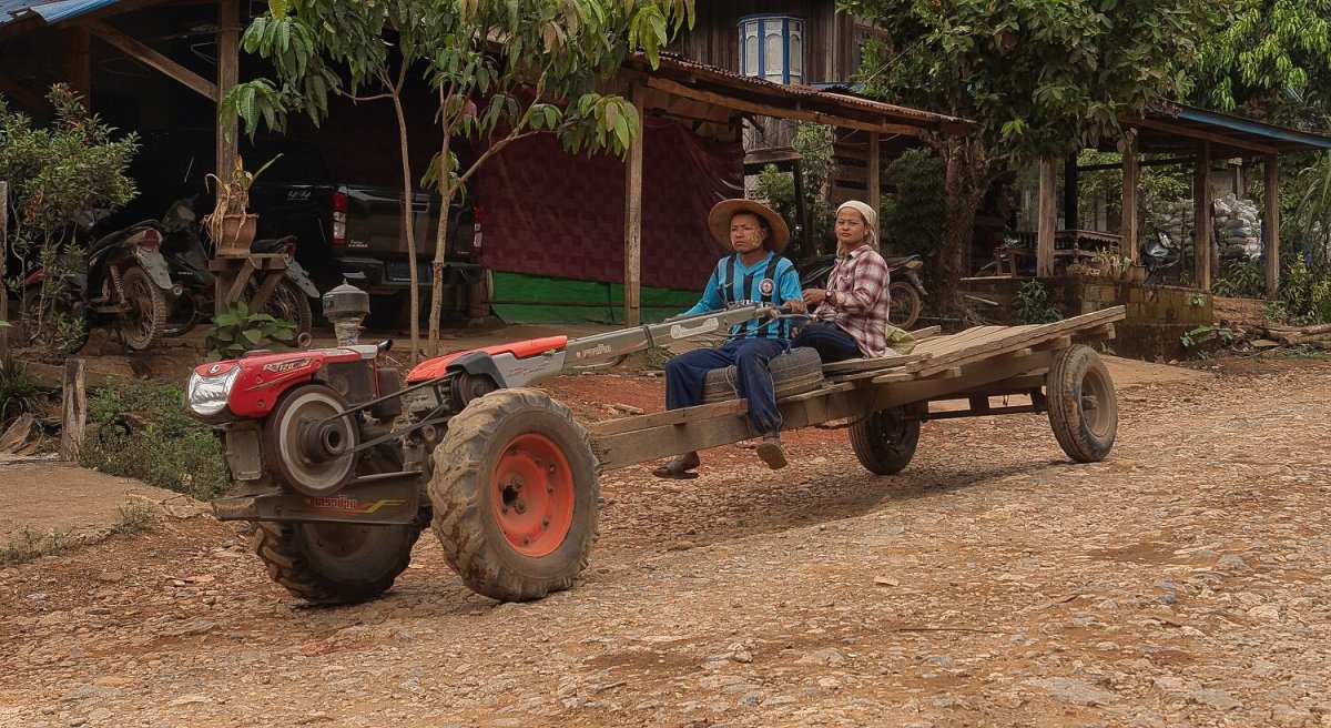
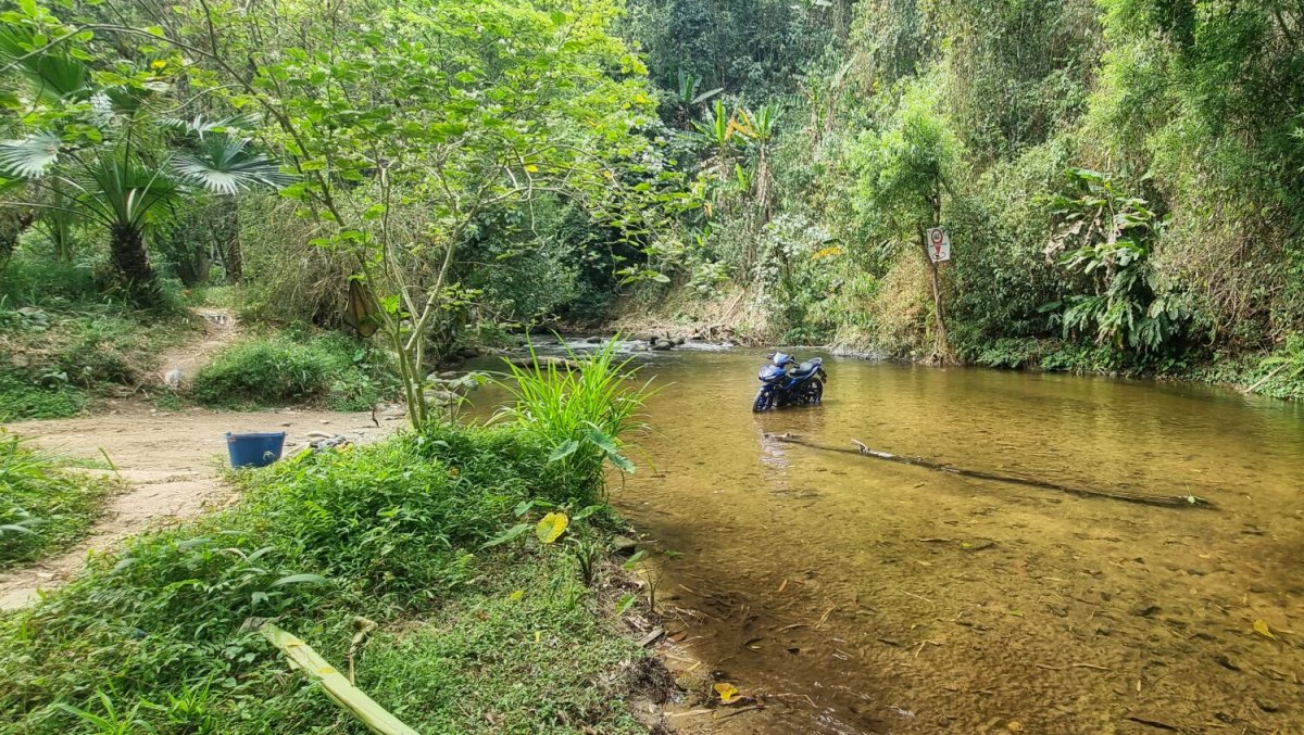
Today was day 100 of my trip, I started with watching another sunrise at Sai Kaew Beach, Ban Krut. https://maps.app.goo.gl/fFmGbvvqqiUiEPnr8 From here I rode to Mining Pine Forest, here. https://maps.app.goo.gl/vUuA25bAMgcLFagY7 The pine needles were very soft as I found out when riding through the forest! Riding back I stopped at Khok Ta Hom Train Station, here. https://maps.app.goo.gl/VcGwGNH9d7i8Sykc8 Then back to Phra Maha That Chedi Bhakdi Prakat, here. https://maps.app.goo.gl/9fQDqXZ2sg5qaj5W6 To photograph the stained windows. https://www.relive.com/view/vXvLELnze1O

.jpg.3873b4bebe50887ddb4efd3190c9bb40.jpg)

-
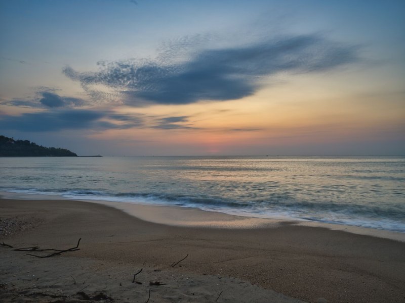
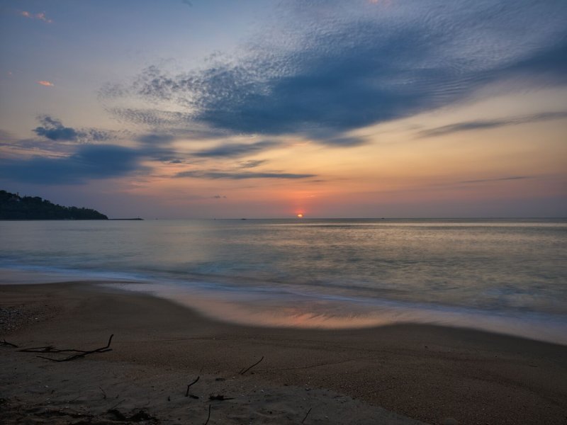
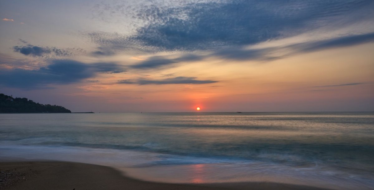
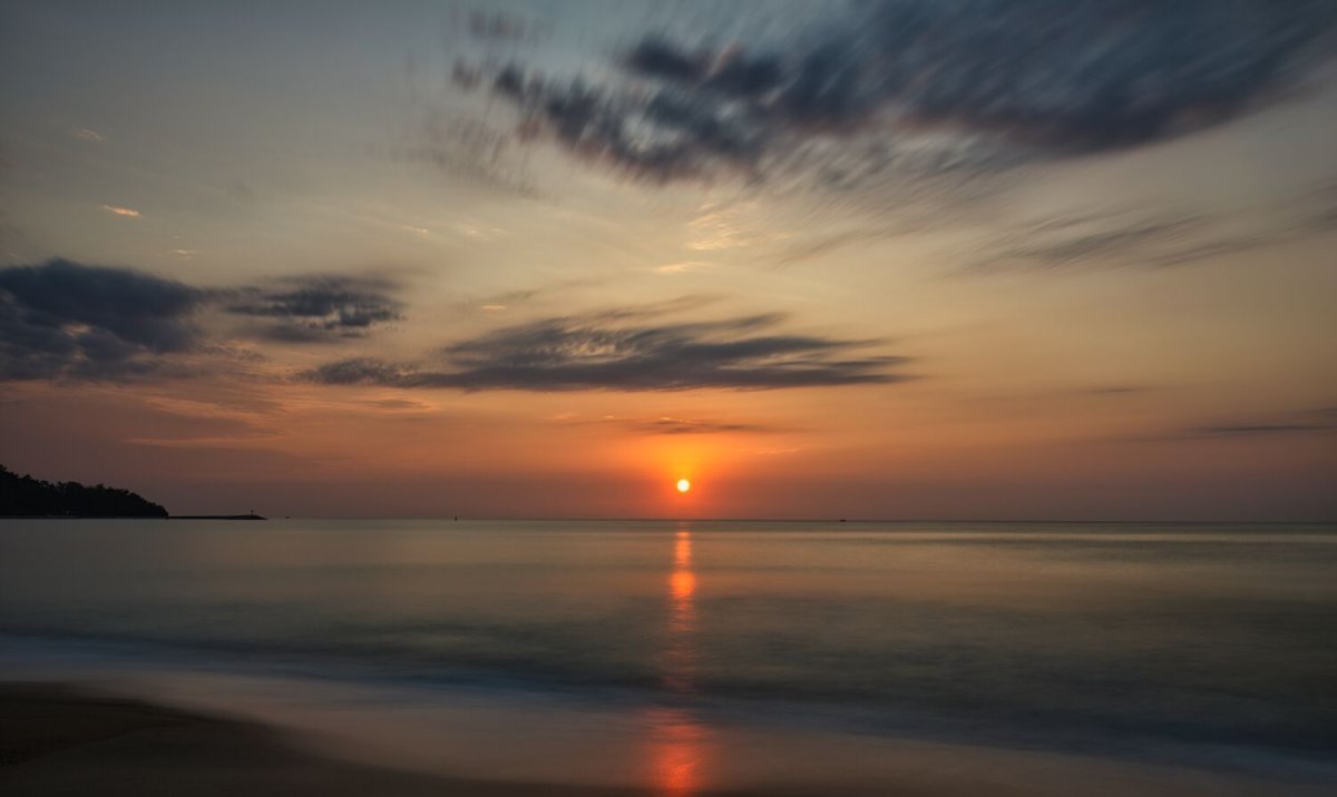
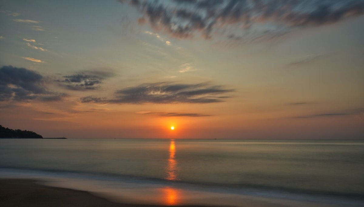
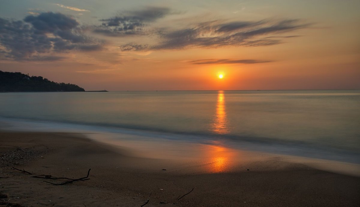
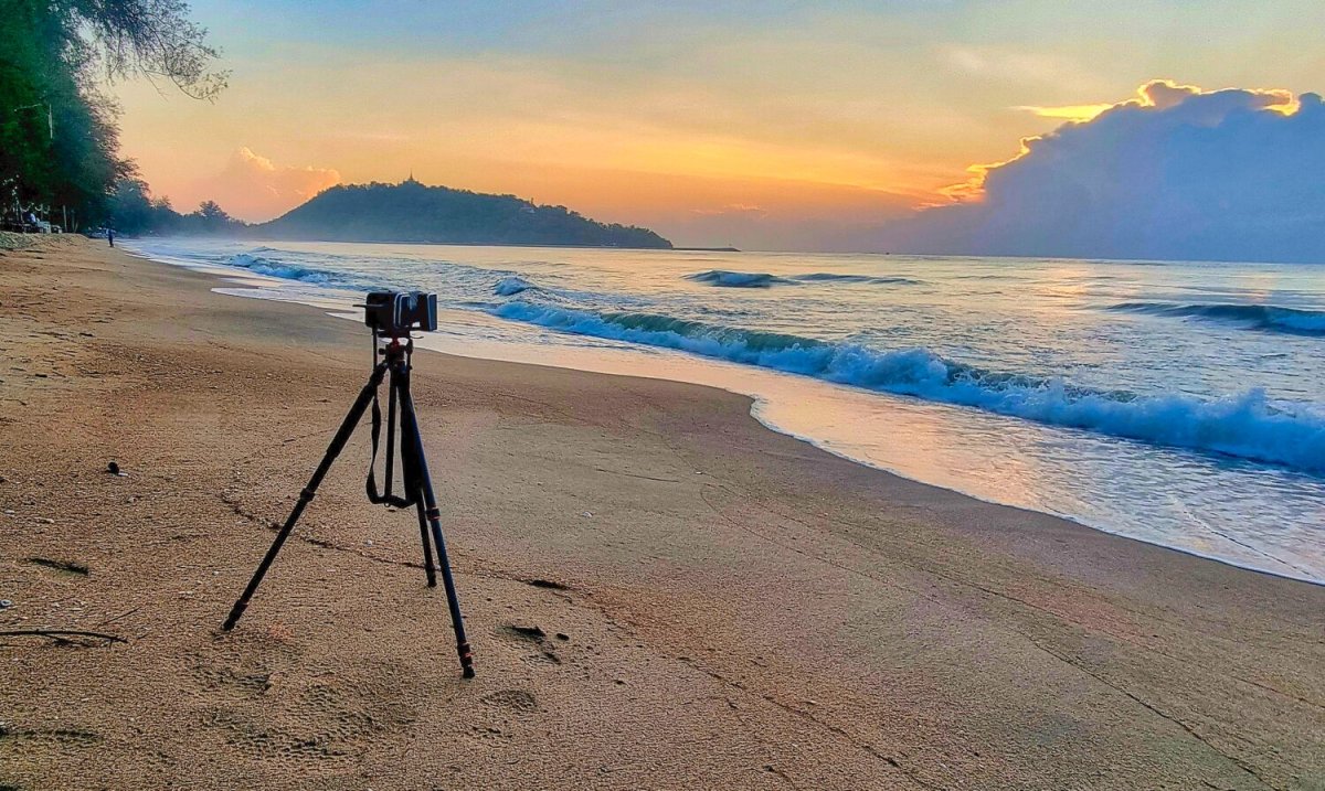
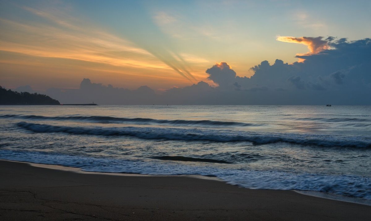
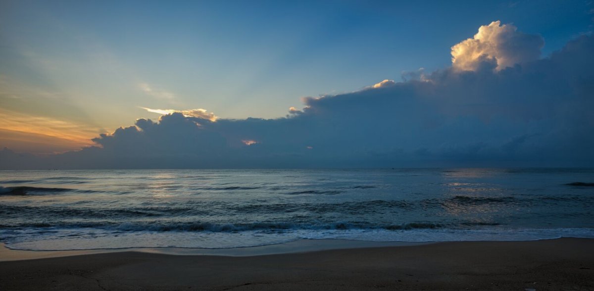
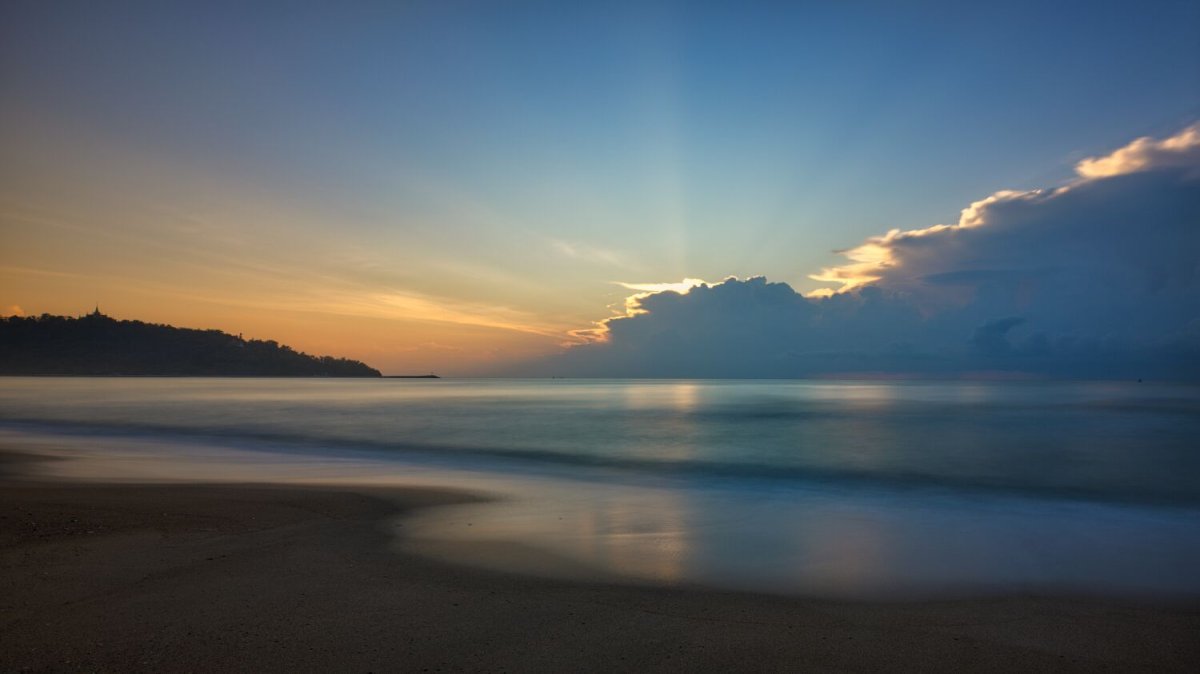
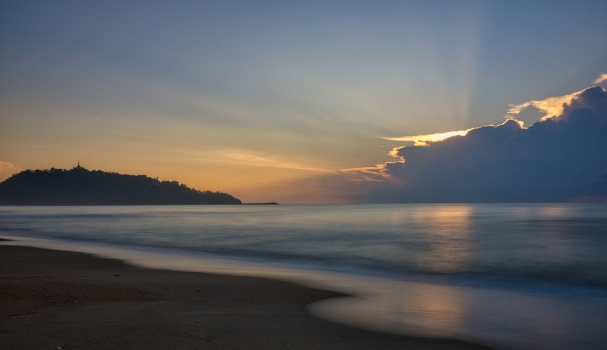
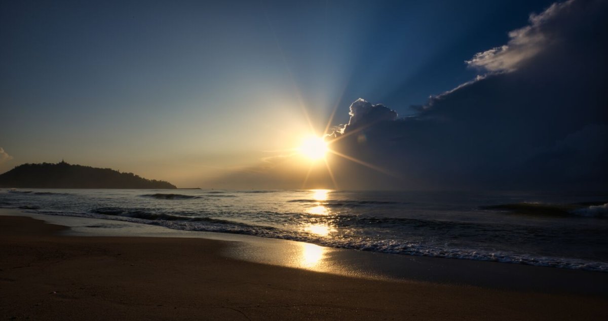
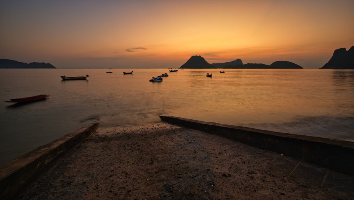
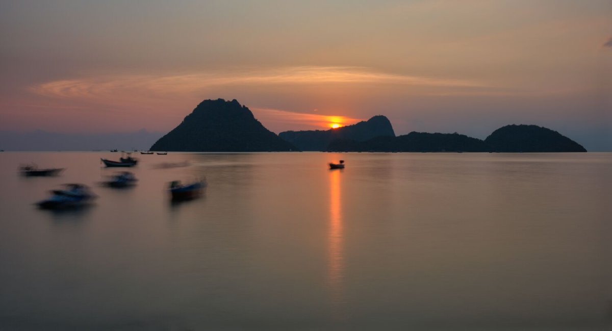
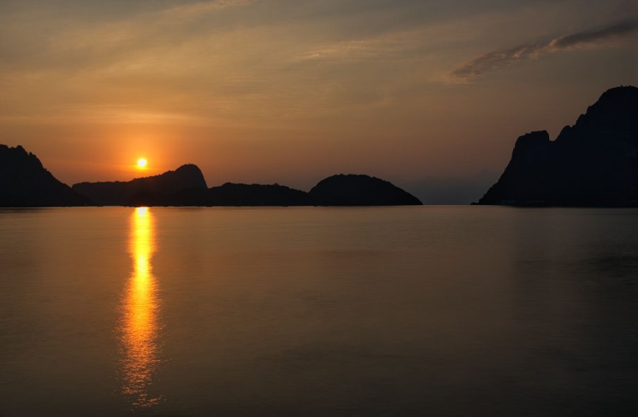
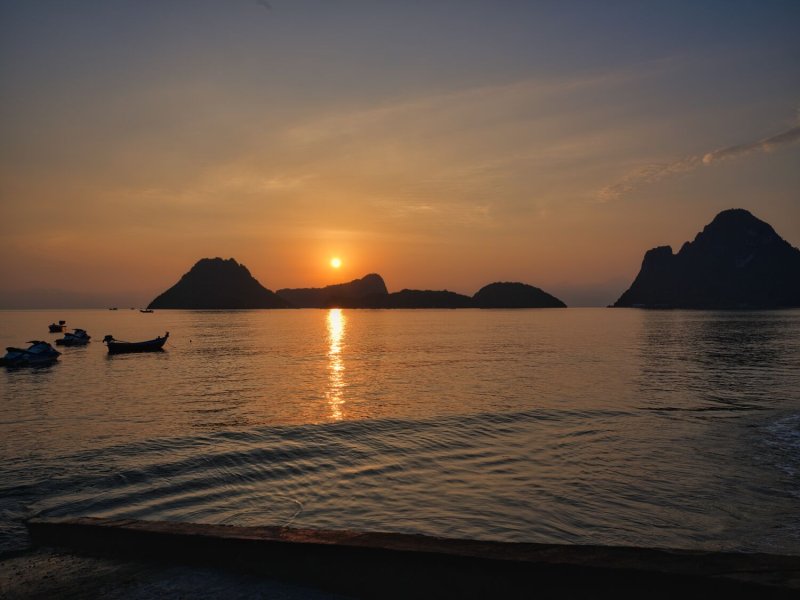
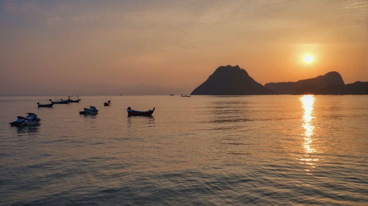
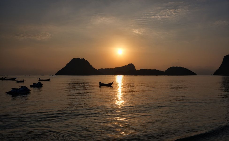
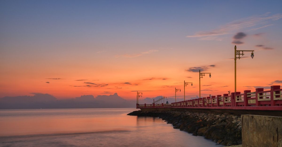
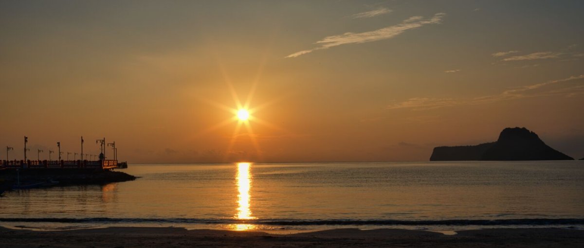
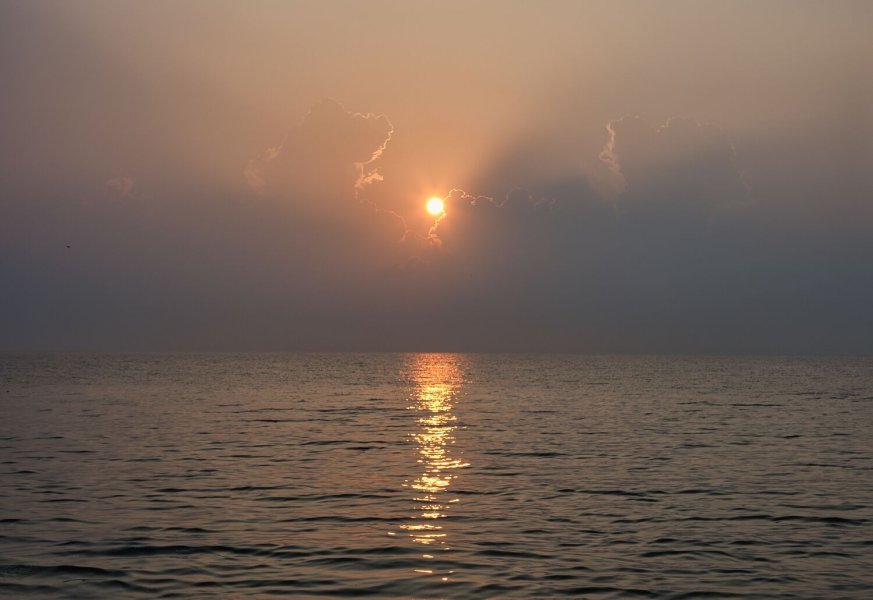
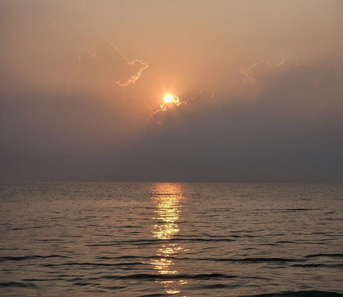
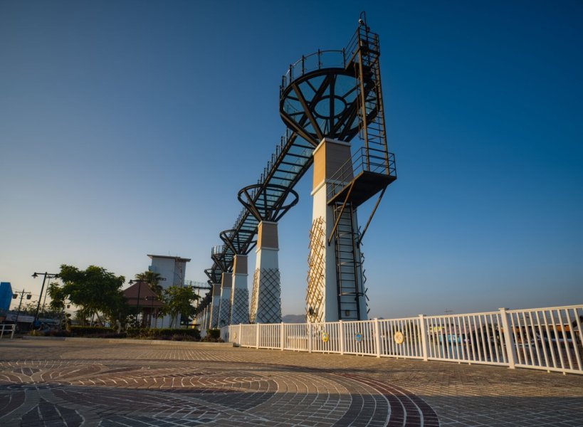
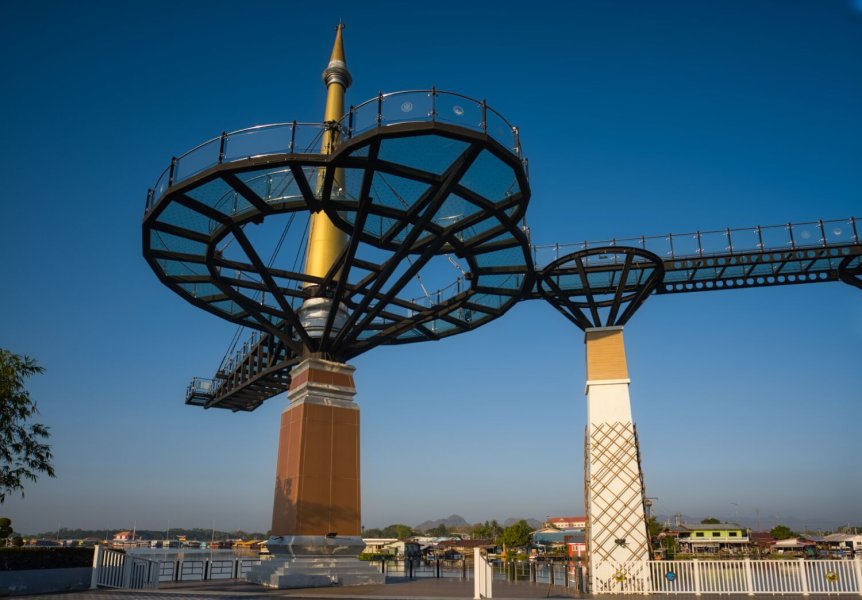
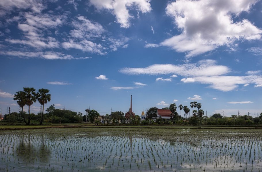
This morning the weather app showed rand early and I nearly didn’t bother going to take photos of the sunrise at Ban Krut Beach. I’m glad I did. There was a storm coming in from the south with thunder and lightning. I packed up and got back for coffee in my room when it started raining. Once it had stopped I rode up the temple on the hill, Phra Maha That Chedi Bhakdi Prakat, here. https://maps.app.goo.gl/9fQDqXZ2sg5qaj5W6 There are stained glass windows there that are impressive, but my photos came out very badly, I will try again.


-
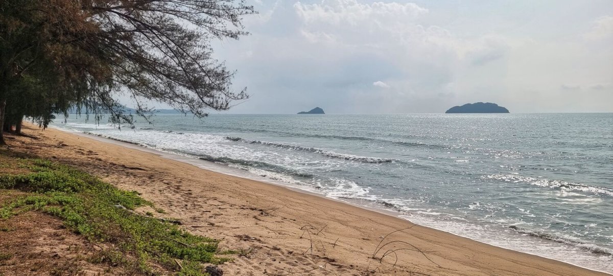
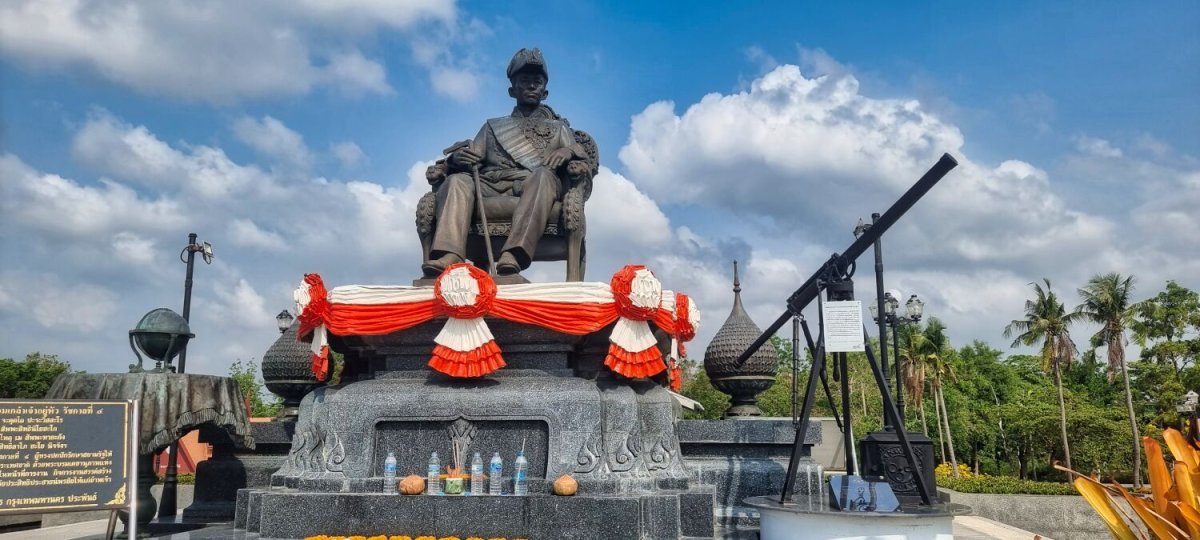
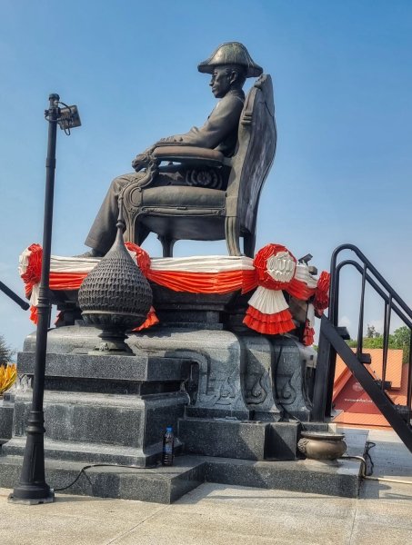
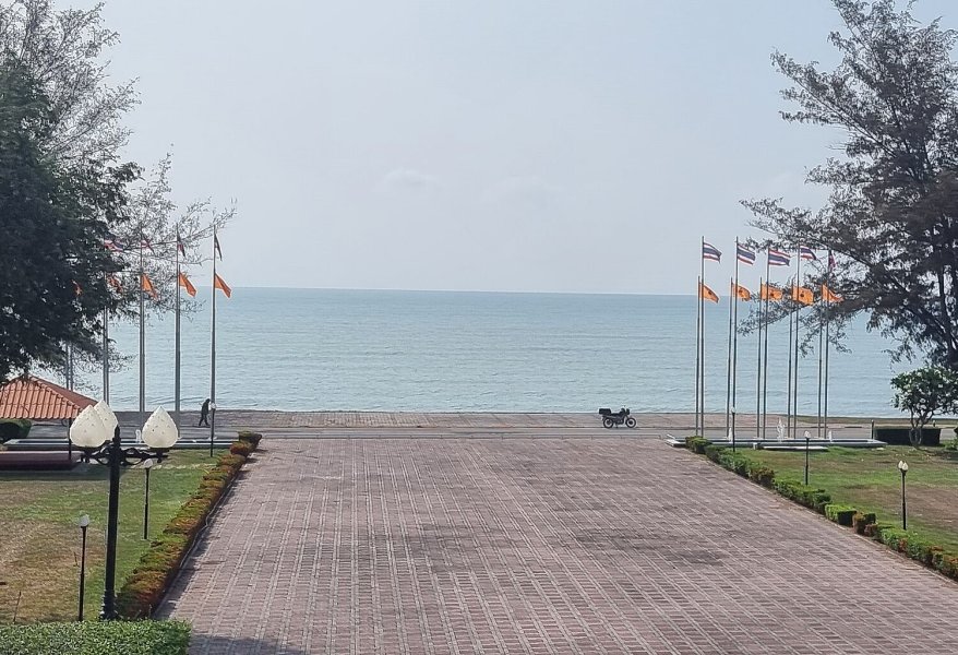
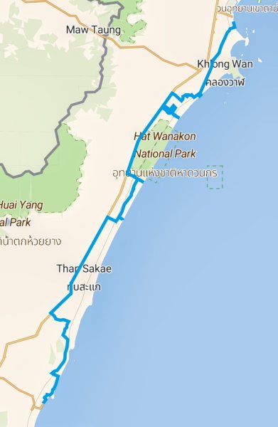
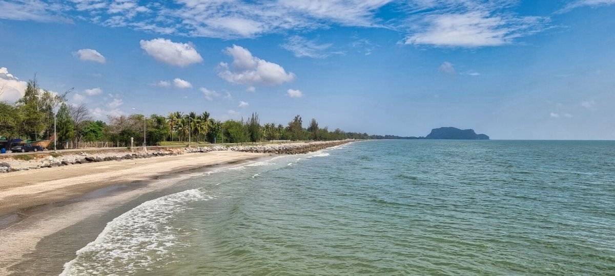
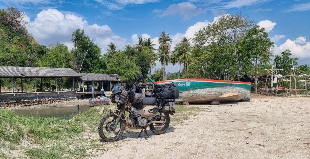
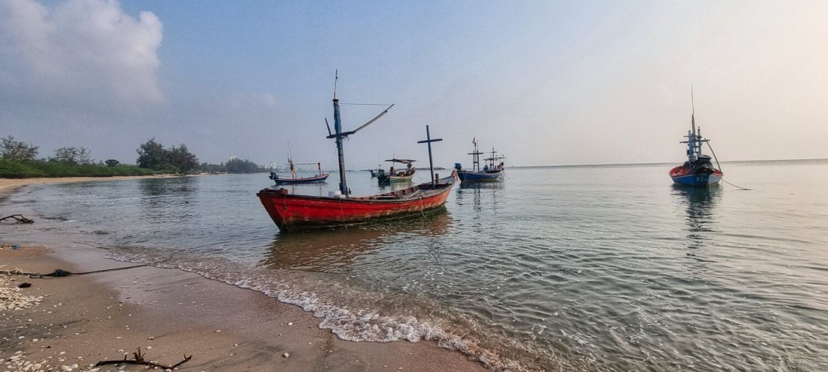
Today I had an easy ride from Prachuap to Ban Krut, stopping just outside of Prachuap first at Monument to King Rama IV. https://maps.app.goo.gl/mzzi8CPXrNgRhEE67 From here I stopped at a beach, here. https://maps.app.goo.gl/PPMZBe4kAZX2bjCeA Then slowly riding close to the coast when able until arriving in Ban Kruat https://www.relive.com/view/vXOnzjdk2BO

-
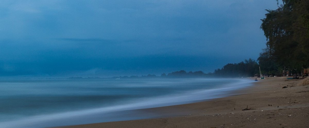
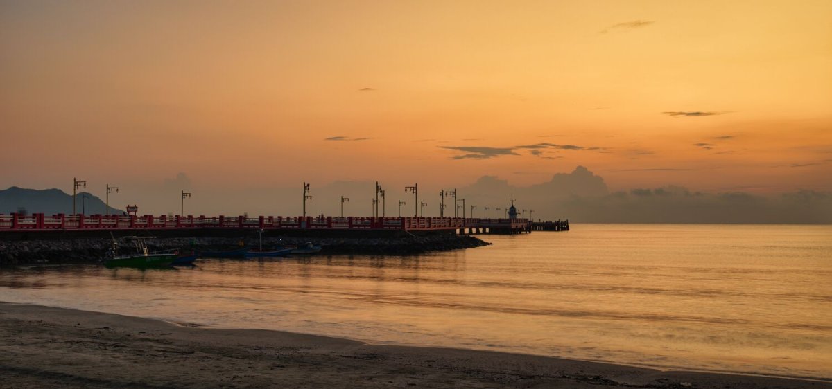
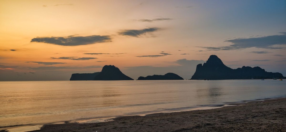
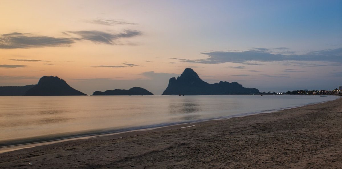
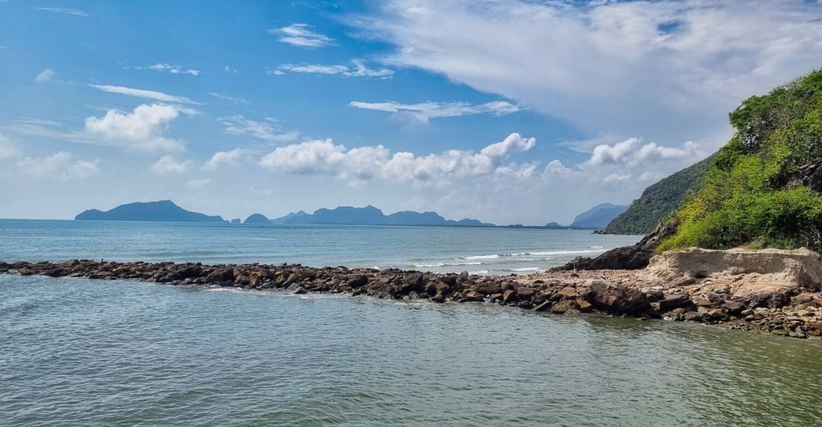
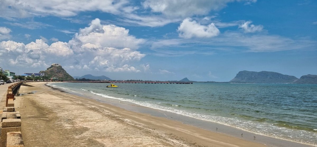
This morning I rode to the south of the city beach at Prachuap Khiri Khan to photograph the sunrise. https://maps.app.goo.gl/xFjaVXeTWEcVPWs2A From there I rode to Khlong Wan Pier, here. https://maps.app.goo.gl/Cbc2Jv15ywC6pUGRA But there was nothing to photograph. I then rode to the two old trans, here. https://maps.app.goo.gl/Se9mykj3WuNJxJAy9 Riding back towards Prachuap I stopped at Pak Khlong Khlong Waen, before riding back. https://maps.app.goo.gl/JCrjCv3oFK1TU24E8 https://www.relive.com/view/v7O9gLJn1Qq


.jpg.3c9250a47e2c7bb3a8fdf92d3f22e0c0.jpg)
-
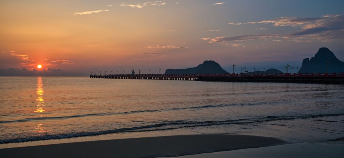
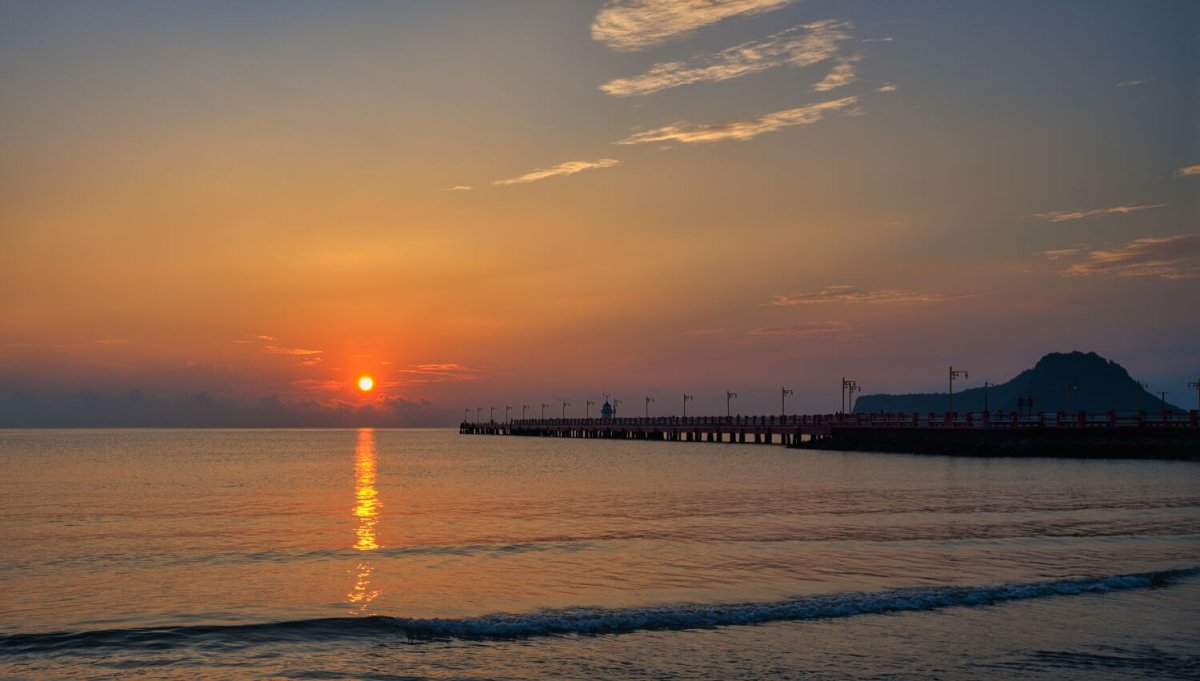
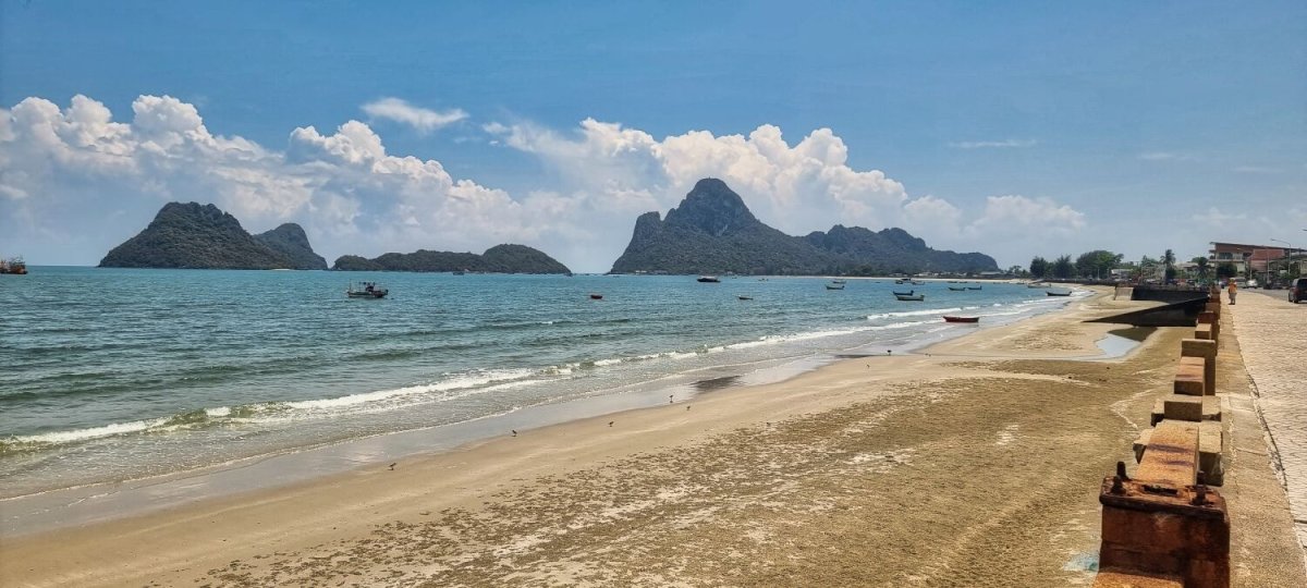
This morning early I went to Prachuap Khiri Khan Walking street and Saranwithee Pier to take sunrise photos. Even when dark it was very busy with walkers and quite a few photographers waiting for the sunrise. https://maps.app.goo.gl/6BPUcu1pAiwfdZSk8 https://maps.app.goo.gl/js99nwBpAJpjr2zp6 From here I rode to Khao Tamonglai National Park Visitor Center, here. https://maps.app.goo.gl/SkB49WhnX8gwTDEW6 I then rode a loop back across the military runway, past Ao Manao and returned.
.jpg.4b0d0ca3ad2aed32dfc876d4df7d2588.jpg)
-
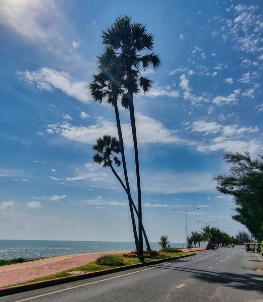
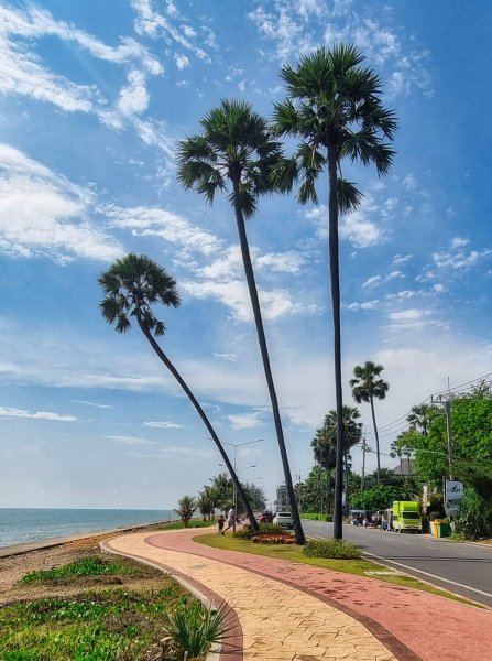
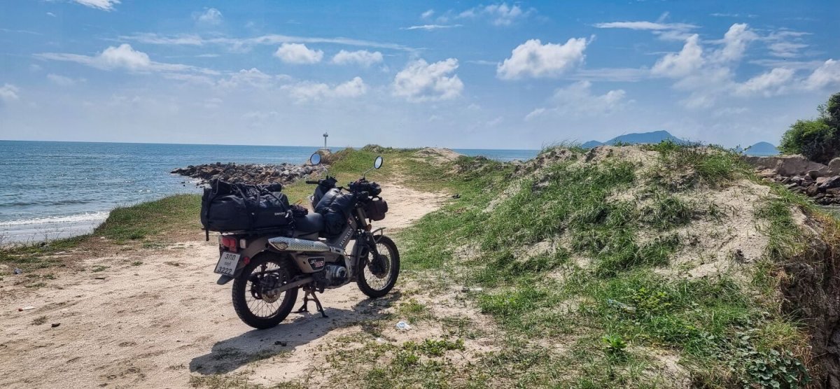
Today I rode south from Cha-am to Prachuap Khiri Khan, in easy ride of 144km First thing this morning it started raining and weather radar showed it would be a damp day, but I left and rode in sunshine, which was good. My first stop was at Three Palm Trees, here. A place I have stopped at a few times. https://maps.app.goo.gl/jq3cS4D6sDm5YGhJ8 Then Fisherman's Harbor Viewpoint https://maps.app.goo.gl/3XDF7r4aUCubYKSk7 And the headland, here. https://maps.app.goo.gl/CEdXwKMK3znzZmqQ8 Then onto Prachuap for lunch at the Greek Taverna, here. https://maps.app.goo.gl/abvz2SpY1Qn2FE1BA https://www.relive.com/view/vr63WDYpm86


.jpg.ca8a3f152f412a9858eff992b54adf99.jpg)
-
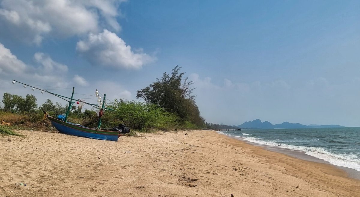
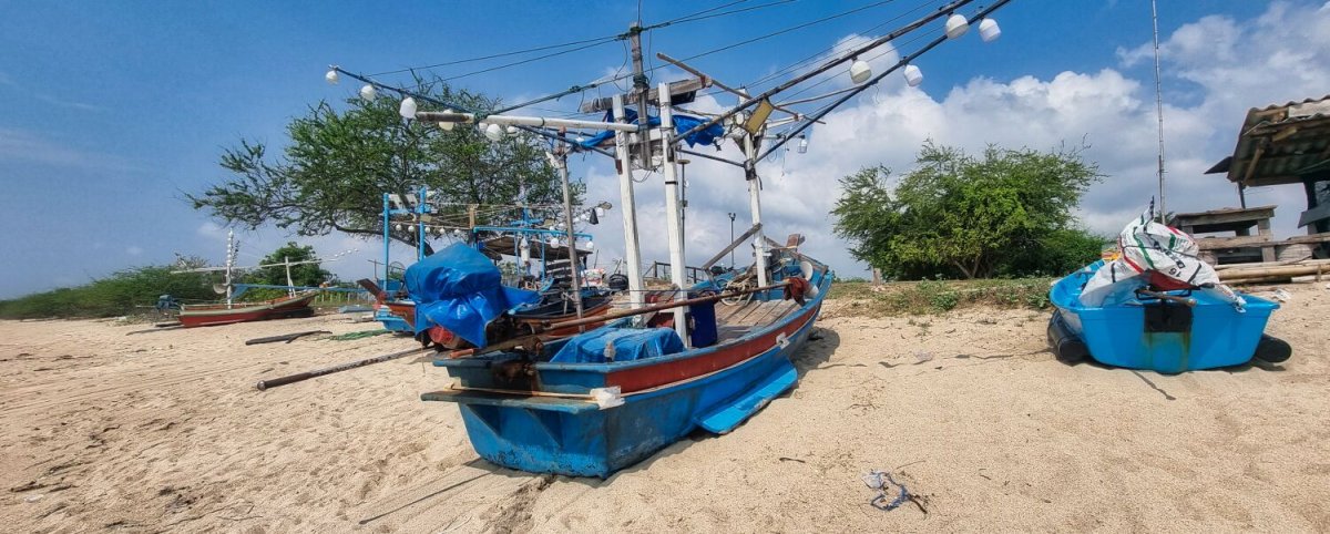
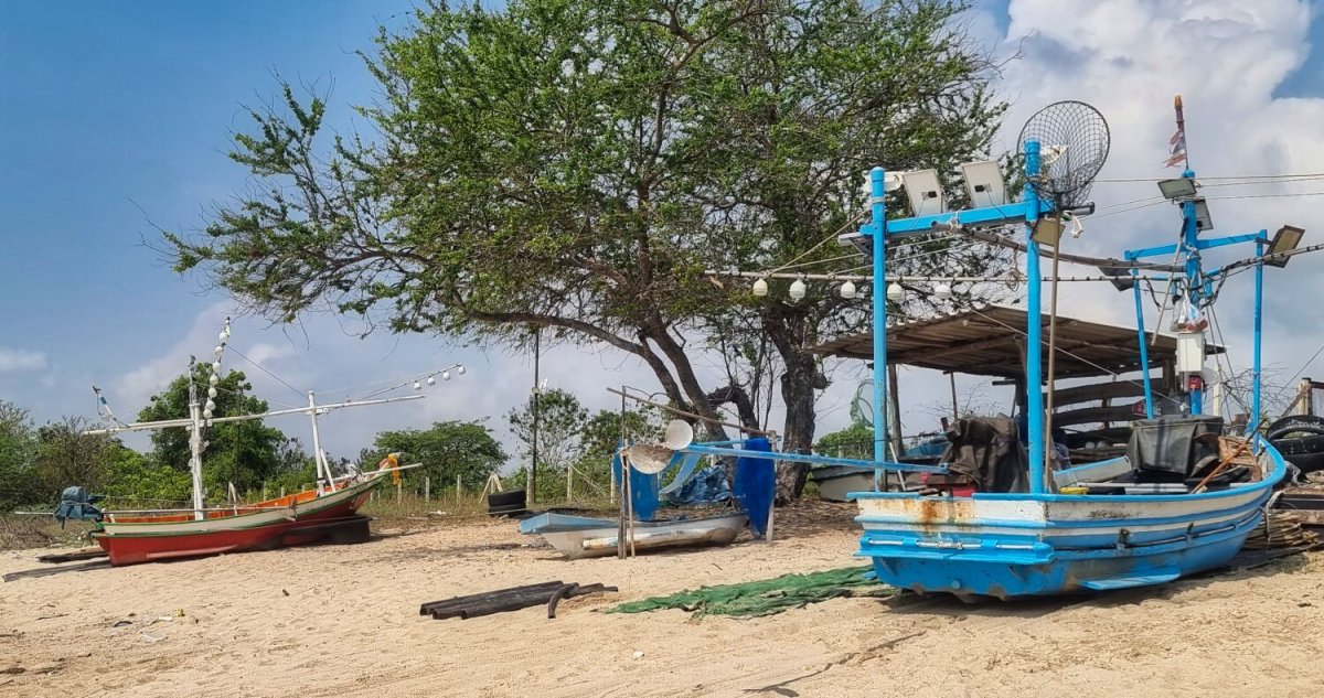
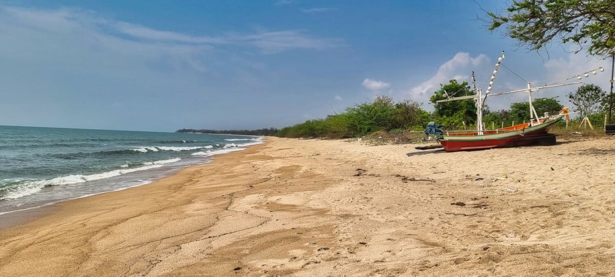
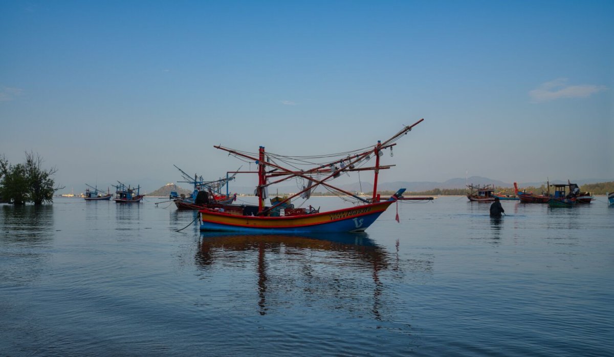
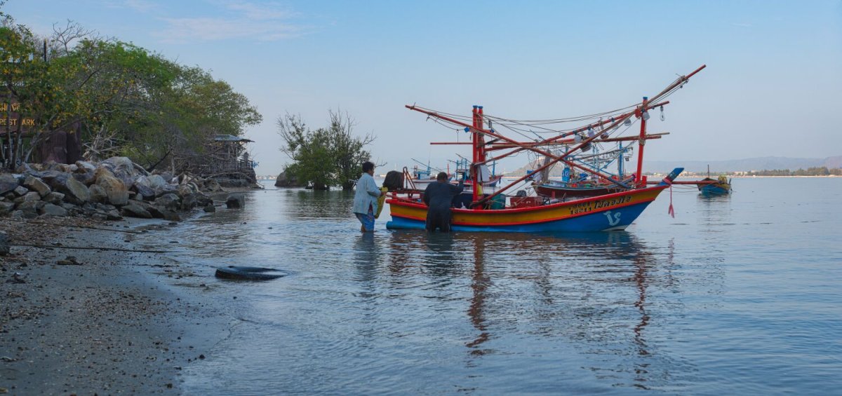
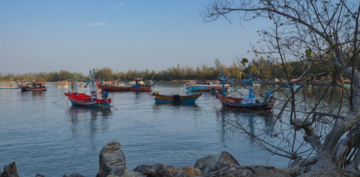
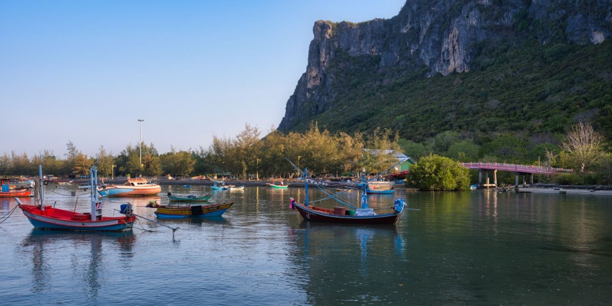
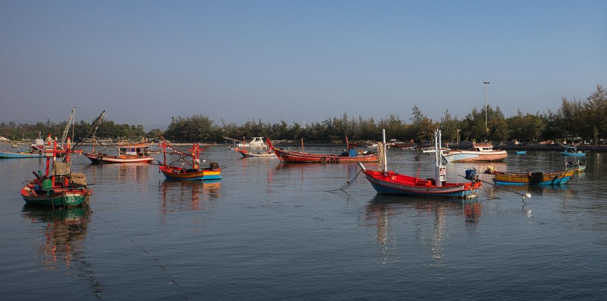
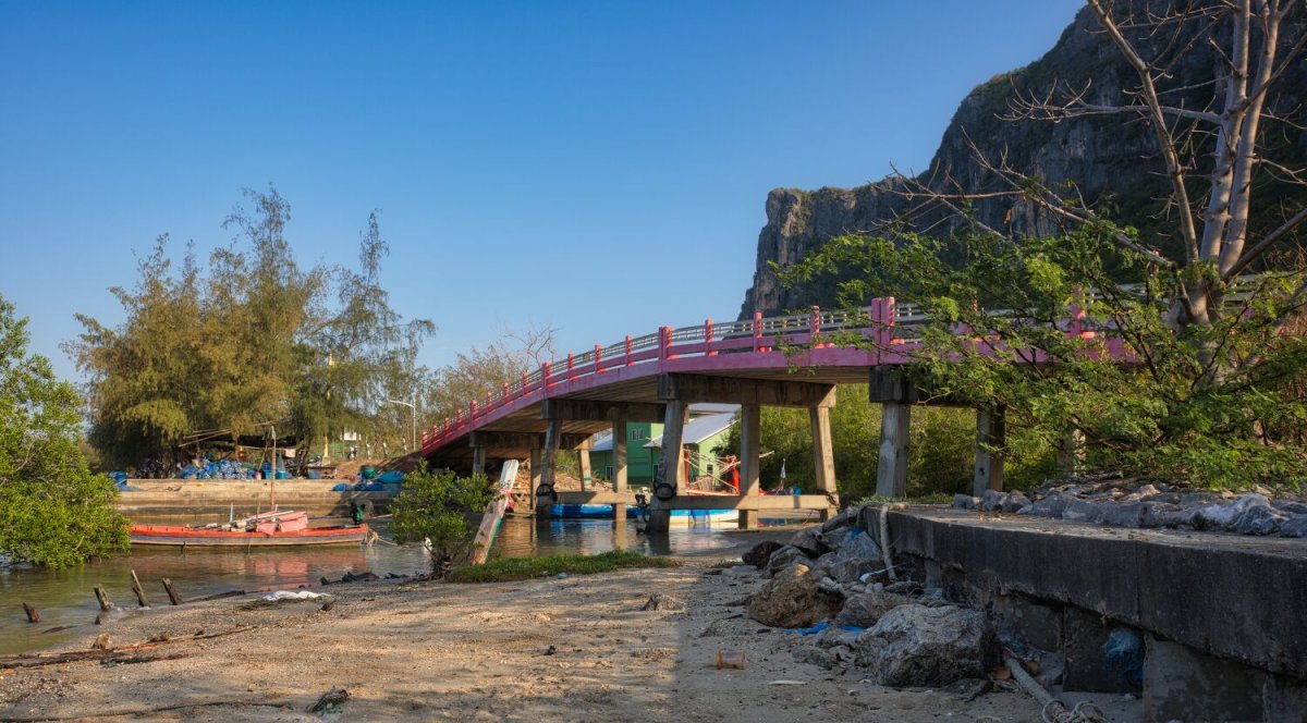
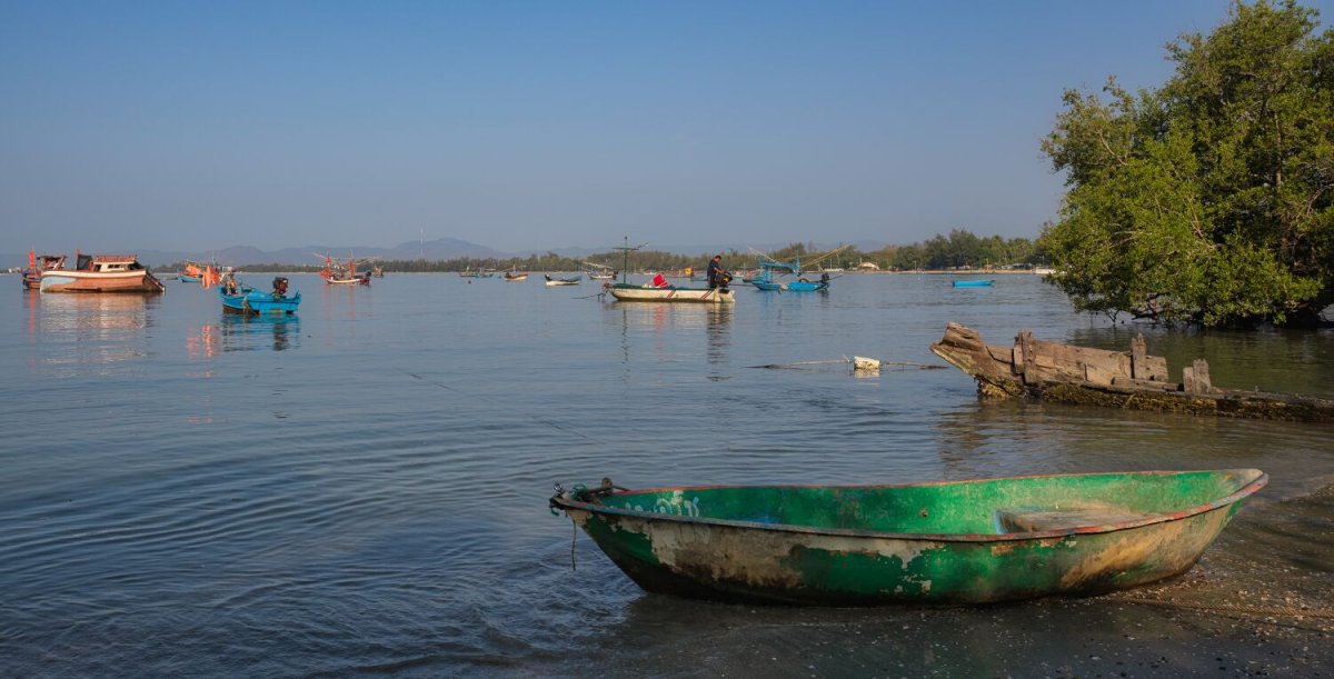
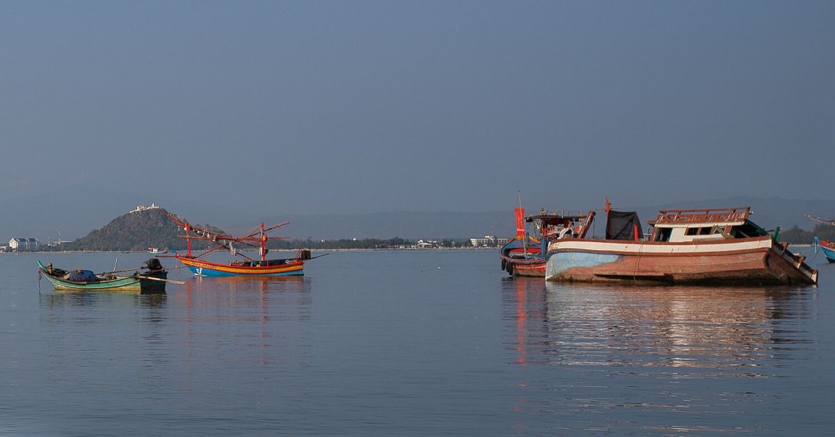
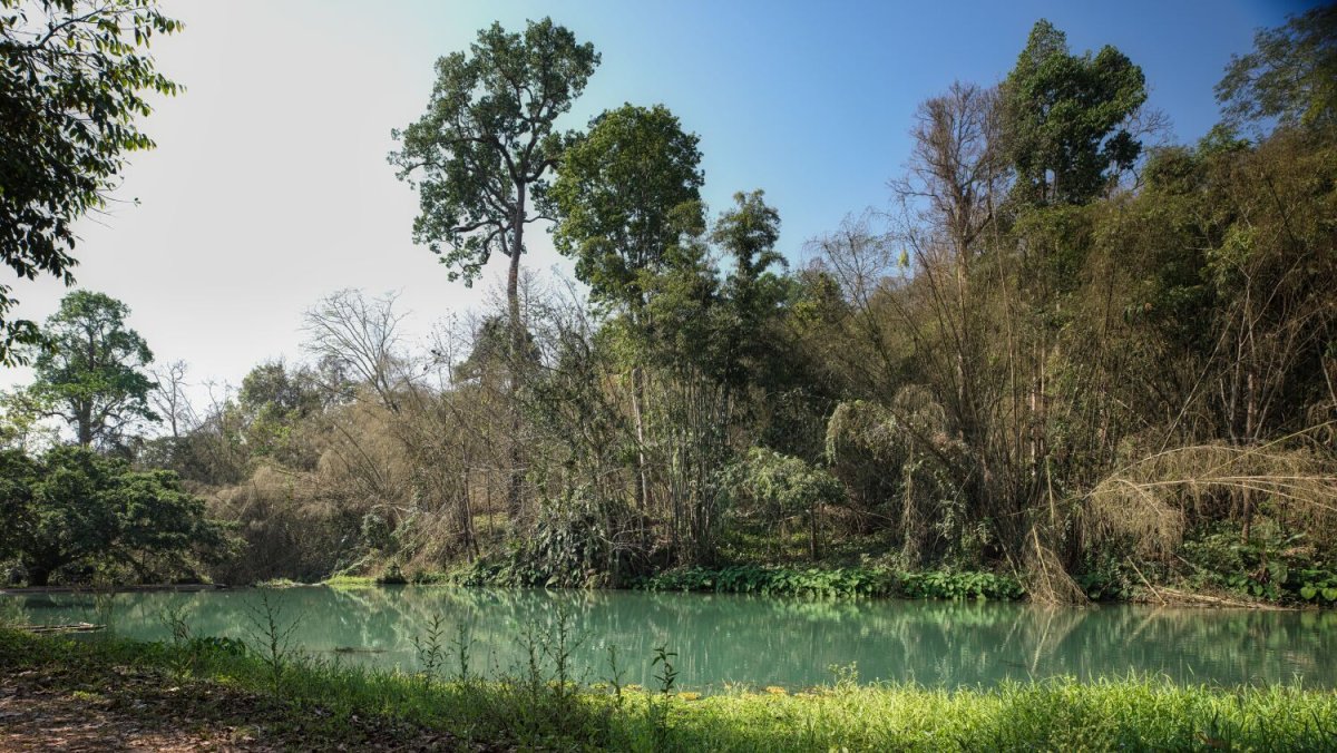
This morning, I went to Cha-am beach early to catch sunrise. https://maps.app.goo.gl/sFaXWGsJC7xhFrRYA It was quite cool and very hazy. I took a few photos and gave up on a sunrise photo, when riding the sun broke through, so I stopped at Beach Camping area, here, https://maps.app.goo.gl/i2PQUszDcuEPSzD9A From here I rode south to find Khlong Bang Tra Noi Lighthouse, here. https://maps.app.goo.gl/xcZzXGWt63o2KSf98 I got to the mangrove area, which was filthy with rubbish and stray dogs everywhere. I got to the bay area, took a photo of the fishing boats and called it a day. https://maps.app.goo.gl/ccjifVocKguXNRD98 https://www.relive.com/view/vXOnz5g5RBO
.jpg.a264e4de436571998d7448933807e706.jpg)
.jpg.d2a4b41a954f5fb435080ff10e97d179.jpg)
.jpg.f433abeb86a52703bfaa49ea5ae8a7be.jpg)
.jpg.ad2da095345f29a58d008edfa101c284.jpg)
.jpg.0c35c2d772d238609de753d4b82d6086.jpg)
-
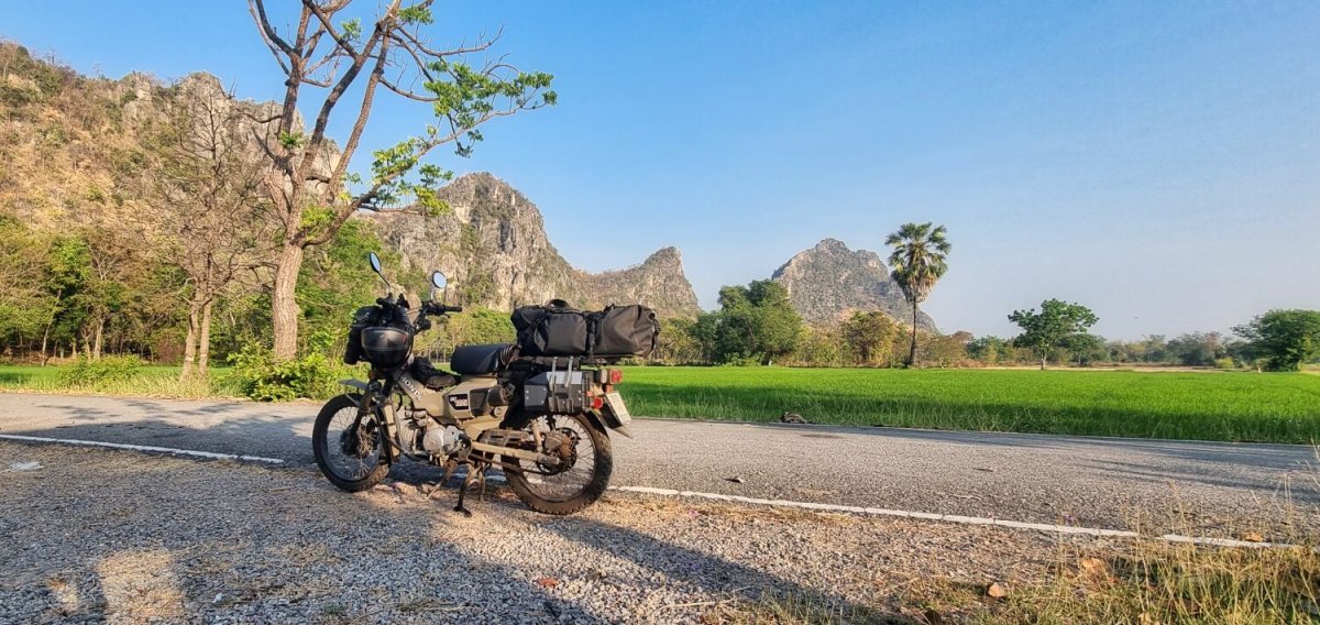
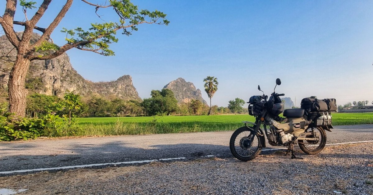
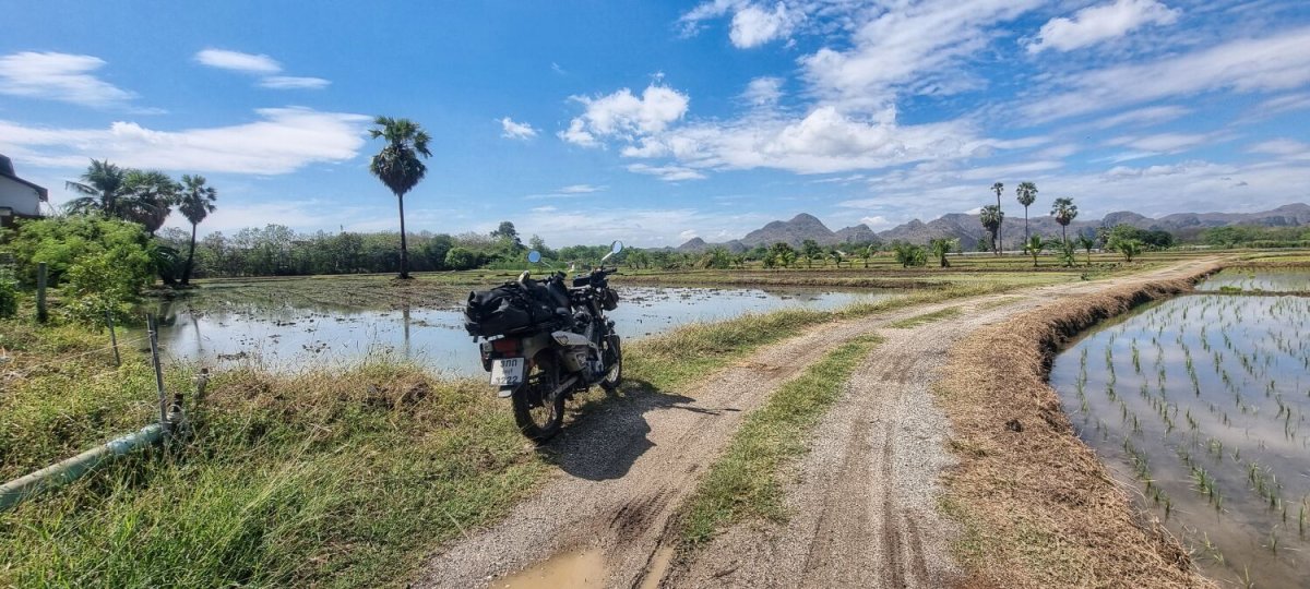
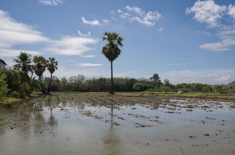
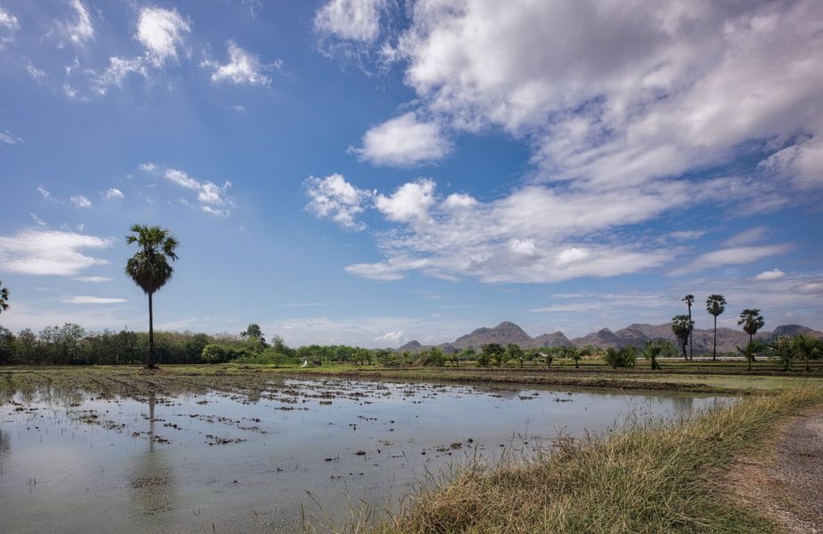
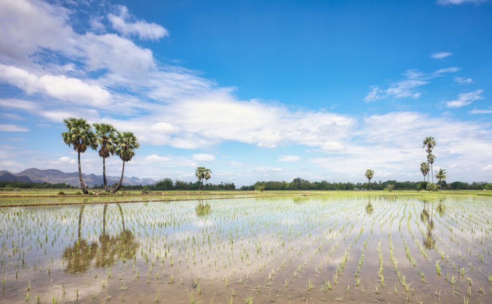
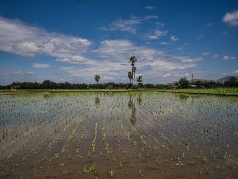
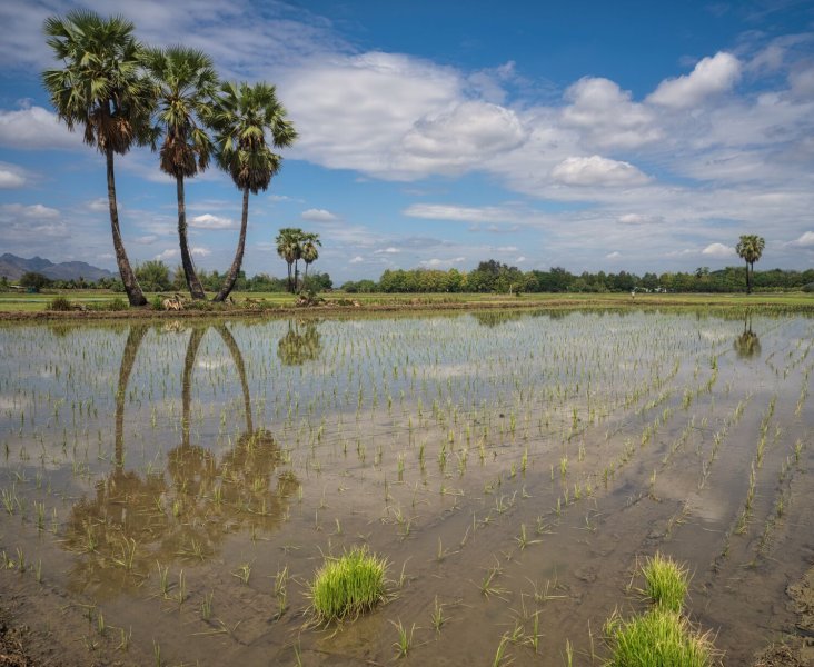
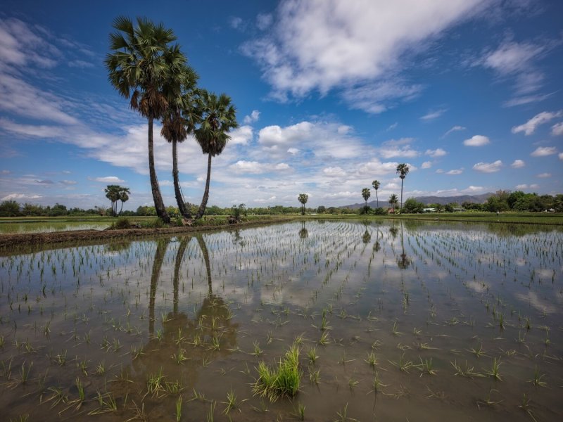
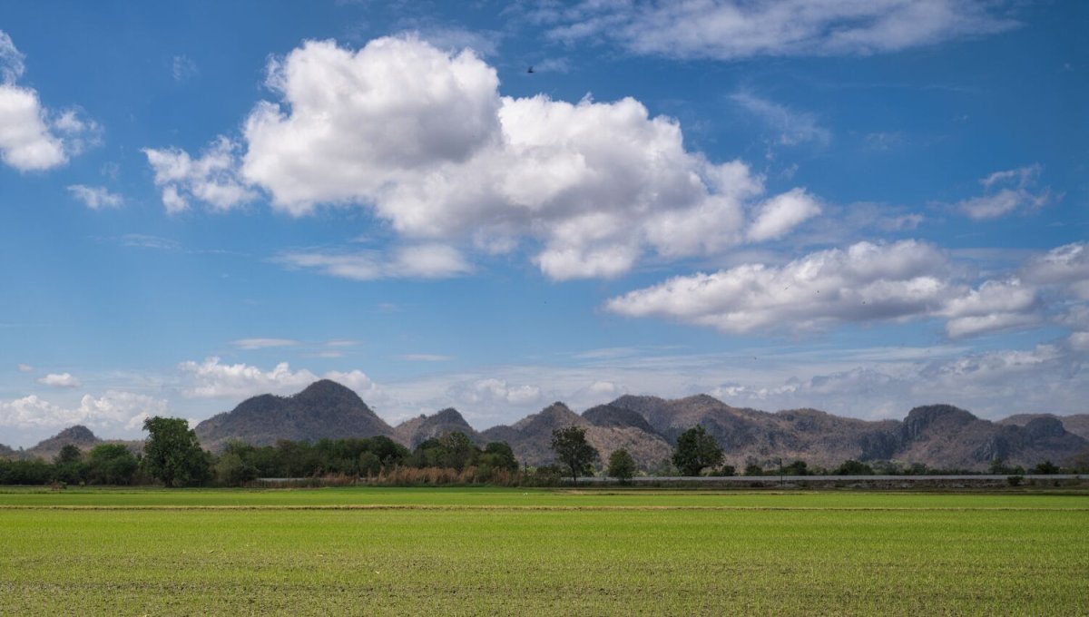
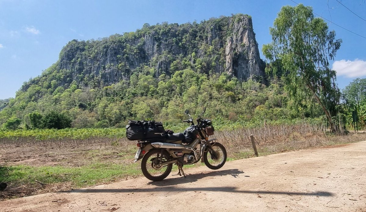
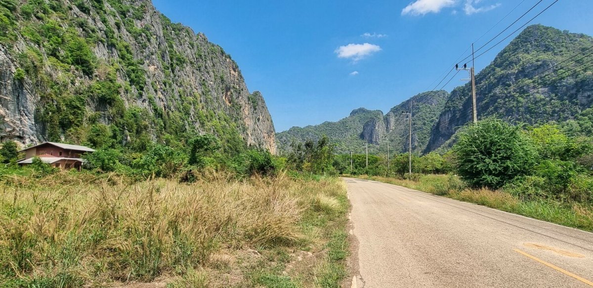
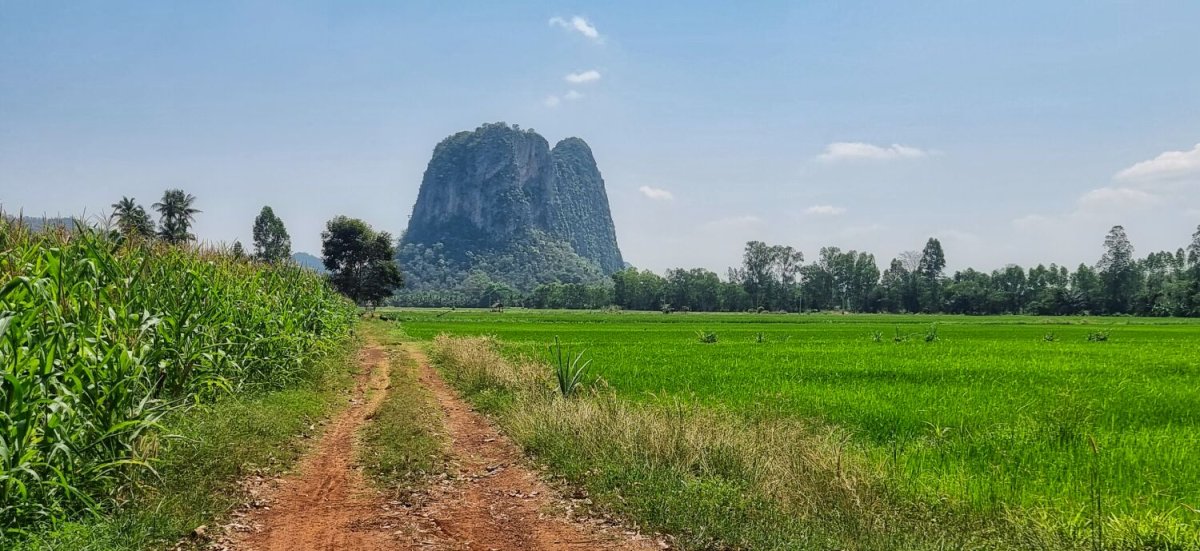
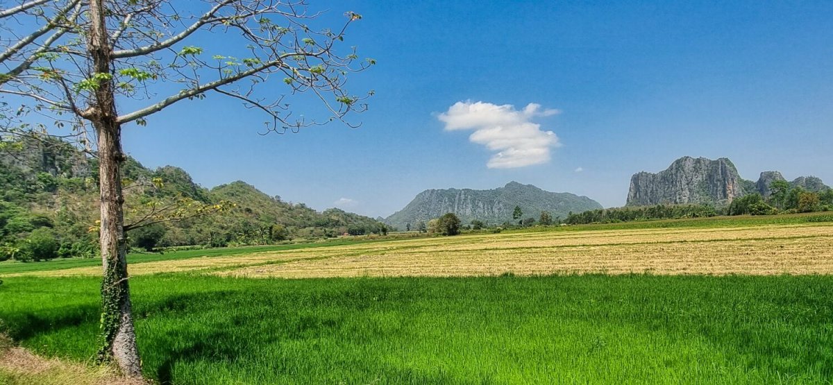
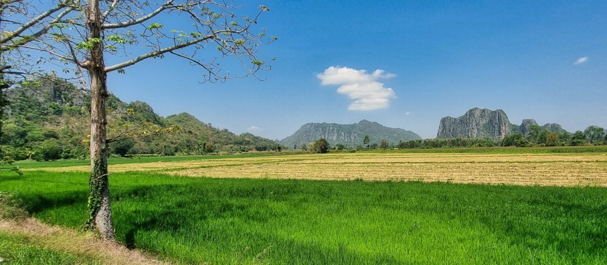
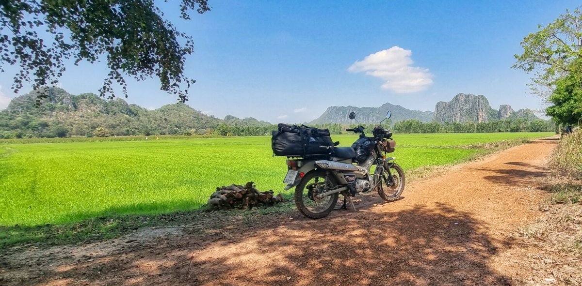
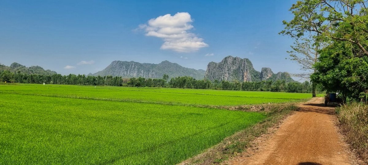
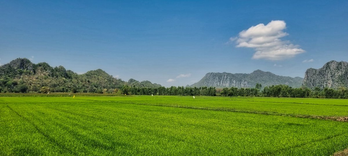
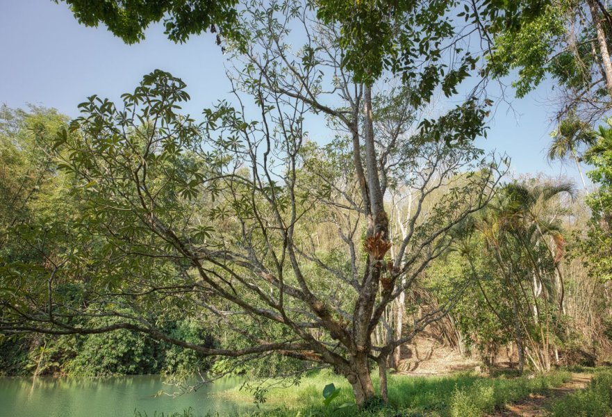
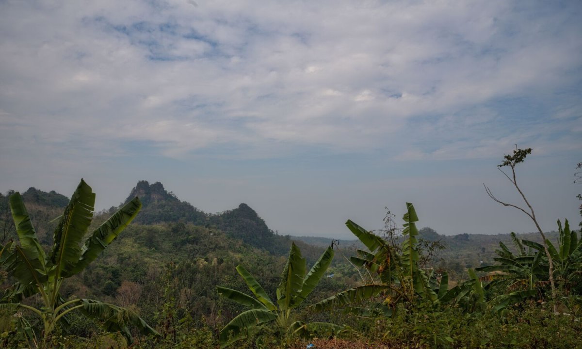
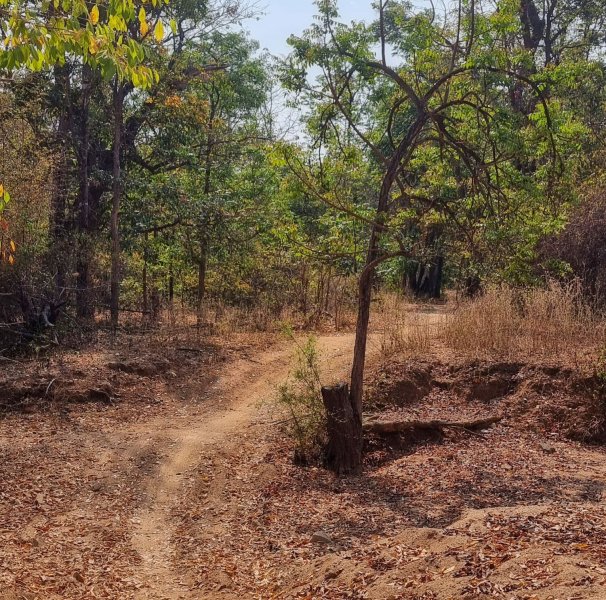
Today I woke very early and rode in the dark to some karst mountains and rice fields. Both motorbikes and push bikes were doing their best to stay invisible by have no lights or turning them off! My first stop was here. https://maps.app.goo.gl/nSBygyPU5pQr2pK88 A mountain view, A short walk found me at rice fields with good views of the sunrise and the mountains too. https://maps.app.goo.gl/w4gnjh9JfML7Yz927 I then rode on to Khao Nang Phanthurat Forest Park, here. https://maps.app.goo.gl/3FikP2JUrh7bjfjAA I then rode to the beach and looped back to my resort.
.jpg.64da7d45cdfeaceab0ada588f9223c5a.jpg)
.jpg.349e4221930aa41446a3506b78736da3.jpg)
.jpg.66c67900c0baa8df6eebacf3d8981b40.jpg)
.jpg.b831bada3a8468b8a0b5ace03507fc17.jpg)
.jpg.f6cb8348ac795adc84aee65f80e8f0ed.jpg)
.jpg.677b33329aa6a656cdf00463c0148743.jpg)
.jpg.9371b344786254c806f536ef18ead4c1.jpg)
.jpg.a9abb5e5eefc852d857e894e67f81a9b.jpg)
.jpg.93cdc131f6e81ba1c2ccbb29665903b6.jpg)

.jpg.9d5ea2103214edf4c13a37462d0b4170.jpg)
.jpg.c043462a7d5a5f2cc2a4bbb2d6e145c4.jpg)
.jpg.27c10df6ea8039b6bee881041bfa804e.jpg)
-
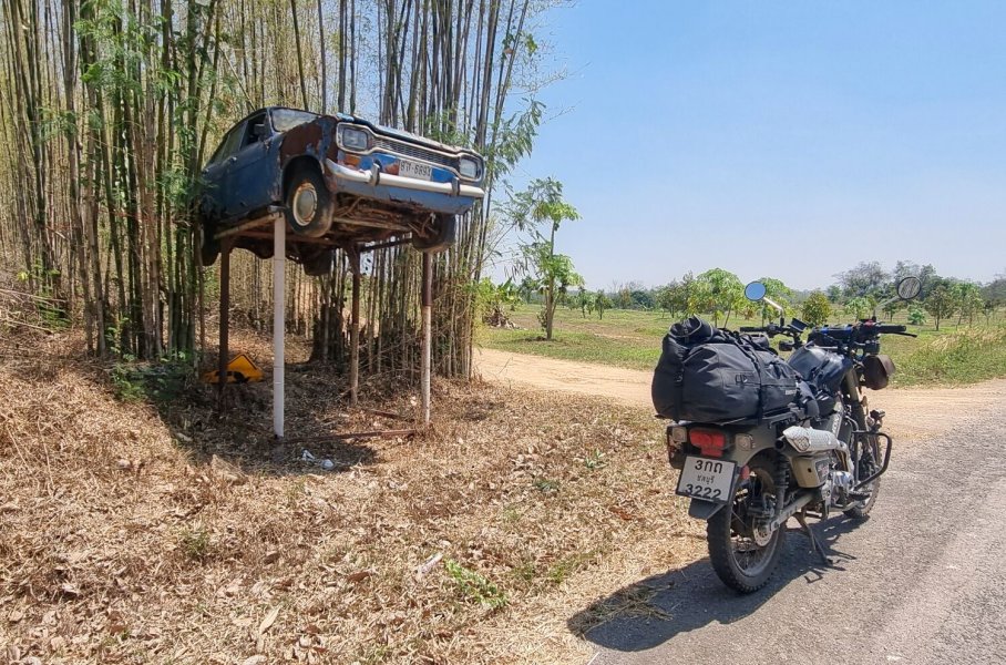
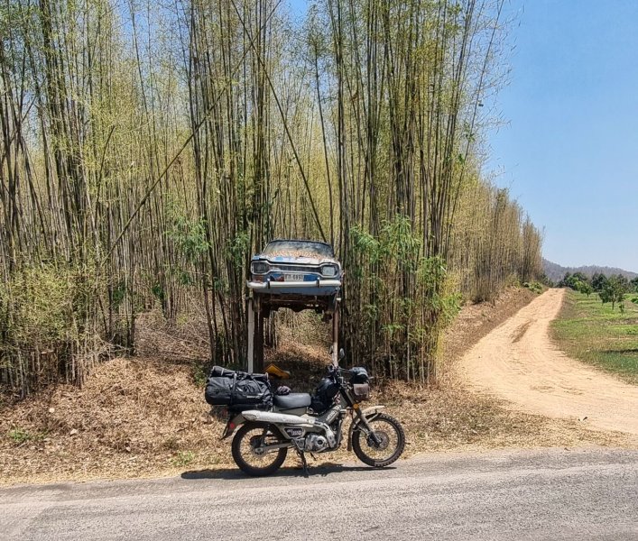
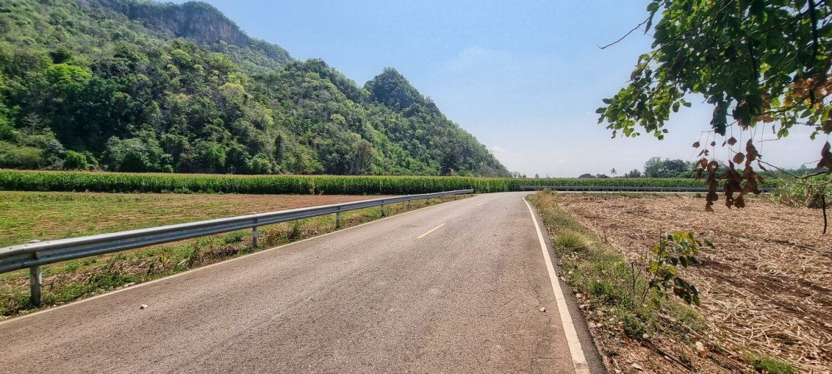
Today I left Kanchanaburi and rode to Cha-am. As you can see I took a scenic route, nice riding, especially along the border area. No main roads too. A 241km ride. The raised car is here. https://maps.app.goo.gl/tymwg8N9bgF5MvVcA https://www.relive.com/view/vAOZmejEgov

.jpg.7533ab6763db0e27249a39c4a532bdfd.jpg)
-
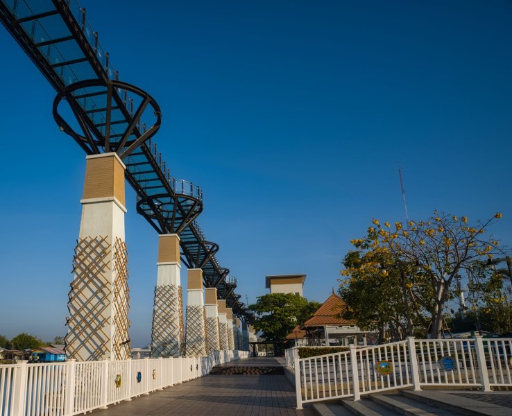
Today I had another touristy day at Kanchanaburi, I went the River Kwai Skywalk area first. https://maps.app.goo.gl/rSB2ZxMoRqG1NqDp6 I then rode to Khao Krachai Viewpoint, here. https://maps.app.goo.gl/LsFZEQhundCbN5bBA https://www.relive.com/view/vKv2352ZwoO
.jpg.2967414cd856483f11c56cbb12d62d32.jpg)
.jpg.cdeb63a81b620dbc319c790c60266f86.jpg)
.jpg.c0043e16781fae98ecd79ffcb04f221d.jpg)
-
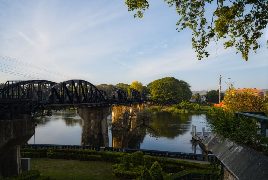
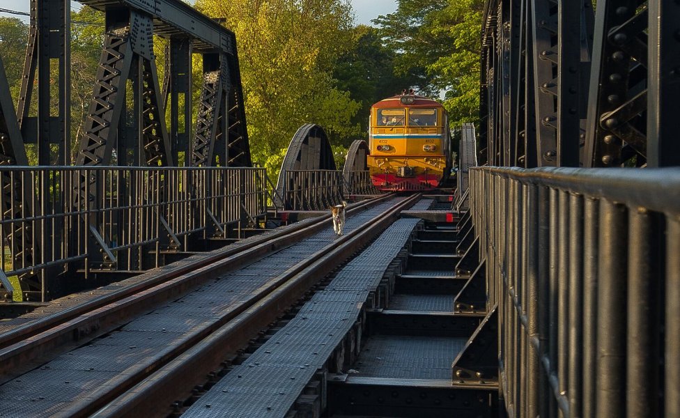
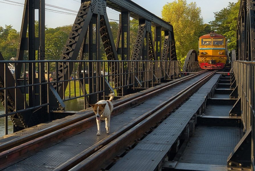
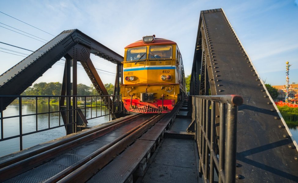
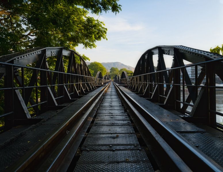
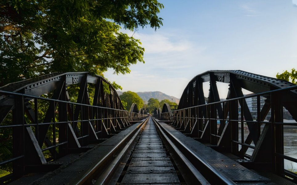
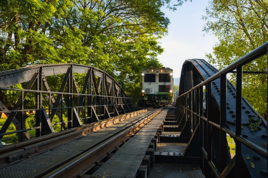
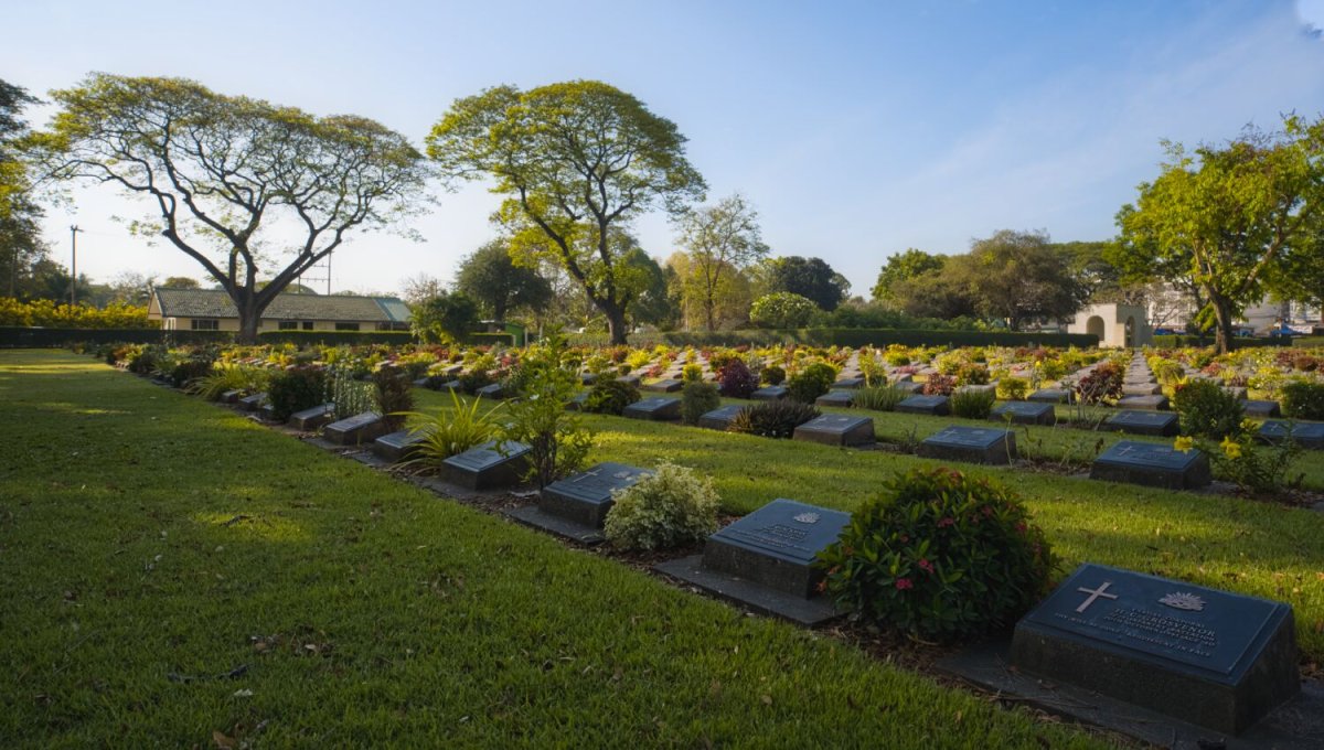
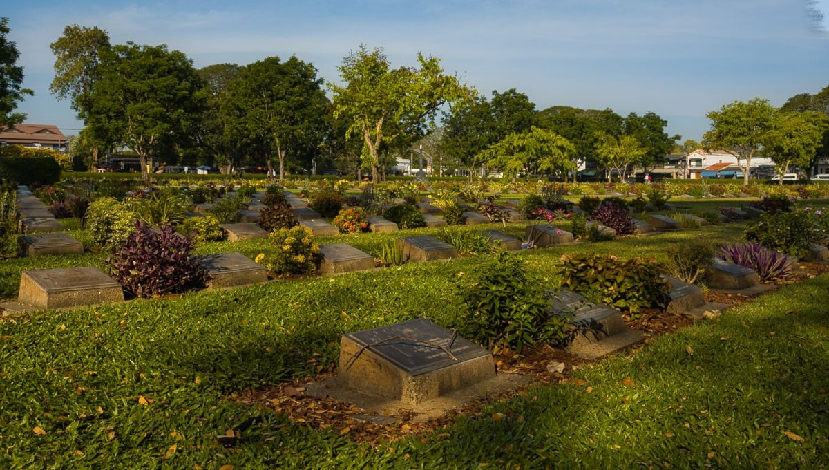
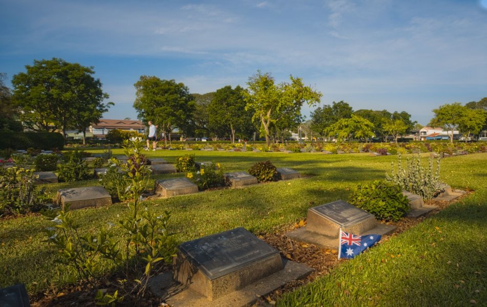
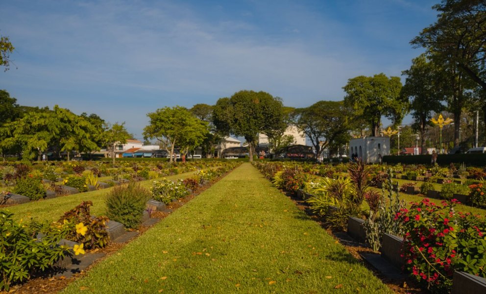
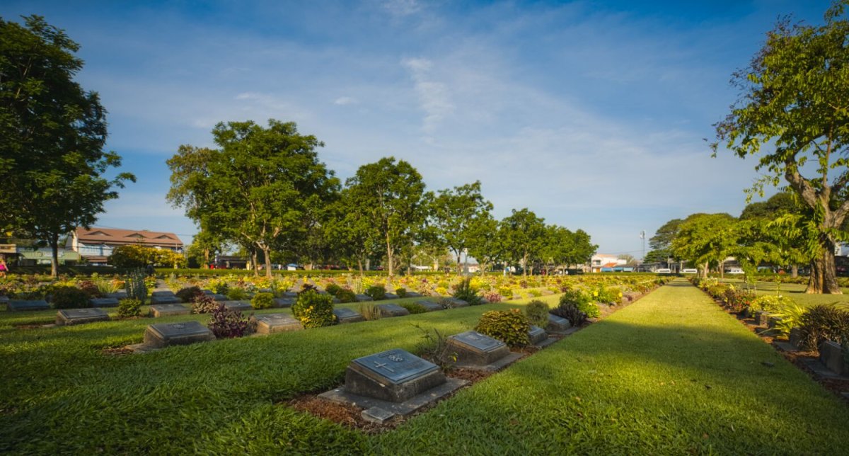
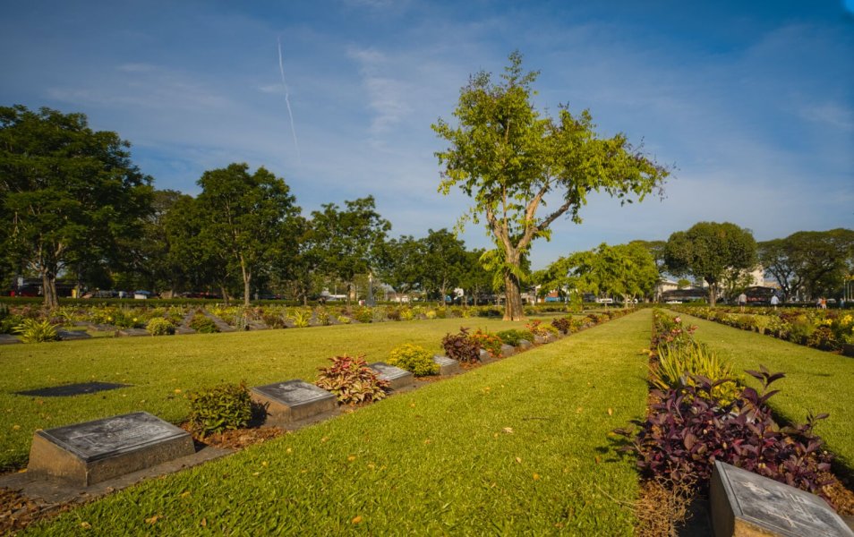
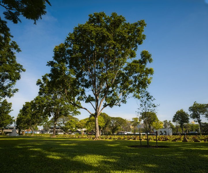
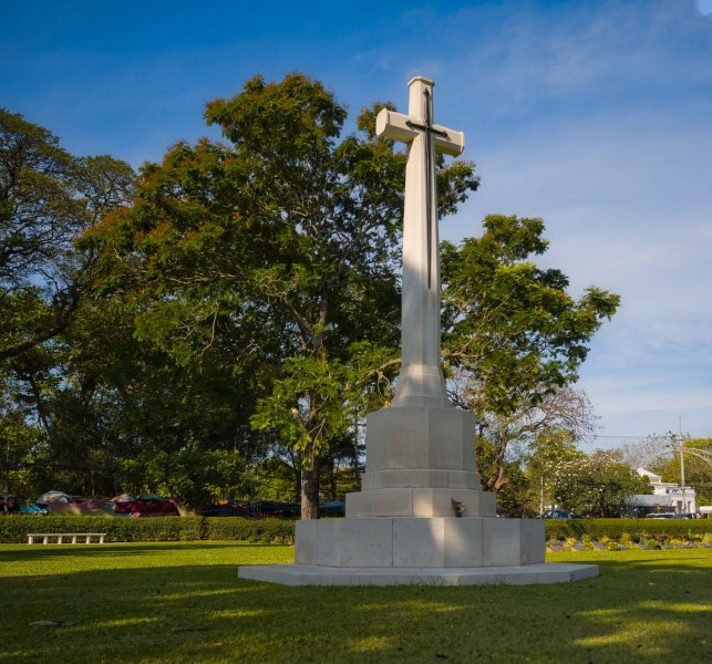
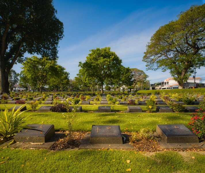
This morning, day 90 of my tour was a tourist day in Kanchanaburi City. I rode to The Bridge on the River Kwai and parked up to walk across. As i was walking I spotted a guide dog guiding the train! The train kept blowing its horn, but the dog just kept walking along at its own pace, not a care in the world. https://maps.app.goo.gl/ue3cmLggJwBGZnqx6 After walking the bridge and back I rode onto Don Rak Allied War Cemetery. https://maps.app.goo.gl/6Xr5seDNQ2bT6BGMA
.jpg.17d1d30afefe106e0a259fcf63bfa098.jpg)

-
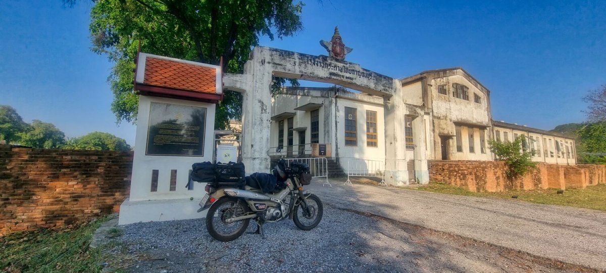
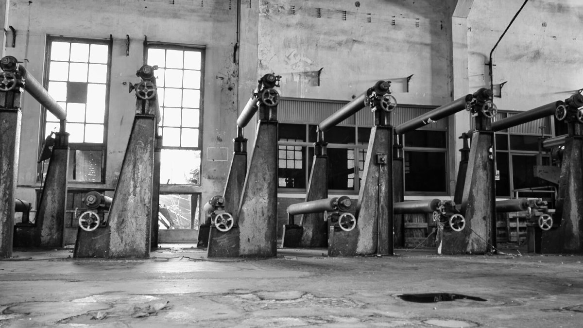
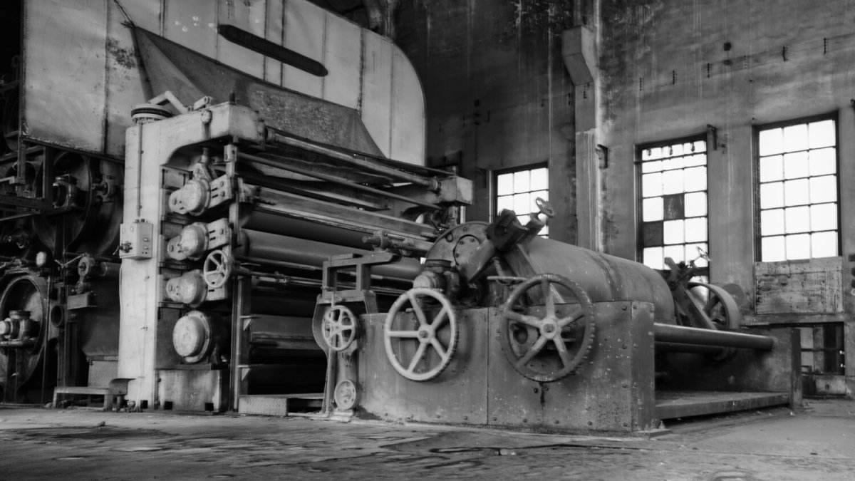
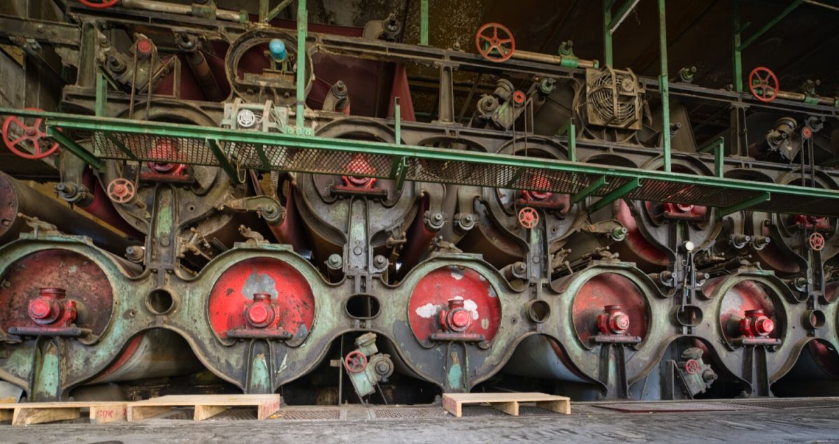
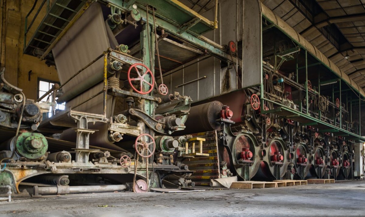
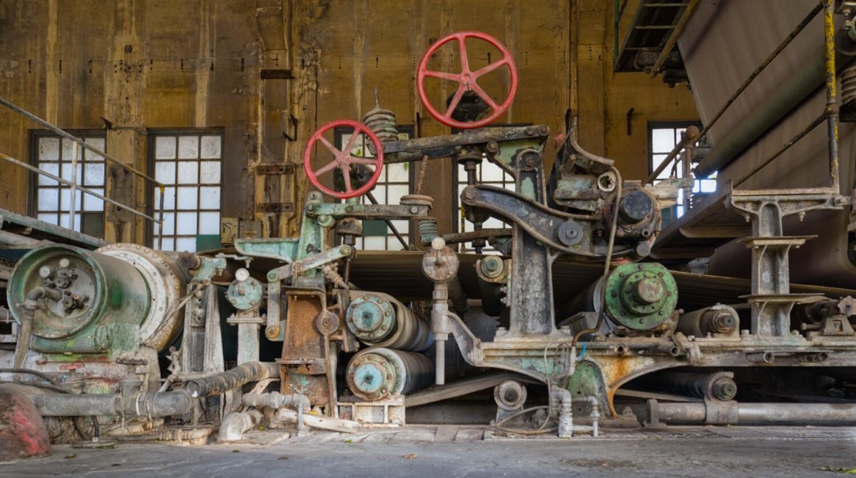
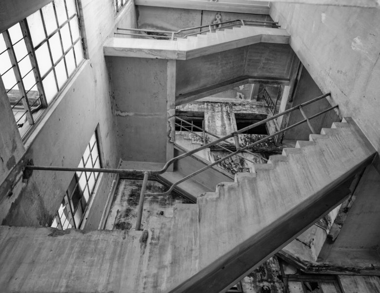
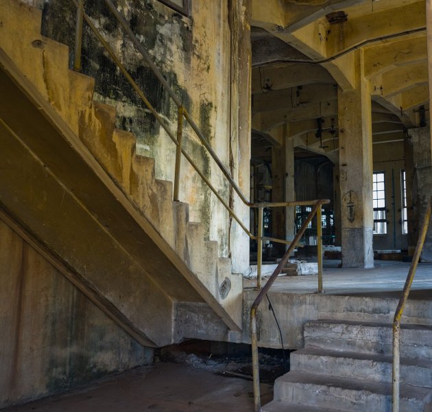
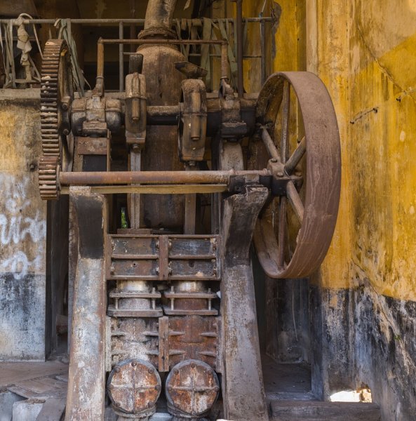
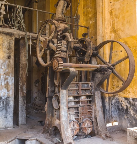
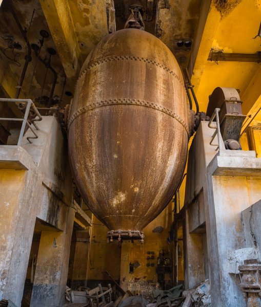
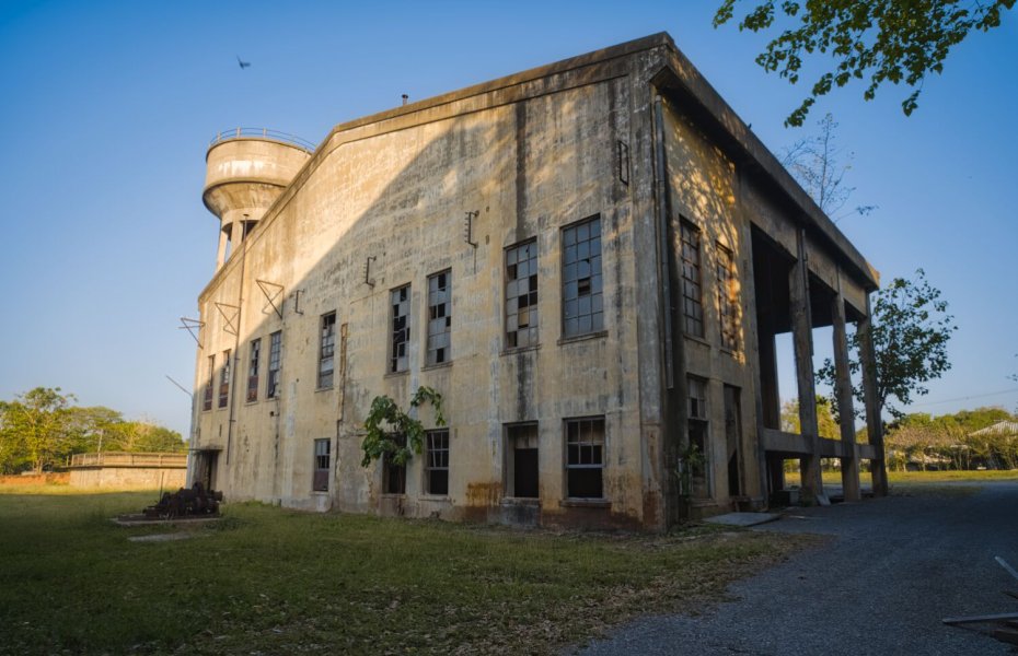
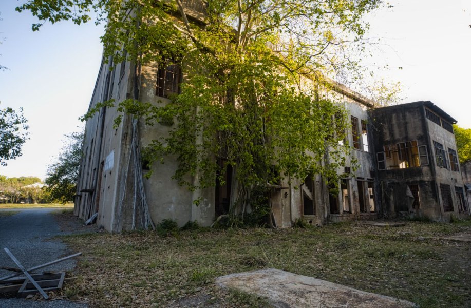
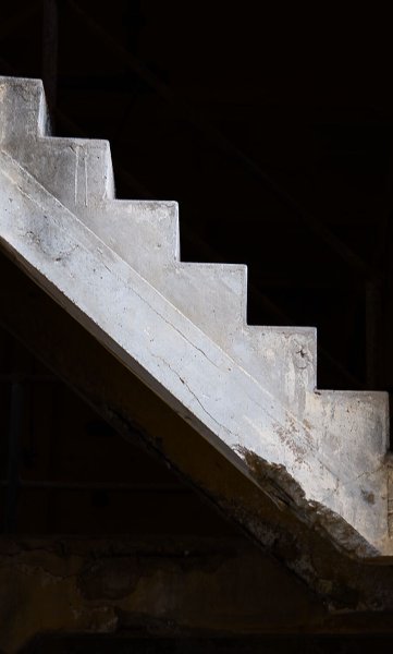
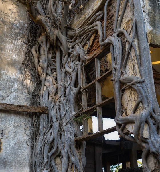
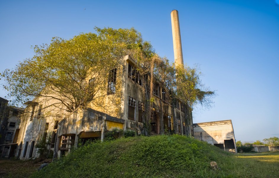
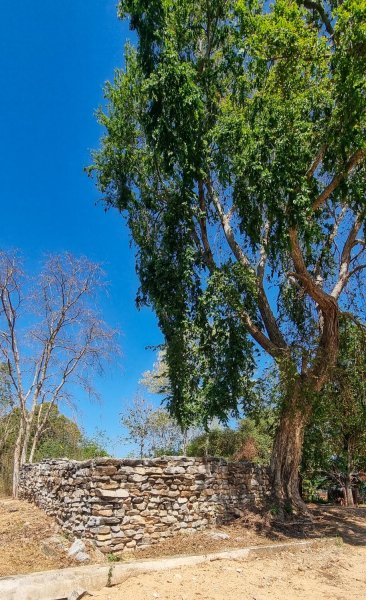
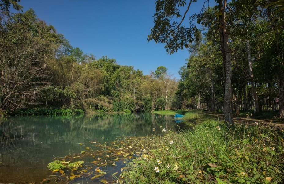
Today I decided to go see the old paper mill in Kanchanaburi. I have been before but decided to go and take some more photos. https://maps.app.goo.gl/EyZV8P5H8c4j7iqf6
.jpg.376bb48680058a7bda6d6c5c94fe7ebd.jpg)
.jpg.094bb5622977b82d105af48da01748fa.jpg)
.jpg.d9e7ef506258922969a60235d1b81663.jpg)

.jpg.e85e5ec1bfb8aff8cb192264f44721b5.jpg)
.jpg.9fd2159e0946f846d4e3fbffd7a00168.jpg)
.jpg.33d7db6a2ccfc84eda94acf107457e5f.jpg)
.jpg.db2932c58adb24ee77194a5ae4883f0d.jpg)
.jpg.f7c55a611fa24c7d6673f3f5cd0202e0.jpg)
-
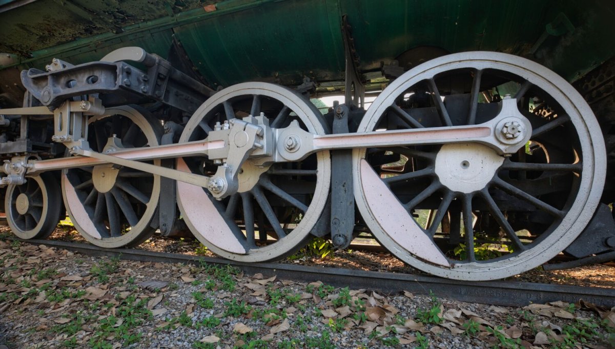
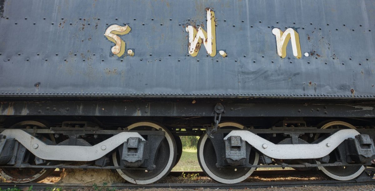
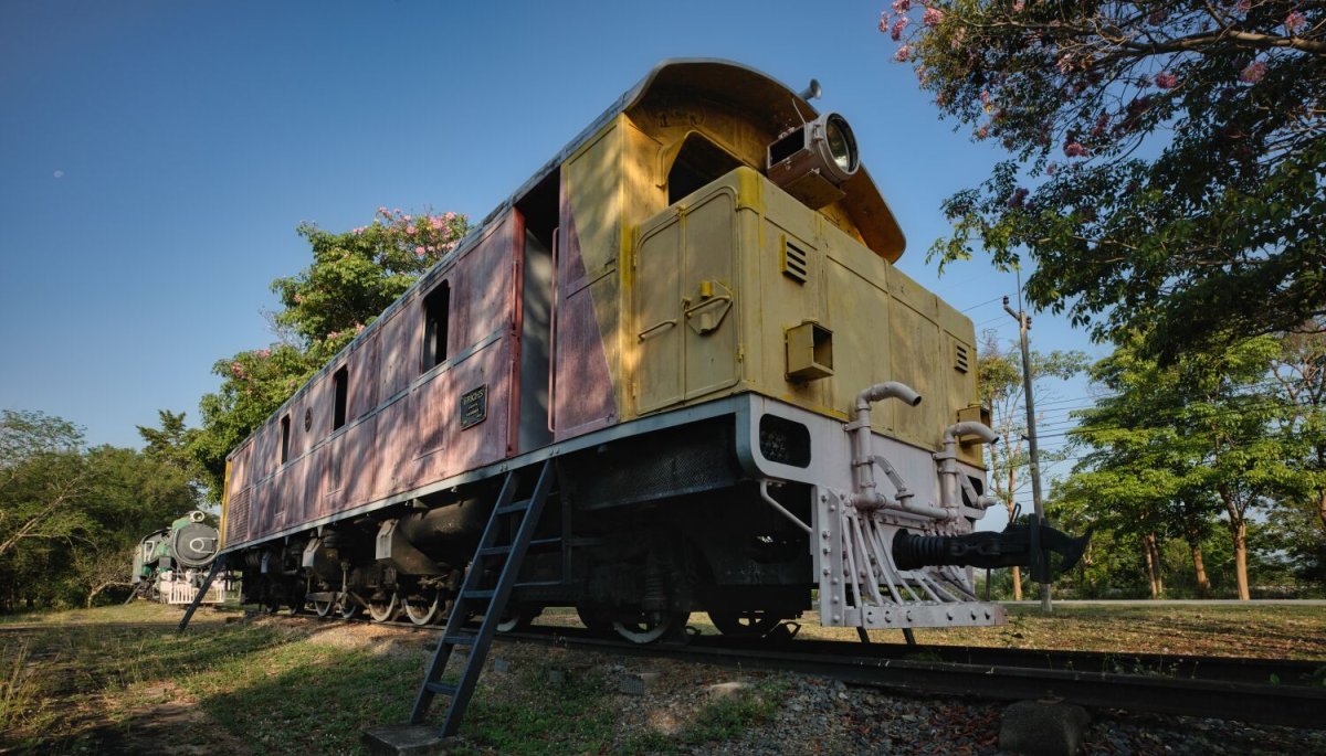
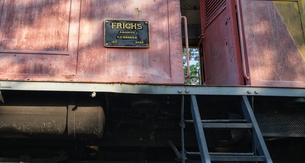
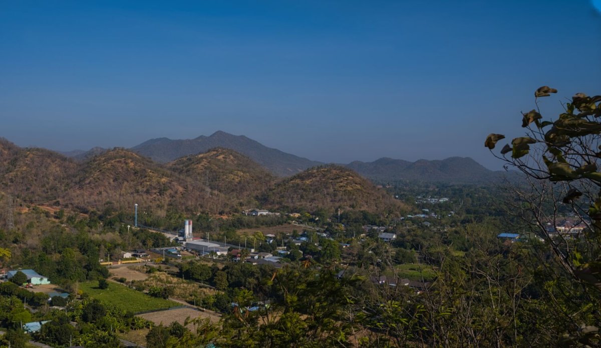
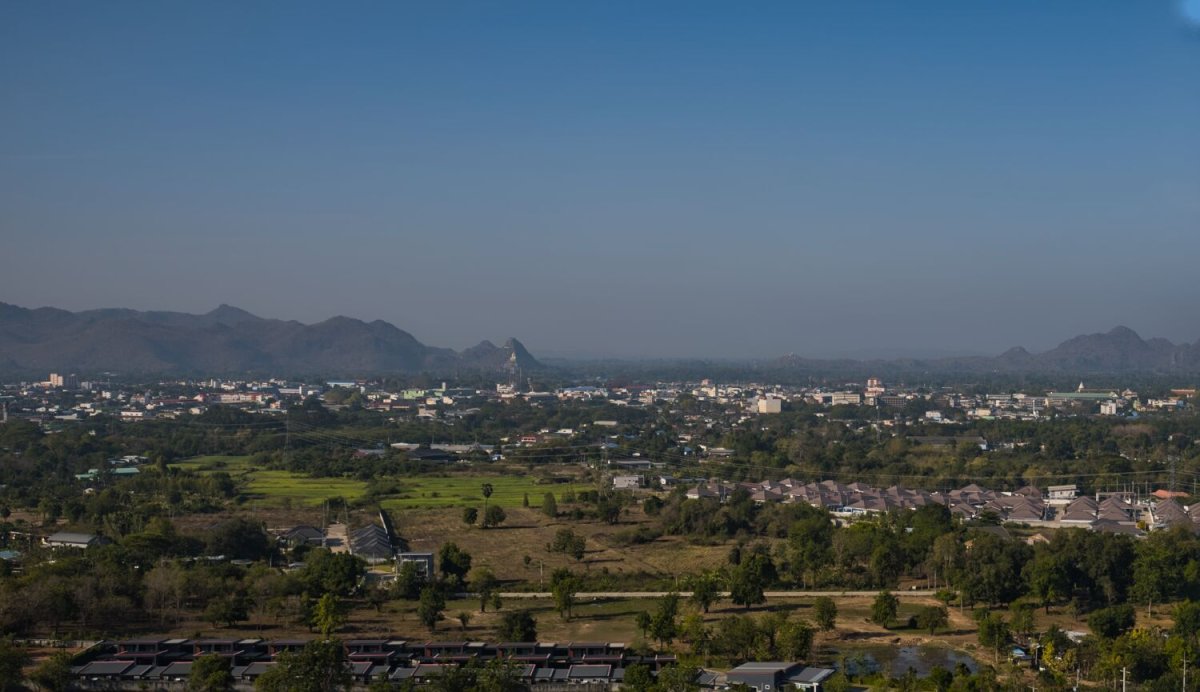
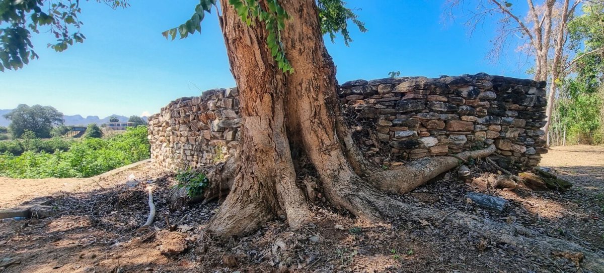
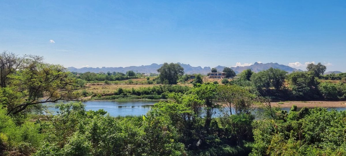
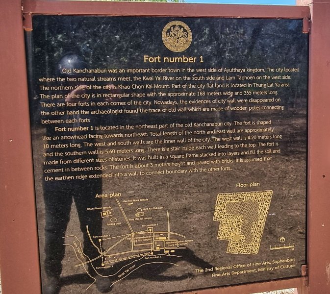
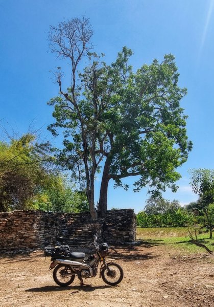
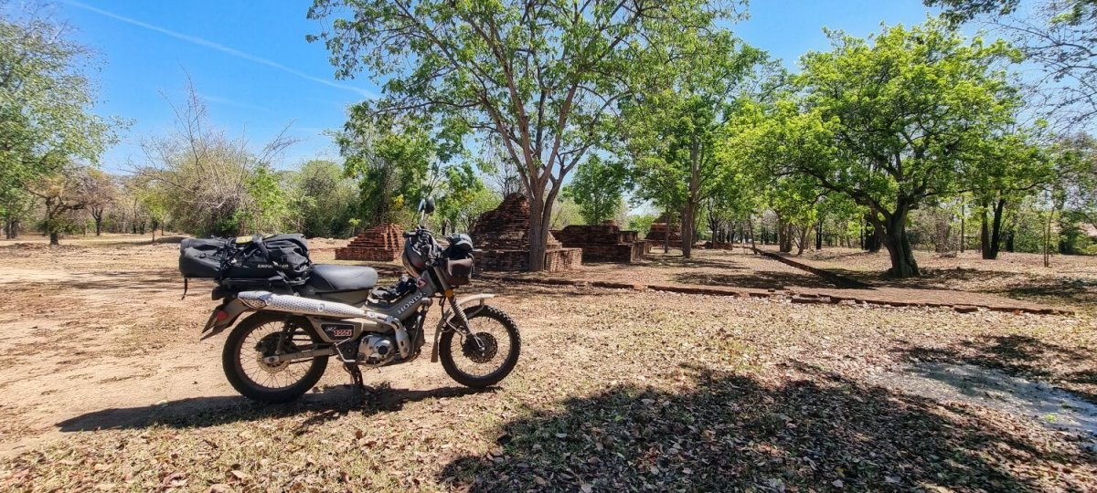
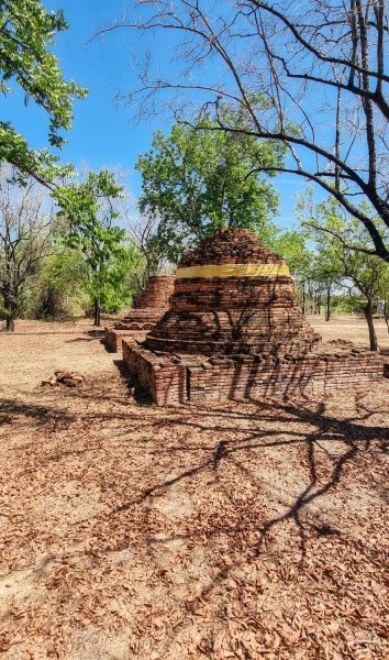
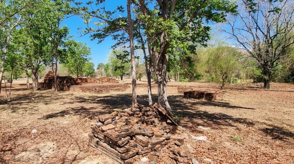
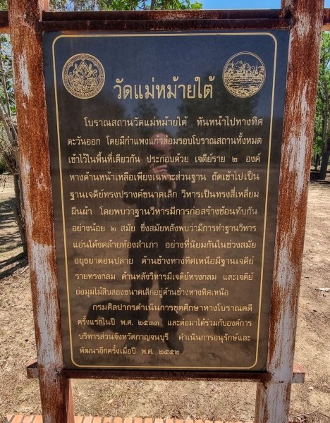
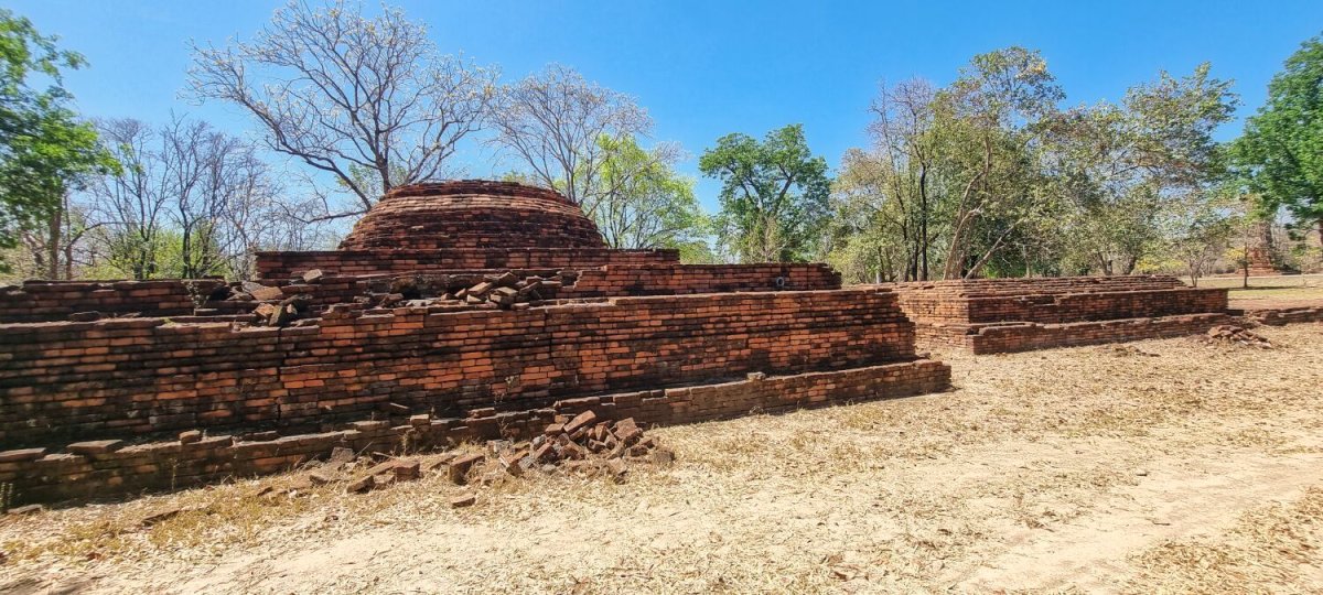
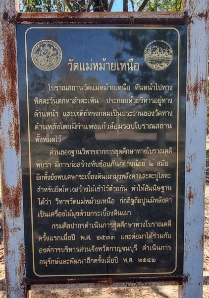
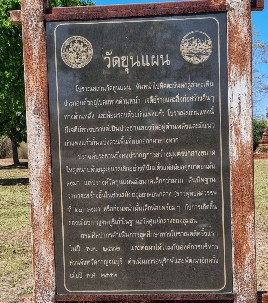
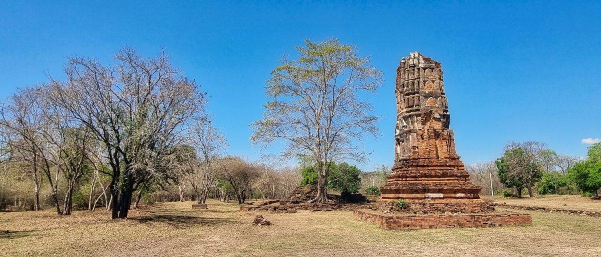
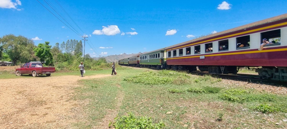
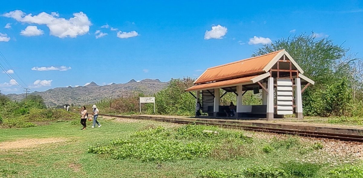
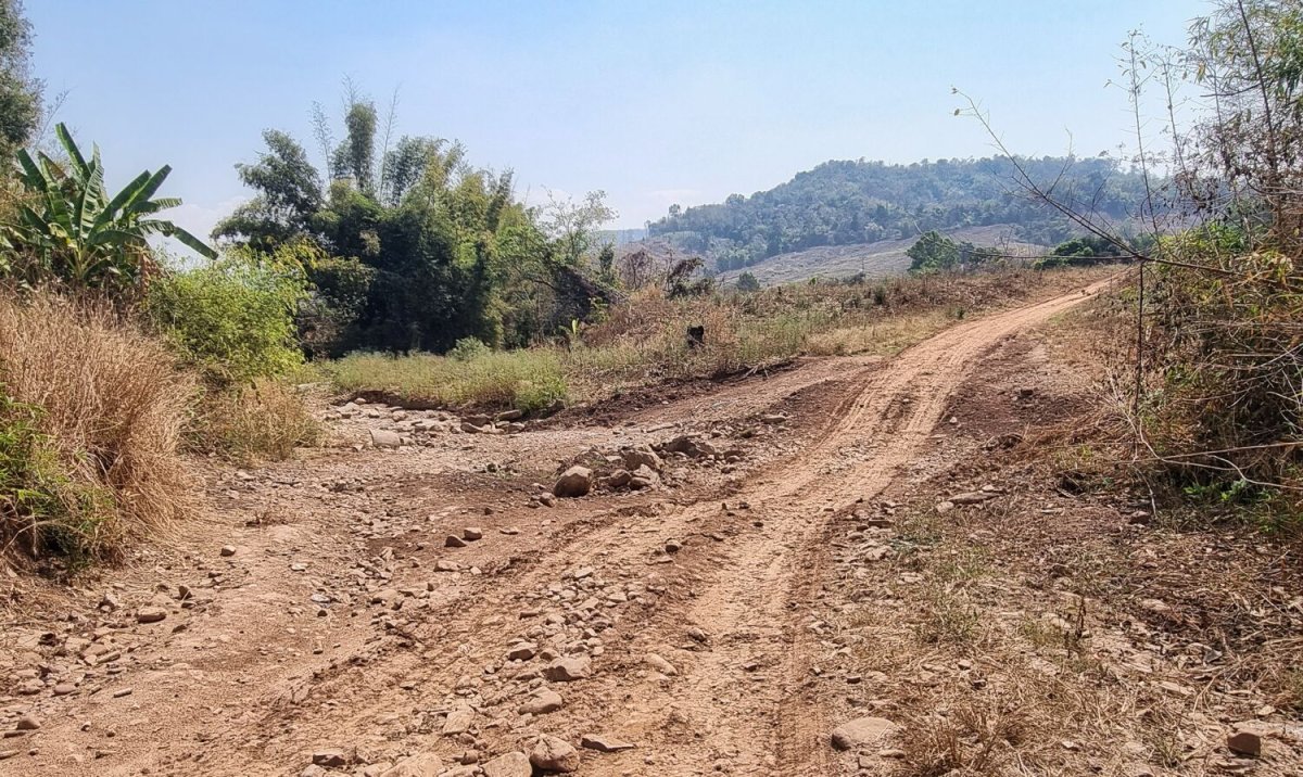
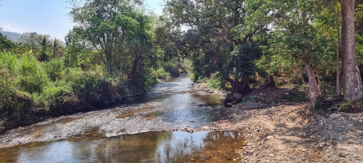
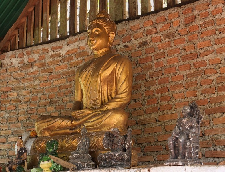
Today I rode to some ancient site around Kanchanaburi, first stop was at Kanchanaburi Old City Fort No. 2, here. https://maps.app.goo.gl/WvYgCoMmodaLewiNA Nearby is Fort 1, not on Google maps for some reason. https://maps.app.goo.gl/PACUDWBTWsB3pd2x9 Just up the road was a group of more ancient temples. Wat Mae Mai Tai, here. https://maps.app.goo.gl/nXr1uhg2HsKDEYoE6 Northern Widow Temple, here. https://maps.app.goo.gl/38SF5mUnnezVi6x68 Wat Khun Phaen, here. https://maps.app.goo.gl/oLLHh1Vh7d8ARpor8 I then rode to Ban Kao Railway Station and as luck would have it a train arrived when I was there. https://maps.app.goo.gl/uUF6iKLwi66LJzFV8 I then returned to The Smiley Frog, a nice 80km ride.


.jpg.5471c857f7ee9be58791ff3fb05a074e.jpg)
-
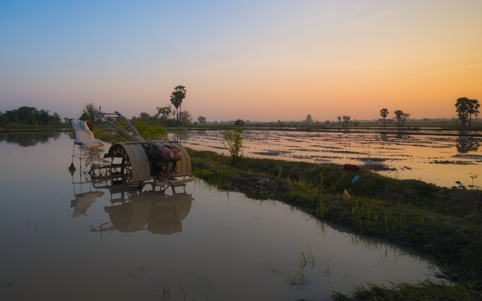
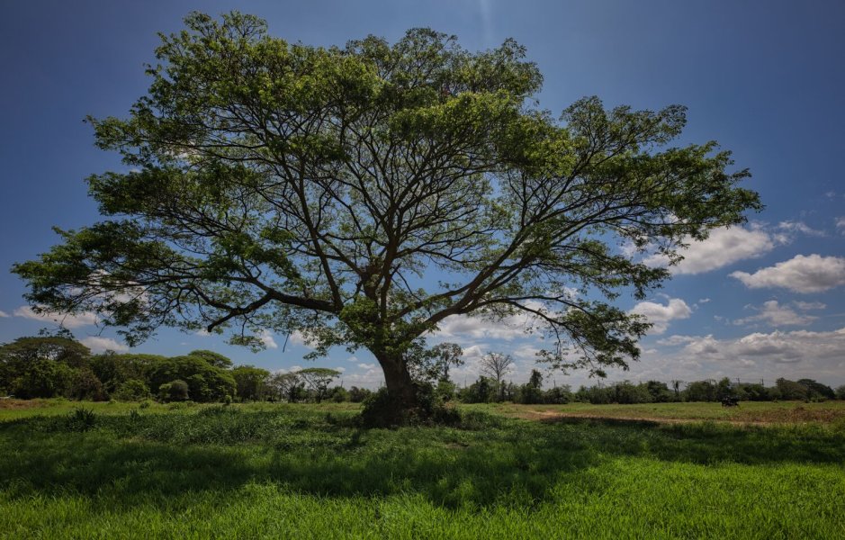
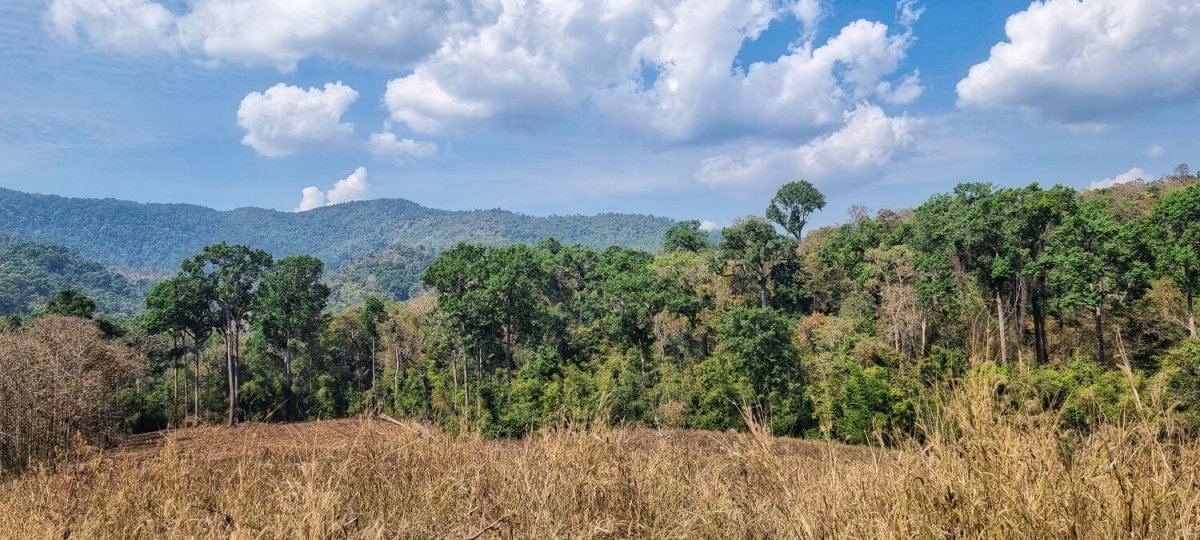
Today I stayed local, taking a few photos at The Smiley Frog before riding to a paddy field to take some photos. https://maps.app.goo.gl/UDW2waeDauARqDZx9 From here I rode to a Rain Tree to take a few more photos. https://maps.app.goo.gl/ZnxWDWbnEqgv2QvG6 Nice skies after last nights raining. https://www.relive.com/view/v8qVzJPMD3q
.jpg.9c1cf8b9111511359ca79c2a3b498e15.jpg)


.jpg.6b962a0dfc7d0954a13ada36581a9beb.jpg)
.jpg.90402dd0bc9bb59c0acc1d0a1a2d833b.jpg)
-
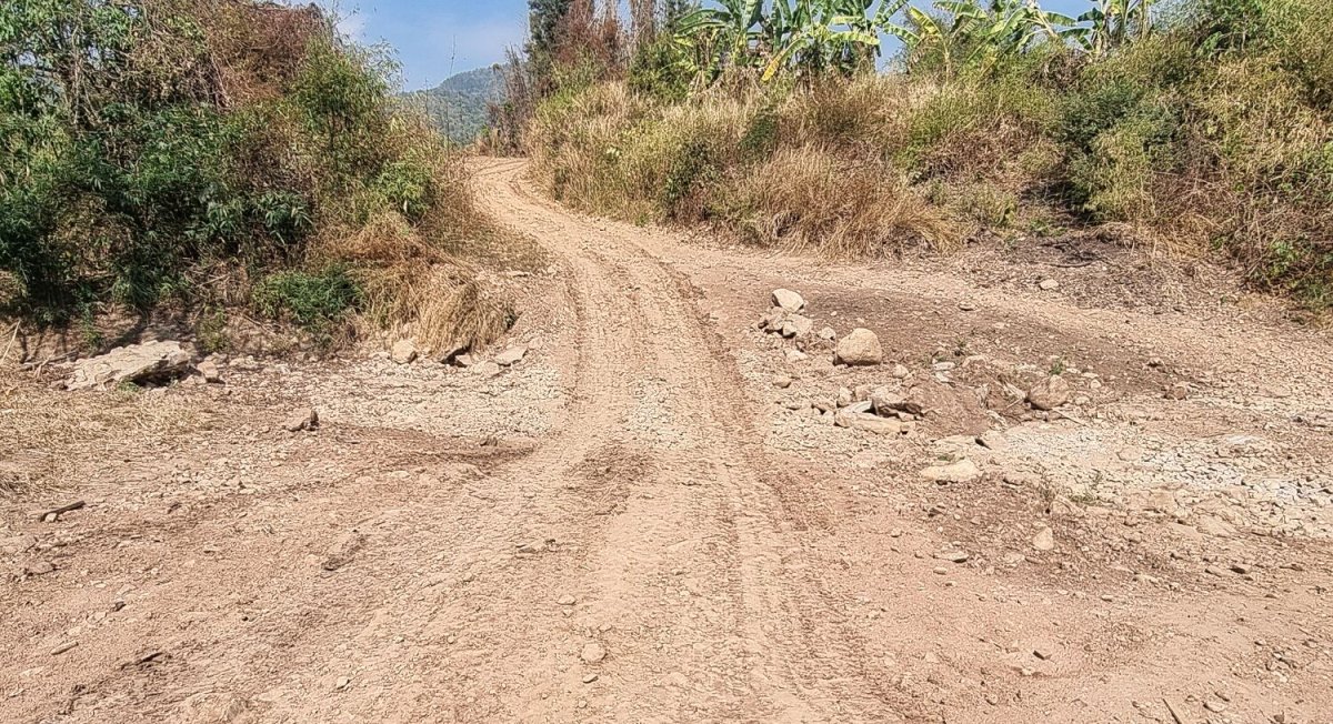
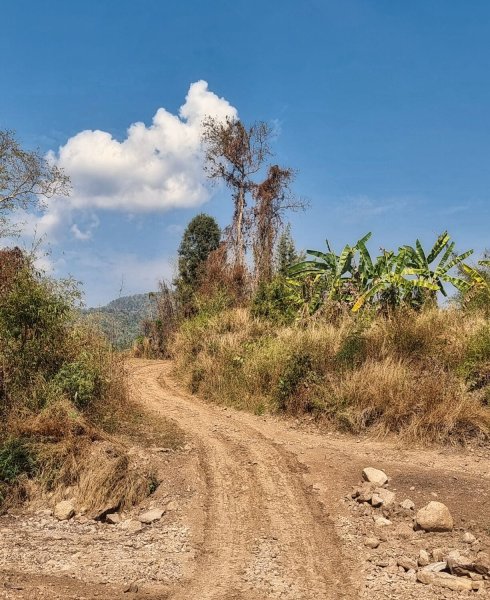
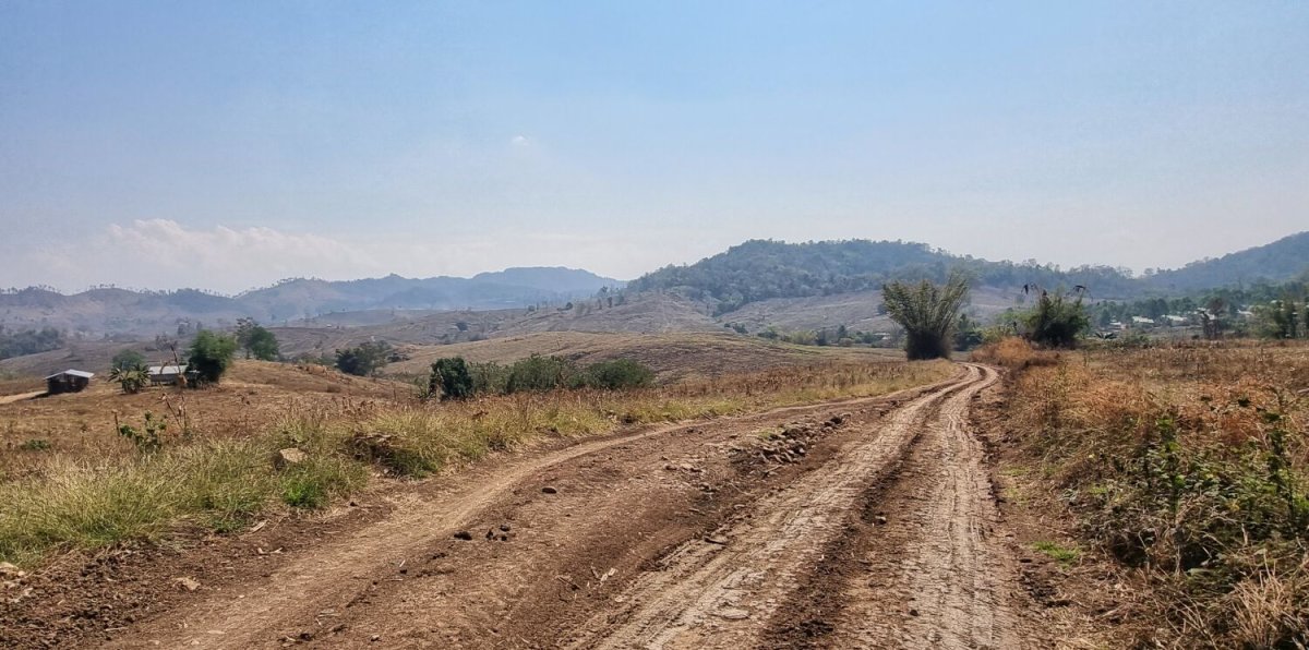
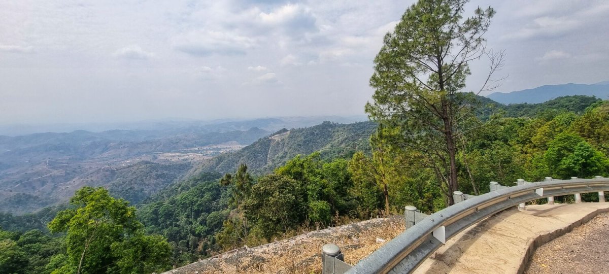
Today I rode south to Kanchanaburi from Tak, a ride of 409km. On the way I stopped looking places that would make a halfway stopover worth doing. I think that Hup Pa Tat area, here. https://maps.app.goo.gl/iadCC1WRLZevBeSo9 Along with Thai Switzerland, here https://maps.app.goo.gl/e9EPX4fZQoxoswHp6 Would make a great place, especially in the rice growing season. I will look up resort prices too. https://www.relive.com/view/vKv23Kppy4O

.jpg.8a1aa8a4e86ae33989faa67f7fd33df9.jpg)
-
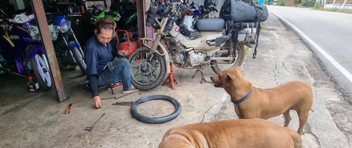
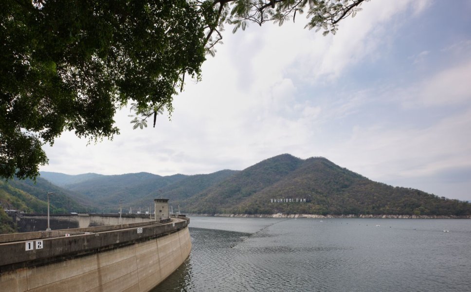
This morning riding to Bhumibol Dam I stopped to fill up with petrol and check my tyre pressure. Unfortunately, the air pump went berserk and let most of the air out. I rode slowly a few hundred meters to a Honda shop, but their compressor was broken, another few hundred meters I found a repair shop that sorted me out. Arriving at the dam, just past the security gate I had a blow out on my front tyre! I found a local who tracked down an office lady who called a pickup truck to take me and the bike out to the local village for repair. They were great and could not be more helpful. Total cost 120 baht! After the repairs I rode back to the dam, took a few photos and rode back to Tak. https://maps.app.goo.gl/LMhf8QwuFUTmuaUG8


.jpg.4714448cbb26cc1c20b6b702089cd7ee.jpg)
-
For me riding to the end and walking into Burma, yes.
-
Its about a 4 to 5 hour ride taking it easy. Busy now, before very quiet. Following the road to the end and walking through the Burma border was the best bit.
-
Today I rode from Umpang to Tak, I started the ride at 8am because the weather forecast for Tak said 50 percent thunderstorms in the afternoon. I wanted to be out of the mountains and racing trucks before then. I arrived at 2pm after 243km and no rain. https://www.relive.com/view/vYvrzrRKALv
.jpg.eee697ba0e75ca8b2501220f474907f7.jpg)
-
Today I stayed local to Umpang, riding to Nam Dan Pilgrimage Station, here. https://maps.app.goo.gl/M1FQDepzjq3yXEJT6 Riding to the border there was an army checkpoint that allowed me to ride on, then I came to the border, Ban Nong Luang, here. https://maps.app.goo.gl/U3nEvj5YERqQeuZ77 There was no army at the border so I kept riding a few km along a track until I could see a small village, Htee Ta Pa Law, presuming the Burmese army would be there I made a U-turn and rode to a small bridge over Ya Mae River, here. https://maps.app.goo.gl/u6ZFedDcca71UPRq9 https://www.relive.com/view/vMq5RKPow8v

.jpg.261b87ba98de26d5894cefebb9448813.jpg)
.jpg.00e18625e7898efdddd65c5aa5069c47.jpg)
-
A mix of Burmese people and some Thai's
-
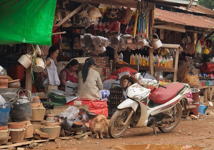
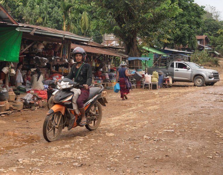
Today I rode south to the Thai-Burmese Border at the end of R1288. I parked up and walked into the market area. What a great time! All the people were smiling and happy, some came to chat and say hi, a few were a little shy. It made the ride worthwhile, a 175km return ride. https://www.relive.com/view/v26MzZdLK3q
.jpg.65d724aa4cf46f3a66d1e11616f9018e.jpg)


.jpg.bfb11e8655ad952ee405833437c83d74.jpg)
-
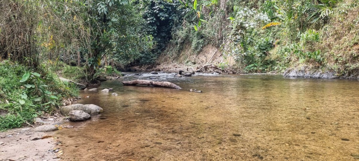
Last night woke and thought, this view from my bed would make a an interesting photo. Not sure now, but I have added it anyway. I headed south from Mae Sot stopping only once at a camping area by Mae Klong Noi-Mae Klong Yai Watershed Management Unit. https://maps.app.goo.gl/wmLyXUUAZpXK389E8 This area is very rural and I saw a local girl washing clothes in the river. https://www.relive.com/view/v8qkKmBBR3q

.jpg.ef6bd5af38870bd82b8ed9fa4eb7dc1c.jpg)
-
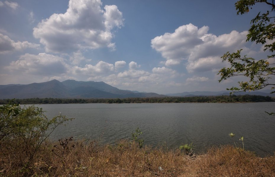
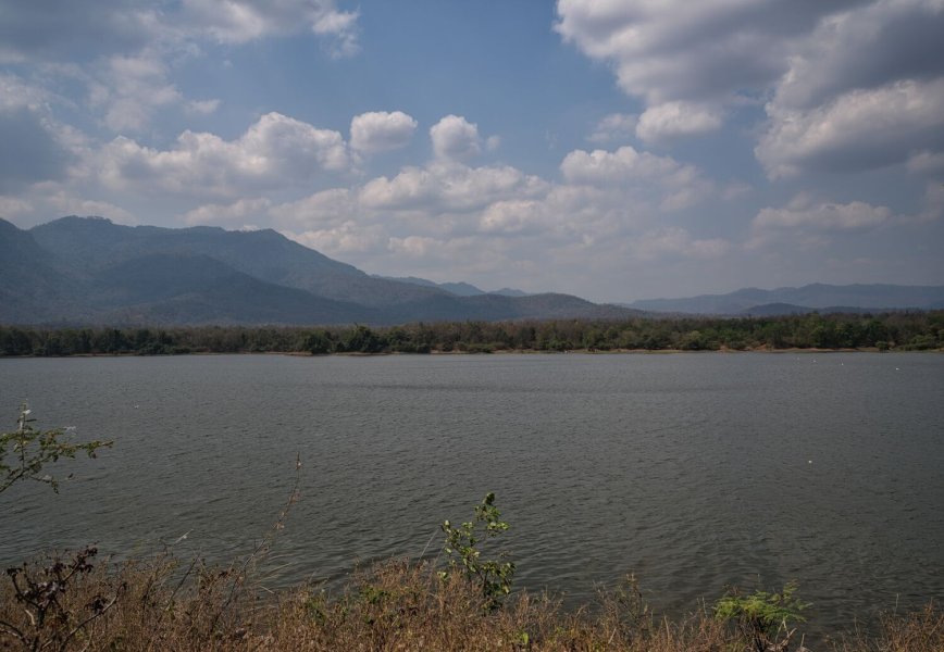
Today, day 80 I rode to Mae Sot from Tak, an easy ride. When in Mae Sot I went to Huai Luek Reservoir, here. https://maps.app.goo.gl/2rJf4s1oLyHz1Vpe6 I then rode to Dam embankment, Huai Mae Sot Reservoir, here https://maps.app.goo.gl/PvsT9MLQC1jjEbBH8 https://www.relive.com/view/vYvrzrMKJxv

(1).jpg.cf9c69ff9528479a4ec1b77fcee45b94.jpg)
.jpg.dfc50bdea5a121e9a3b31929ac13a8bc.jpg)
-
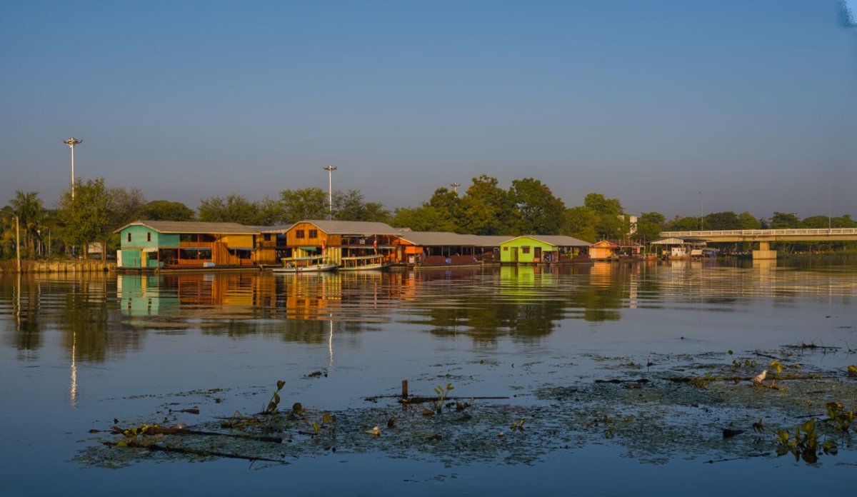
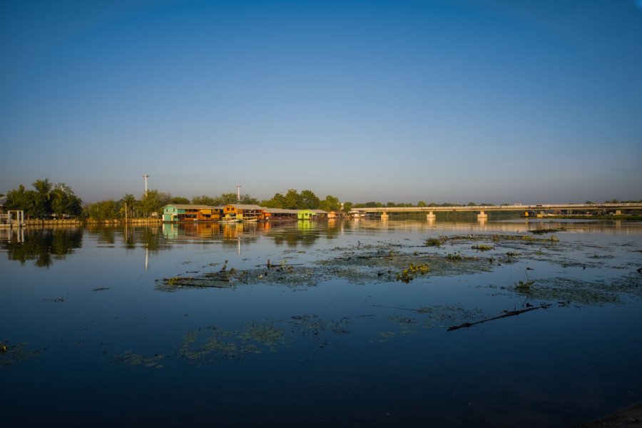
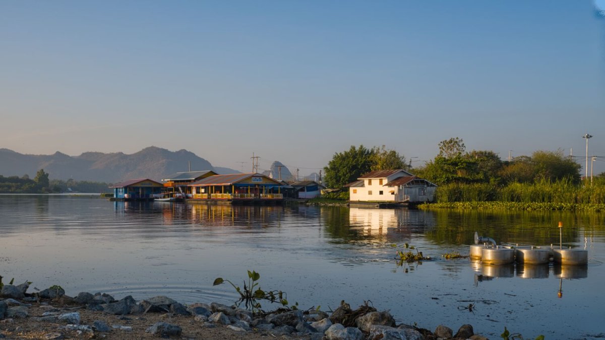
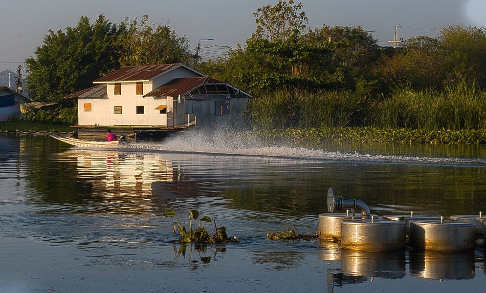
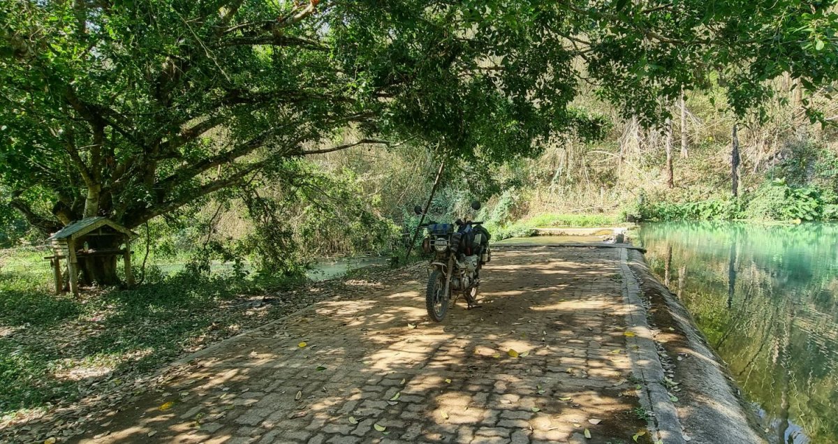
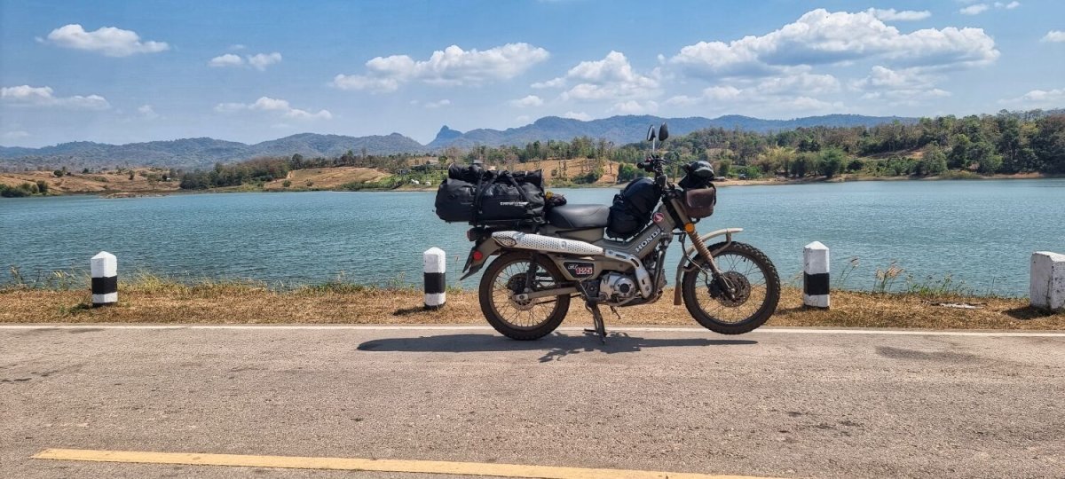
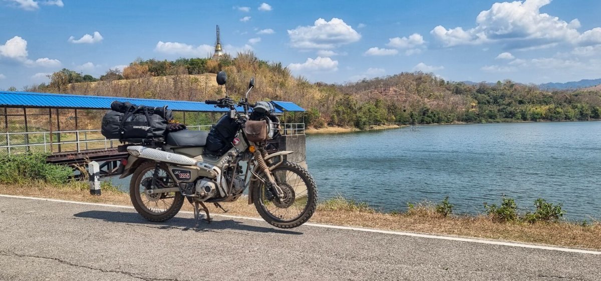
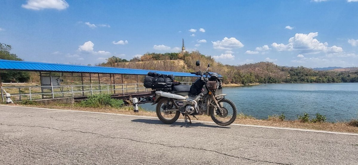
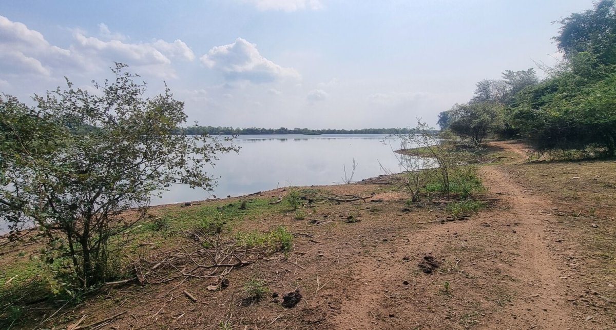
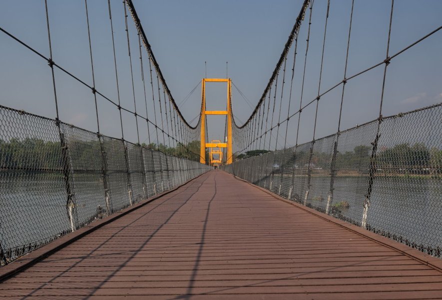
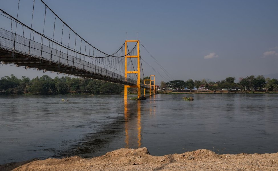
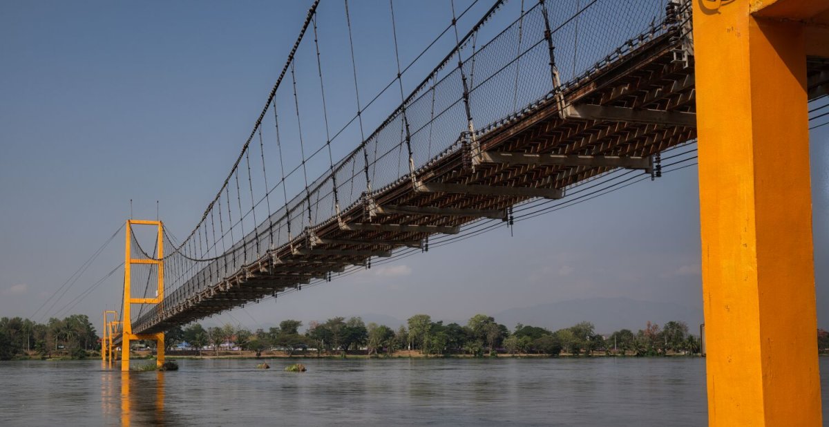
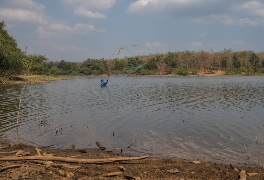
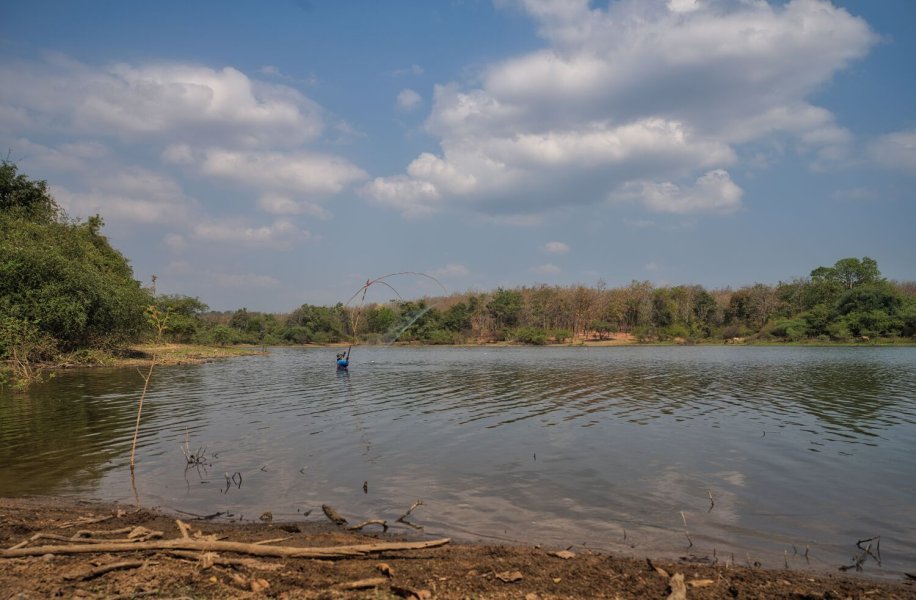
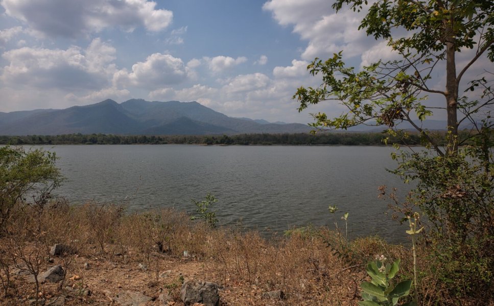
Today I stayed local to Tak, my first stop was at 200th Anniversary of Bangkok Bridge (Suspension Bridge), here. https://maps.app.goo.gl/w9zckCbR1Tj8spgx6 I then rode to Huai Buak Luang Reservoir riding tracks, and then to the dam itself. https://maps.app.goo.gl/Uazzr41jc94PFQVE6 Here, where the local farmers were fishers and taking care of their cattle. Very polite and came to check up on me and let me know the track I was riding was a dead end. Then back to the dam here. https://maps.app.goo.gl/X4SVSH7UE8jwkjA5A https://www.relive.com/view/v1vjZx5g1Yv
.jpg.a8ae87567a0e3754e31aacc4fca30947.jpg)
.jpg.d73d12aac633fb14421c98eccdd051ab.jpg)