

T_Dog
-
Posts
4,212 -
Joined
-
Last visited
Content Type
Events
Forums
Downloads
Quizzes
Gallery
Blogs
Posts posted by T_Dog
-
-
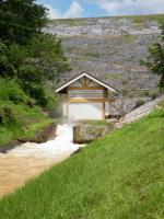
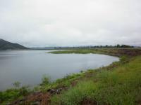
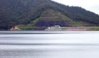
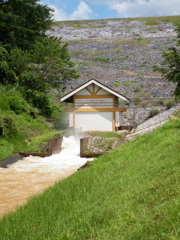
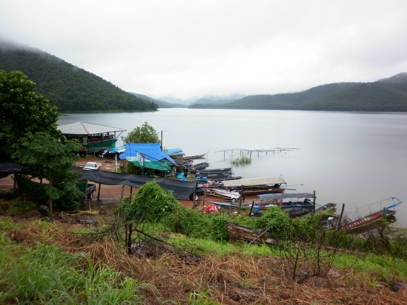
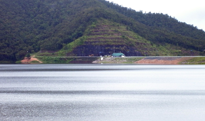
Mae Ngat Dam was discharging a bit more than last week, but according to the folks up there it was at fairly normal wet season maintenance levels. The small gate house controls an irrigation canal, and the main hydroelectric plant is about 20 meters lower. Always a picturesque place to have lunch.
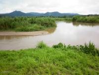
Did not get any photos of the Mae Taeng River, but it was much lower than during the flood crest.


-
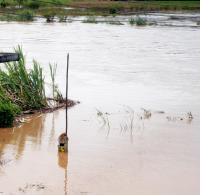
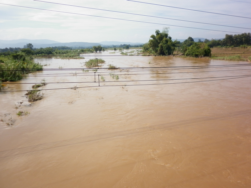
The Ping River along the road to Chiang Dao is still running very high. The flood crest through here uprooted trees that are now lying on sand bars.
-
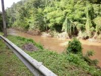
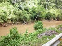
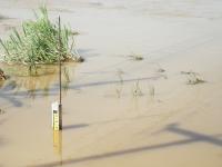
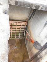
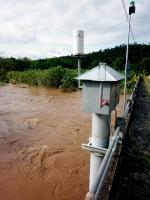
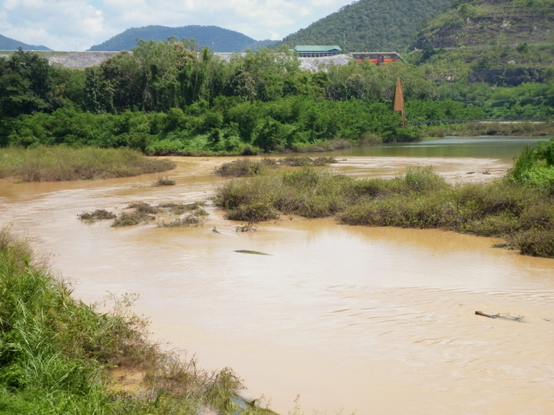
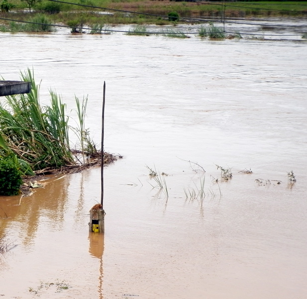
Here are photos taken on 7 October or 10 days after the flood crest at the HWY 1323 bridge near the Mae Ngat Dam. There is a "during crest" and "after" photo of the depth gauge and the water is down 60 cm from where it was, but still a meter higher than three weeks ago. Still some flooding up there but it is not causing too much problems except to the farmers that own the fields.

-
You tell the wife you have to turn the water off because you have to put the engine in the Edan to drive into town to buy beer....

Thanks, But I still give my top vote to:
"You are a local when you go into the bathroom and the muddy footprints on the toilet seat are your own."
-
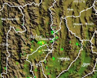
Very dark to the south of CM. Anyone report any heavy rains in Airport Pz down to Hang Dong area??
G
Rain by CMU at the moment. Not very extensive per the radar image.
-
You tell the wife you have to turn the water off because you have to put the engine in the Edan to drive into town to buy beer....
-
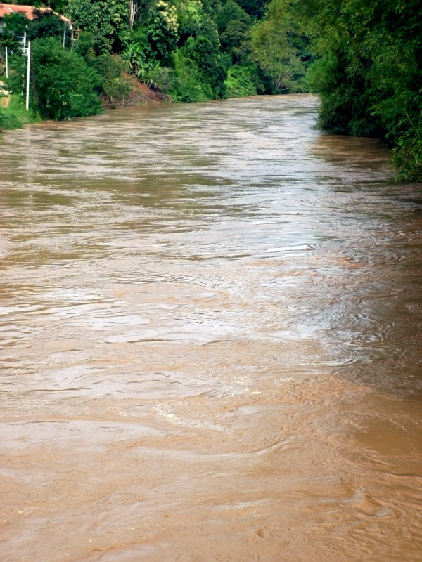
Just got back from Mae Taeng and the rivers are still running quite high. Some minor flooding in the adjacent rice fields at the HWY 1323 bridge near Mae Ngat Dam. The river is 60 CM down from where it was at its crest ten days ago, but still a meter higher than it was three weeks ago. Most of this water is coming down from Chiang Dao as the river next to the road in that direction is high. Judging by the uprooted trees laying everywhere in that valley, the flood crest would have been an impressive thing to see. We took a run up into the mountains and saw some areas in steep country where the flash floods must have been terrible.
The Mae Taeng River has come down a lot. Mae Ngat Dam is releasing just a bit more water than last week but pretty much a normal wet season maintenance level.
-
Friends that had the 60csx have moved on to the Garmin Oregon which has much superior mapping and also a better user interface. Check that one out as there are a lot of internet GPS forums where you can find opinions.
-
Just heard from a local of possible big water coming down from the North at 4am this coming morning.
Anyone heard anything similar?
If that were true, Mae Taeng and Ban Pao would already have seen it. Just spoke to folks up there and no mention of high water. You can probably put that in the same bin with the rumors of dams bursting.

-
Annabel... If we do get some more heavy rain, it could get bad, but the reporting by the Nation seems a bit sensationalistic since Northern Thailand is only getting light scattered rains at the moment. They also published an article a few days ago that had dam data that was incorrect.
The tropical storm on its way has lost a lot of energy and precip, but it could still cause problematic rains. (When the links below open, Scroll Down)
Keeping an eye on this would be a good idea.
Sorry to hear you had flooding at your place. Did it at least drown the roosters?
-
Are the dams here built with no ability to release water until they are full?
Why would they be??
Irrigation perhaps? They were able to flood all the paddies around Doi Saket from Mae Kuang reservoir starting Jan 1 for this purpose.
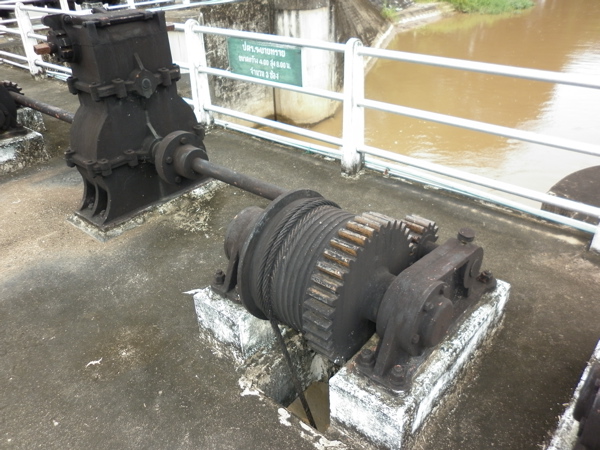
Mae Ngat Dam releases water all year from its lower gates for irrigation purposes. Swimming below the dam is very popular during Songkran as the water coming down the canal is clear and cool.
-
Check those brakes pulling out of a service shop. Just had the brake pads replaced front and back and as I got into traffic, no rear brake whatsoever. Turns out they bled the rear calipers right onto the new pads and disk without using a bleed tube. Not sure when they will break in now as short ride got them to start working only a little. Talk about crap service. And they never tightened my chain as I asked them, but that was my bad for not checking before I left. Some day I will have my own shop so I can do my own work.
-
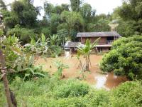
Thanks for the photos, T-dog. It puts into perspective what people had to go through in the recent flooding. It is also fair warning in what to expect in the future and then take necessary precautions. Living in a flood plain is ALWAYS a risk.
You are right there Ian! Many people were impacted by the floods and it is likely to happen again. In Ban Pao folks had to get up in the wee hours of darkness to evacuate as the waters rose so rapidly. Not fun at all, but things seem to be getting back to normal for the most part.
-
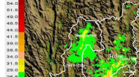
Does anyone know anything about the road to Mai Hong Song and how it fared in all the rain?
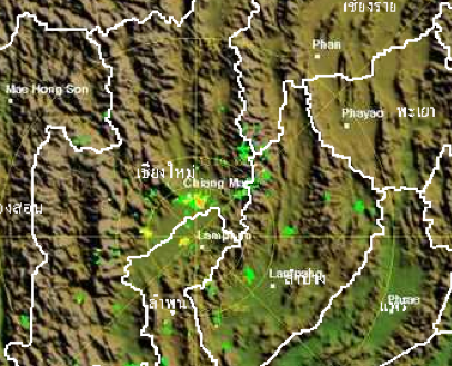
Haven't heard anything on the news, but MHS is getting very heavy rain at the moment. Here's a radar precip image.
-
Just took a cruise through there and on the main drag you would never know there had been a flood. Even the basement 711 was open for business like nothing had happened. Still some water hanging in the low areas of Loy Kroh Road toward the river but the merchants have done an incredible job of getting back to business.
-
If you want locations of the measuring points in the Ping basin you will have to look on the RID site. They have an XLS file with all stations and the rough GPS locations, description of the location and since when operational etc.
water.rid.go.th/hyd/list_station/ping.xls
not sure if links will survive on this site but otherwise Google Mae Taeng P.70 P.65 and it will be your first hit.
Joop
Joop... Thanks! Downloaded it and will attach it here under a different file name for future reference. Now if only they were all operational.
-
This link is to the Mae Taeng River level at Hydro 1... but there is no data.
http://www.hydro-1.com/index.php?id=61&rivercode=0603
Thanks a lot for the pictures and report T-Dog.
Weary....Thanks for the link, and it is unfortunate that site is down. Good early warning information and it would have been interesting to look at the past week's trend data for the next time. As far as I know, no one has canceled the possibility of wet weather!
-
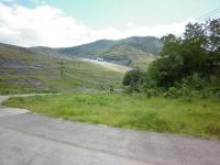
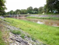
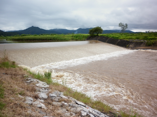
Thanks for the comments. Here are some photos from early September of the canal diversion dam on the Mae Taeng River. It is the only dam on the Mae Taeng and it is free flowing over the top so water can rise and enter the canal. Did not have a chance to get up there during the high flows but I am sure there was a lot more water going over. This area doesn't look like much when you drive up but it has several nice picnic areas with great views down by the river.
By the way, there are no dams on the Ping River except for a few weirs. (Mae Ngat Dam feeds from a separate drainage basin into the Ping above Mae Taeng.) I believe even Mae Kuang Dam in Doi Saket feeds into the Ping River below Chiang Mai in the Lamphun area.


-
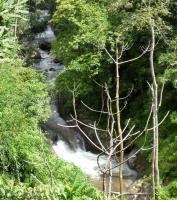
DAY 3 - Mae Taeng River:
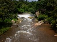
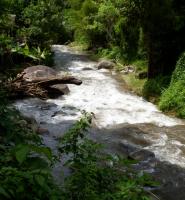
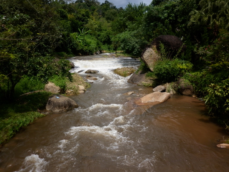
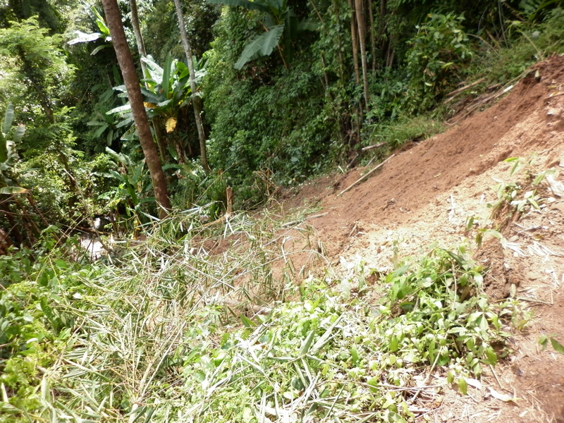
I decide to ride into the mountains to see how the streams are doing up there. The Mae Taeng valley has hundreds if not thousands of these beautiful rivulets, and this one is running as high as the Mae Taeng River at summer levels. Several landslides on the trail going up to 700 meters MSL makes the trip a bit risky, and the swimming hole I am trying to find is too dangerous to approach with the high flows and slippery rocks. Falling into the stream would be certain death. I decide its time to head for home.
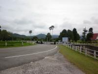
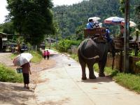
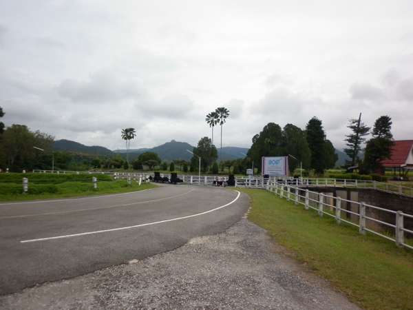
On the way back down, the tourists have arrived and it seems to be a fairly normal day at the elephant camps. I know that far south of this beautiful place where nature rules, people are busy mopping up a big mess. Let's hope we don't get any more flooding for a long time to come.
That's it for chronicling the Mae Taeng 2011 flood days. See you on the trails whether they be concrete or dirt.


-
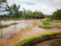
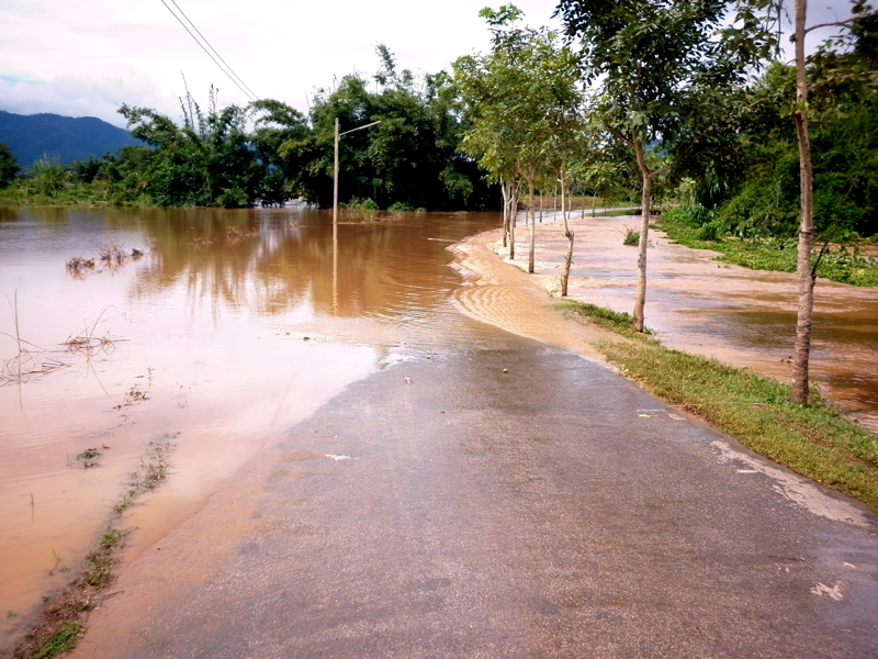
DAY 3 - Mae Taeng River:
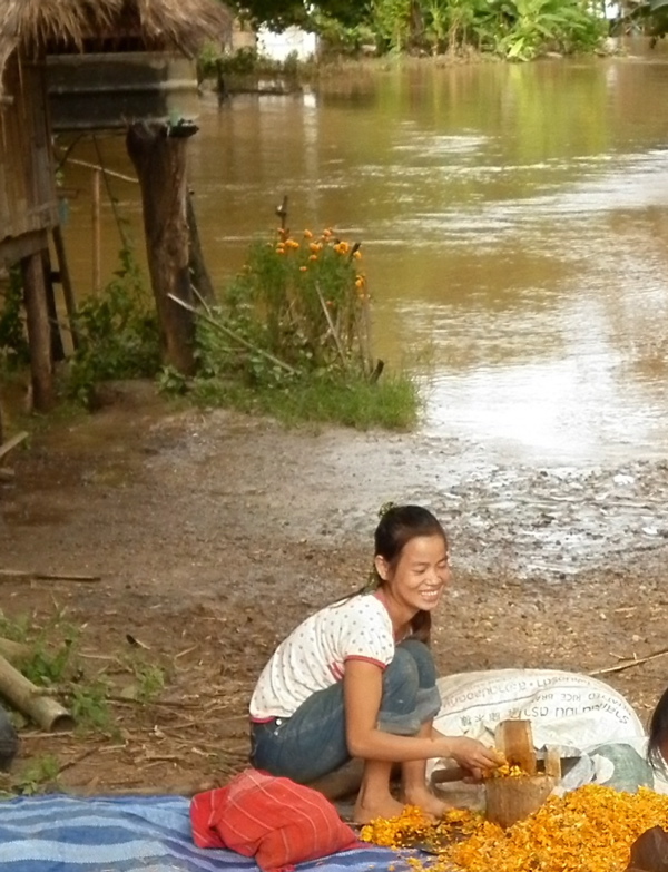
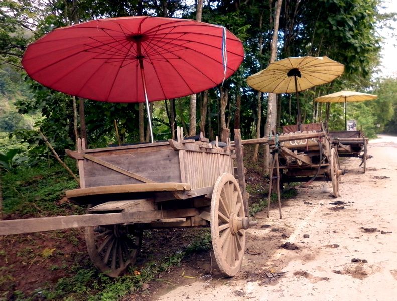
Even with the flooding going on, people try to go about their normal lives and they can even still smile. Ox Carts await tourists which will arrive later in the day by bus and van. No elephant rides will be fording the Mae Taeng however.


-
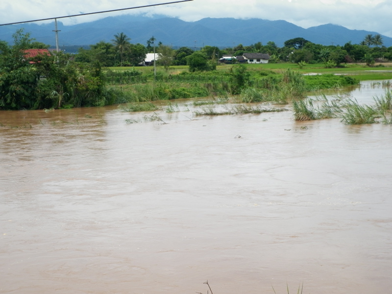
DAY 2:
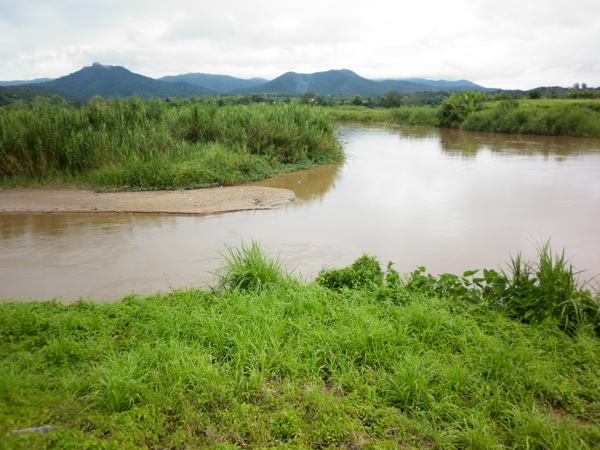
The waters of the Ping continue to subside. The Mae Taeng River however rises. The Mae Taeng River drains a much larger and wilder area than the Ping River by the way and it joins the Ping River just north of the downtown area of Mae Taeng. The 2005 floods were caused mostly by days of rain up the Mae Taeng River valley which is huge.
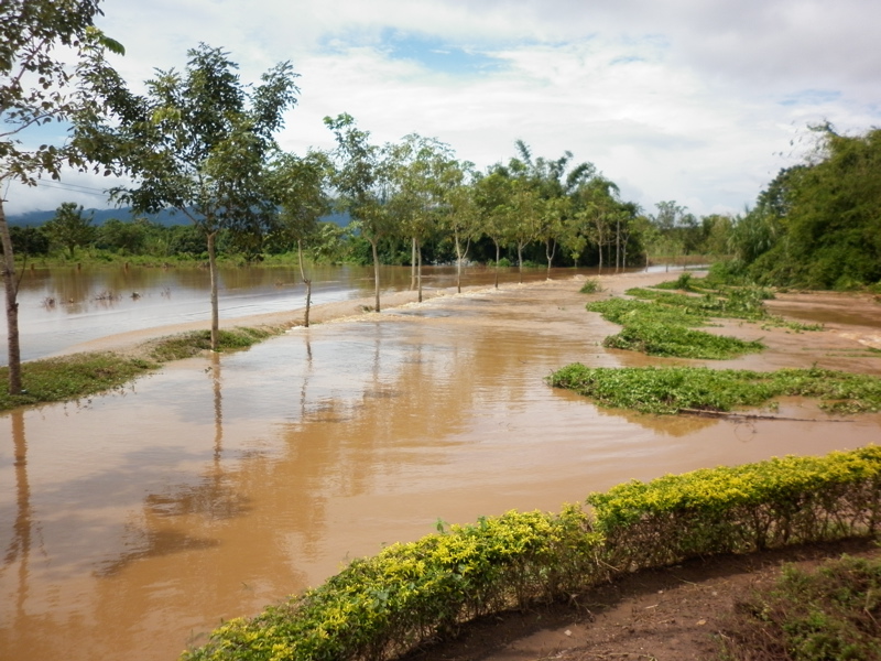
DAY 3 - Mae Taeng River:
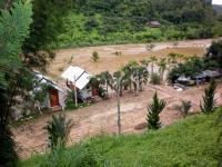
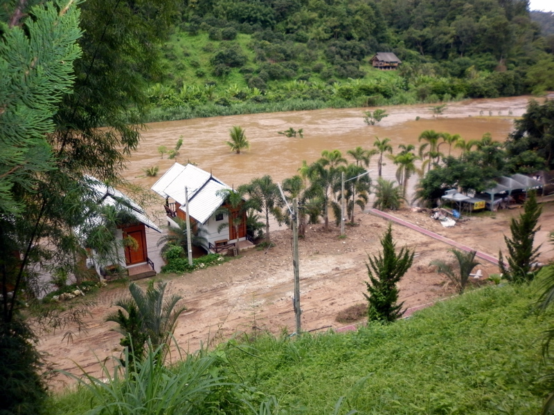
Needing a good mountain bike ride, I hop on the bike and head up the Mae Taeng River. Talking to the locals up the Mae Taeng Valley, they say the flow was not as bad as it was in 2005. I see some resorts that still have one or two meters of water in them, but the water has dropped a meter in the last 24 hours. That is certainly good for everyone downstream.
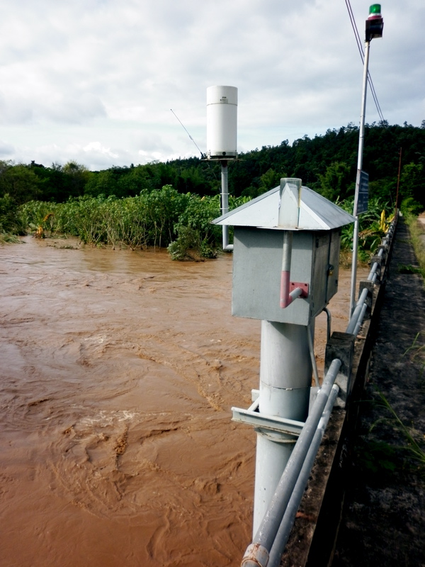
One of these photos shows a water level gauging station on a bridge near the elephant camps. It has a cellular link for the data so I am wondering if it is on the Thai Hydro-website. If anyone has found web links to gauging stations on the Mae Taeng River, please post them here or send me a PM. This is probably the best area for early warning of floods.


-
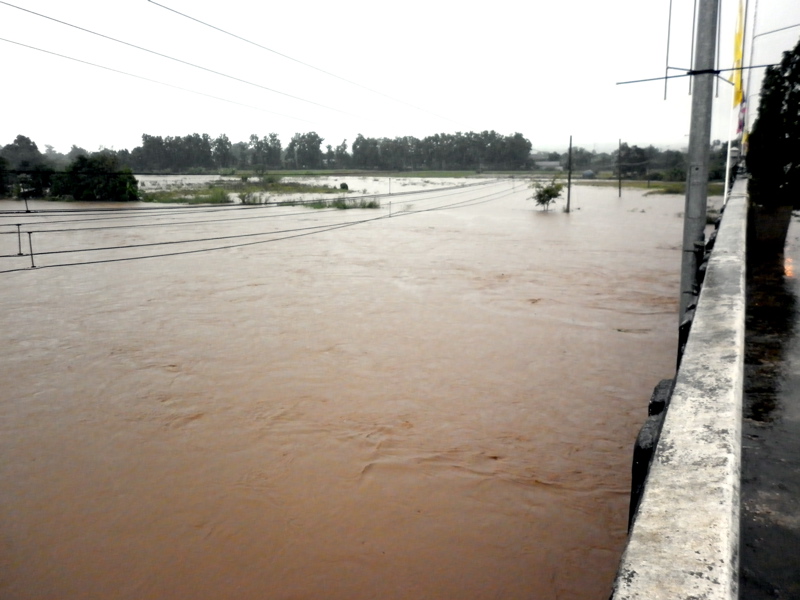
DAY 1 2 PM:
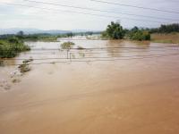
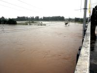
The Ping River is cresting at the HWY 1323 bridge. We drive 10 kilometers up the Ping to Ban Pao and see many roads washed out. The folks manning the police box say that at 5 AM a meter of very fast moving water had swept through and some residents had to evacuate. No casualties due to speaker trucks and word of mouth. Now it is low enough for us to drive through.
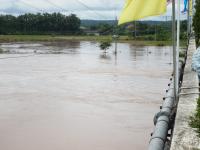

-
DAY 1 9 AM:
I decide to go to Mae Ngat Dam to see for myself what the rumors are all about. I join a steady stream of pick ups and bikes. Stopping at the spillway and release channel, nothing is amiss and the flow of water seems almost low. Driving to the top, I talk to a few fishermen and I tell them of the rumors. They laugh and say they hear those all the time. The dam is just a few meters above summer levels. "Mai Kuun" they say, not high. It is a normal day of fishing at Mae Ngat Dam.

-
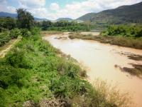
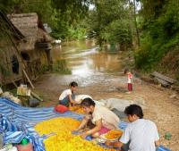
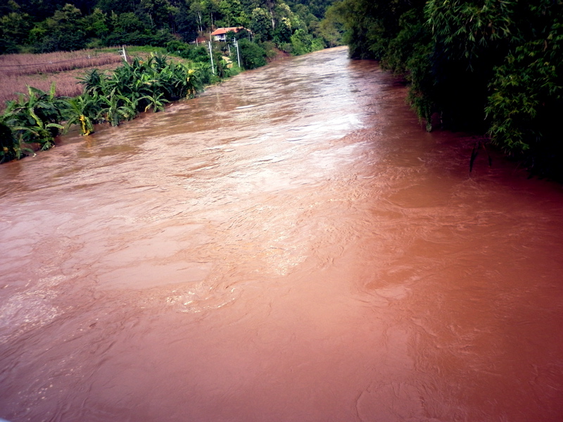
Thought I would post some of the photos from Mae Taeng area as the flood waters passed us. The floods up there were not nearly as bad this time around as they were in 2005. The Ping Valley on HWY 1323 was 1 meter higher in 2005, and the Mae Taeng River this year did not flow as high either as it did six years ago. My sincerest best wishes to those in Chiang Mai that were in the flood areas as Chiang Mai was impacted very hard.
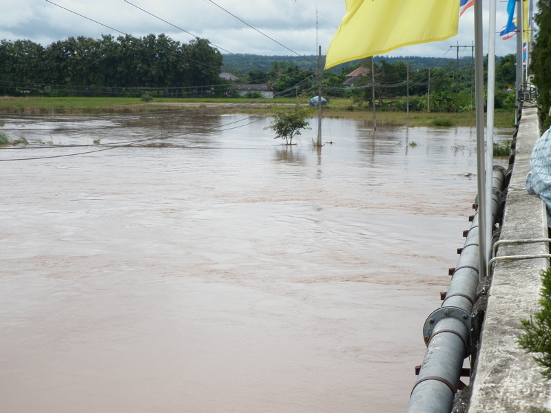
DAY 1
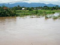
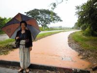
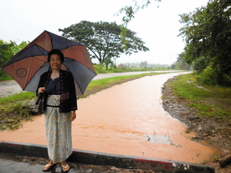
We woke up at 6 AM on Wednesday morning in a small village not far from the Ping River after 12 hours of heavy rain all night. The neighbors were already outside with rumors (which turned out to be baseless) that Mae Ngat Dam was bursting. The local irrigation canal had over run its banks and was running deep red. Ladies in Lanna dresses were donning umbrellas to walk to the valley to see what was up. By 8 AM, we get phone calls that Ban Pao, 10 kilometers upstream on the Ping that has serious flooding with several road closed by meter deep flows of water.
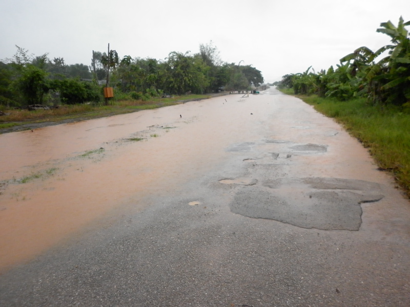
About 9 AM I hop on the motorcycle to go see what is up. The Ping River had been 80 meters wide at the bridge the prior day. Now it is hundreds of meters across. As I watch, I can see a banana orchard being overcome by water. The influx of water in the valley was very fast.


Identify This Insect
in Plants, Pets & Vets in Thailand
Posted
Saw this bug in Mae Taeng in Northern Thailand not far from all the elephant camps and it must been spending too much time up there! It is about 2 inches long and could fly slowly. None of the local farmers had ever seen one and I haven't been able to find it on any of the Thai Bug websites. Can anyone shed any more info on this critter? Looks like it might be some kind of sap-sucker.