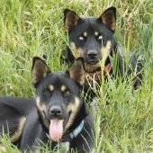
A Great escape into the mountains-- Doi Angkhang
-
Recently Browsing 0 members
- No registered users viewing this page.
Announcements
-
Topics
-
-
Popular Contributors
-
-
Latest posts...
-
29
USA Trump’s Bold D.C. Crime Crackdown Unfolds on National Mall
At the end of the day, you have.... nothing apart from a dishonest and distorting presentation!. 1. You continuously ignore (and hide) the fact the the Senate leader (who was a Republican) has exactly the same responsibilities as the House speaker. There is no predominance of the House speaker on the Senate leader. 2. You wilingly misrepresent the fact that the responsibility of "order" in the House, is not the responsibility of order in the whole Capitol. It's the same for the Senate leader. None of them is responsible for "order: in the whole Capitol. 2. You also ignore the fact that the 'offer' (so to say) was made to, and rejected by, the Mayor, not by Pelosi. Per Ornato's testimony touted by Loudermilk. https://cha.house.gov/2024/3/chairman-loudermilk-publishes-never-before-released-anthony-ornato-transcribed-interview 3. Your interpretation is biased and inaccurate. This also confirmed by facts. The NG ultimately was sent to restore order (too late) and it was not on Pelosi's order. -
66
Traffic Pattaya's Helmet Dilemma: German Tourists Weigh In
well that could happen so are you suggesting we should wear a helmet once we get out of bed, go back and read my original post, I was simply stating that it depends on your activity, would you wear a helmet while out walking ? - of course not simply because the chance of falling and hitting your head and dying are so remote it is not practical. My original post .............. helmet use depends largely on what you are doing, if scooting around town at bicycle speeds it's not so important.............I am saying it's not so important same as not so important when taking your dog for a walk, get it ? I own and ride a motorbike capable of 300kph have toured all over Thailand and beyond - I always wear a helmet and other gear when touring, nipping out to the 7/11 on a scooter not so important, but hey you know everything right and I have "no idea" -
32
-
10,134
Electric Vehicles in Thailand
And the final price after the ORC & LCT (if any) .... .... "My local Zeekr dealer sent me an info pack for the 7X, $2k refundable deposit, estimated pricing (before ORC by taking current Zeekr X pricing and differential to Zeekr 7X pricing in China) as follows: Zeekr 7X RWD: $65,000 – $70,000 = ฿1,371,026.15 - ฿1,476,489.70 Zeekr 7X RWD Long Range: $70,000 – $78,000 = ฿1,476,489.70 - ฿1,645,231.38 Zeekr 7X AWD: $78,000 – $85,000 = ฿1,645,231.38 - ฿1792880.35 " ... No mention of wall chargers or 1 yr insurance included. Thai price are 'all in' Looks about the same price to me ... nice try -
43
UK-Politics 25 Lies - How is Starmer still in office
Maybe my memory is playing tricks.......does anyone recall the same type of article written by the Express about Johnson?.......now there is someone who can lie.......he makes Starmer look like an amateur and would even give Trump a run for his money. -
4
BA pilot left cockpit door open ‘so family could see him
Couldn't the co-pilot have been moved up to fly the return leg? Or get another pilot to do it? Canceling a transatlantic flight which had hundreds of paying customers because the pilot left the cockpit door open on the first leg seems overly Modern Britain.- 1
-

-
-
Popular in The Pub


Recommended Posts
Create an account or sign in to comment
You need to be a member in order to leave a comment
Create an account
Sign up for a new account in our community. It's easy!
Register a new accountSign in
Already have an account? Sign in here.
Sign In Now